The right side wins both ends of the flight — Atlanta's skyline on departure and Tampa Bay's open water and the Sunshine Skyway on approach. During the cruise portion over central Georgia and Florida, the right side also tracks closer to the Gulf Coast flatlands and river systems of the Suwannee region.
Flown ATL to MCF? Did we get it right?
Flight Path
Atlanta to Tampa is 416 miles (669 km), a flight of about 1 hour 10 minutes.
The flight crosses central Georgia's pine flatlands and agricultural patchwork, the Okefenokee Swamp region to the east, then enters Florida over the Suwannee River lowlands and the flat karst terrain of north-central Florida with numerous lakes becoming visible as you descend toward Tampa Bay
Great circle distance and headings ›Phase by phase
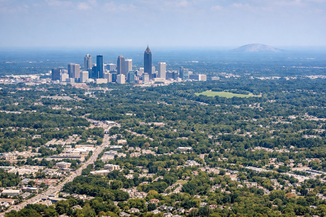
Takeoff from ATL
RIGHTATL typically departs southward on runways 26L/26R or 28L/28R, or uses the north complex heading west. On a southwest departure toward Tampa, the right side gives you a clear look back over downtown Atlanta's skyline as you climb out, with Peachtree Street corridor and the dense midtown cluster visible before turning south.
Landing at MCF
RIGHTMacDill AFB sits on a peninsula jutting into Tampa Bay, and aircraft typically approach from the north or northeast on runway 04/22. On approach from the north, the right side gives you Tampa Bay's open water, the Sunshine Skyway Bridge, and the St. Petersburg peninsula laid out clearly below.
Will your flight be in sunlight?
Pick a date and time in the Sun Map to watch the sun move across your whole flight.
About This Route
Which side of the plane should I sit on flying from The William B Hartsfield Atlanta International (ATL) to Macdill Afb (MCF)?
Sit on the Right side of the plane for the best views on flights from Atlanta to Tampa. The right side wins both ends of the flight — Atlanta's skyline on departure and Tampa Bay's open water and the Sunshine Skyway on approach. During the cruise portion over central Georgia and Florida, the right side also tracks closer to the Gulf Coast flatlands and river systems of the Suwannee region.
What can I see during takeoff from The William B Hartsfield Atlanta International in Atlanta?
During takeoff from The William B Hartsfield Atlanta International (ATL), sit on the Right side for the best views. ATL typically departs southward on runways 26L/26R or 28L/28R, or uses the north complex heading west. On a southwest departure toward Tampa, the right side gives you a clear look back over downtown Atlanta's skyline as you climb out, with Peachtree Street corridor and the dense midtown cluster visible before turning south. Notable sights include: Downtown Atlanta skyline, Stone Mountain (distant to the northeast), Lake Allatoona (northwest), Hartsfield-Jackson airport complex itself.
What can I see when landing at Macdill Afb in Tampa?
When landing at Macdill Afb (MCF), sit on the Right side for the best views. MacDill AFB sits on a peninsula jutting into Tampa Bay, and aircraft typically approach from the north or northeast on runway 04/22. On approach from the north, the right side gives you Tampa Bay's open water, the Sunshine Skyway Bridge, and the St. Petersburg peninsula laid out clearly below. Notable sights include: Tampa Bay open water, Sunshine Skyway Bridge, St. Petersburg downtown peninsula, Hillsborough Bay.
How long is the flight from Atlanta to Tampa?
The flight from The William B Hartsfield Atlanta International (ATL) to Macdill Afb (MCF) takes about 1 hour 10 minutes. The shortest flight path between them is 416 miles (669 km); winds and air traffic control usually add a few percent.
What does the Atlanta to Tampa flight path pass over?
The flight crosses central Georgia's pine flatlands and agricultural patchwork, the Okefenokee Swamp region to the east, then enters Florida over the Suwannee River lowlands and the flat karst terrain of north-central Florida with numerous lakes becoming visible as you descend toward Tampa Bay