Both sides score equally low due to the short 45-minute flight over predominantly flat terrain with minimal dramatic features. However, the left side edges ahead because Atlanta's urban takeoff provides slightly more visual interest than Montgomery's modest landing approach. Neither side offers scenic distinction; this is a utilitarian regional flight.
Flown ATL to MGM? Did we get it right?
Flight Path
Atlanta to Montgomery is 147 miles (236 km), a flight of about 45 minutes.
The flight path crosses central Georgia's Piedmont region, passing over rolling terrain with scattered lakes, pine forests, and small towns. The Ocmulgee River valley may be visible in the flight's middle section, though at cruise altitude (around 15,000-18,000 feet for this short route) individual features become less distinct. No mountains, significant water bodies, or major cities lie directly on the typical flight corridor between ATL and MGM.
Great circle distance and headings ›Phase by phase
Takeoff from ATL
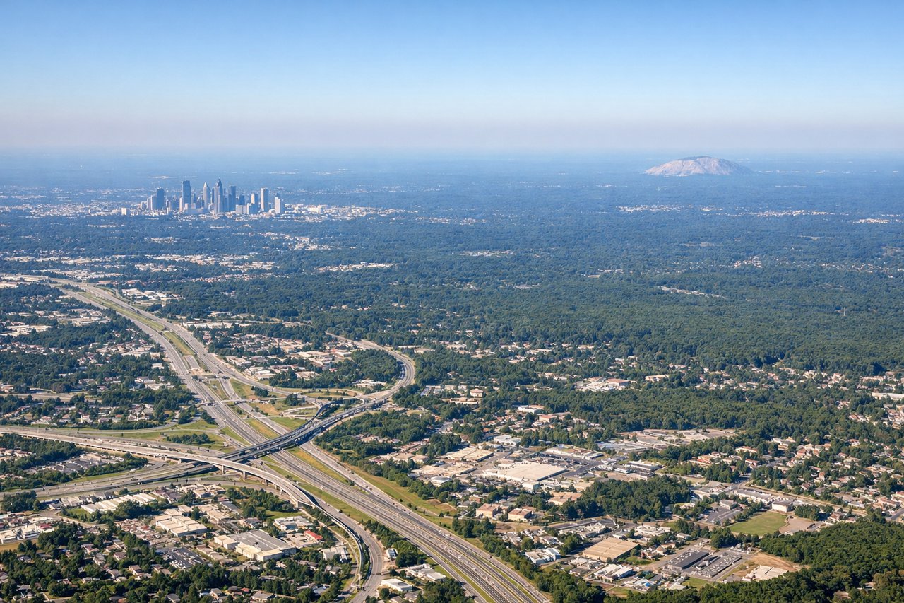
LEFTAtlanta's urban sprawl and the Chattahoochee River valley are visible during initial climb-out on the left side. The city's grid pattern and surrounding suburban development provide more visual interest than the right side's flat terrain.
Landing at MGM
RIGHTThe Alabama River and Montgomery's downtown riverfront are visible on approach from the east/southeast. The river's meandering path and the city's position along it provide more visual definition than the left side's flat, featureless terrain.
Will your flight be in sunlight?
Pick a date and time in the Sun Map to watch the sun move across your whole flight.
About This Route
Which side of the plane should I sit on flying from The William B Hartsfield Atlanta International (ATL) to Montgomery Regional (Dannelly Field) Airport (MGM)?
Sit on the Left side of the plane for the best views on flights from Atlanta to Montgomery. Both sides score equally low due to the short 45-minute flight over predominantly flat terrain with minimal dramatic features. However, the left side edges ahead because Atlanta's urban takeoff provides slightly more visual interest than Montgomery's modest landing approach. Neither side offers scenic distinction; this is a utilitarian regional flight.
What can I see during takeoff from The William B Hartsfield Atlanta International in Atlanta?
During takeoff from The William B Hartsfield Atlanta International (ATL), sit on the Left side for the best views. Atlanta's urban sprawl and the Chattahoochee River valley are visible during initial climb-out on the left side. The city's grid pattern and surrounding suburban development provide more visual interest than the right side's flat terrain. Notable sights include: Downtown Atlanta skyline, Chattahoochee River, Hartsfield-Jackson airport complex, suburban sprawl extending north.
What can I see when landing at Montgomery Regional (Dannelly Field) Airport in Montgomery?
When landing at Montgomery Regional (Dannelly Field) Airport (MGM), sit on the Right side for the best views. The Alabama River and Montgomery's downtown riverfront are visible on approach from the east/southeast. The river's meandering path and the city's position along it provide more visual definition than the left side's flat, featureless terrain. Notable sights include: Alabama River, Montgomery downtown riverfront, Dannelly Field runways, surrounding pine forest.
How long is the flight from Atlanta to Montgomery?
The flight from The William B Hartsfield Atlanta International (ATL) to Montgomery Regional (Dannelly Field) Airport (MGM) takes about 45 minutes. The shortest flight path between them is 147 miles (236 km); winds and air traffic control usually add a few percent.
What does the Atlanta to Montgomery flight path pass over?
The flight path crosses central Georgia's Piedmont region, passing over rolling terrain with scattered lakes, pine forests, and small towns. The Ocmulgee River valley may be visible in the flight's middle section, though at cruise altitude (around 15,000-18,000 feet for this short route) individual features become less distinct. No mountains, significant water bodies, or major cities lie directly on the typical flight corridor between ATL and MGM.