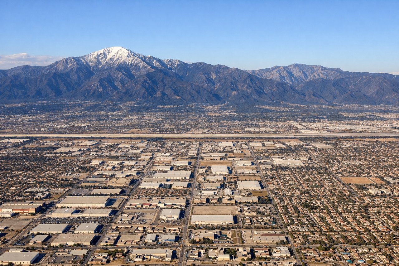
The San Gabriel Mountains on final into ONT are genuinely spectacular and hard to beat. While the right side has a good Atlanta departure view, the left side also picks up the Mississippi River crossing in the middle of the flight and the Mojave Desert terrain on descent, making it the stronger choice end-to-end.
Flight Path
Mississippi River crossing near Vicksburg or Memphis depending on routing, Ouachita Mountains of Arkansas, Texas Panhandle flatlands, New Mexico high desert and Llano Estacado, Arizona's Painted Desert and Colorado Plateau edge, Mojave Desert approaching Southern California
Great circle distance and headings ›.jpeg?width=600)
.jpg?width=600)


.jpg?width=600)
Phase by phase

Takeoff from ATL
RIGHTATL's primary departure runway 26L/26R sends aircraft westbound, and the right (north) side gives you a clear view back over downtown Atlanta's skyline as you climb out. You'll also catch Stone Mountain to the northeast as a distinctive granite dome rising from the Piedmont.
Landing at ONT
LEFTONT typically receives arrivals from the east on runway 26L/26R, meaning the left (south) side faces the San Gabriel Mountains directly — a dramatic wall of peaks including Mount San Antonio (Mount Baldy) at 10,064 ft rising just north of the approach path. The right side looks toward the flat Inland Empire basin.
Landmarks on this routeAll landmarks →
Will your flight be in sunlight?
See exactly which side of the plane gets sun and shade at your departure time.
About This Route
Which side of the plane should I sit on flying from The William B Hartsfield Atlanta International (ATL) to Ontario International (ONT)?
Sit on the Left side of the plane for the best views on flights from Atlanta to Ontario. The San Gabriel Mountains on final into ONT are genuinely spectacular and hard to beat. While the right side has a good Atlanta departure view, the left side also picks up the Mississippi River crossing in the middle of the flight and the Mojave Desert terrain on descent, making it the stronger choice end-to-end.
What can I see during takeoff from The William B Hartsfield Atlanta International in Atlanta?
During takeoff from The William B Hartsfield Atlanta International (ATL), sit on the Right side for the best views. ATL's primary departure runway 26L/26R sends aircraft westbound, and the right (north) side gives you a clear view back over downtown Atlanta's skyline as you climb out. You'll also catch Stone Mountain to the northeast as a distinctive granite dome rising from the Piedmont. Notable sights include: Downtown Atlanta skyline, Stone Mountain, Lake Allatoona to the northwest, Chattahoochee River corridor.
What can I see when landing at Ontario International in Ontario?
When landing at Ontario International (ONT), sit on the Left side for the best views. ONT typically receives arrivals from the east on runway 26L/26R, meaning the left (south) side faces the San Gabriel Mountains directly — a dramatic wall of peaks including Mount San Antonio (Mount Baldy) at 10,064 ft rising just north of the approach path. The right side looks toward the flat Inland Empire basin. Notable sights include: Mount San Antonio (Mount Baldy), San Gabriel Mountains ridgeline, San Bernardino Valley urban grid, Ontario city grid below final approach.
How long is the flight from Atlanta to Ontario?
The flight from The William B Hartsfield Atlanta International (ATL) to Ontario International (ONT) takes Approximately 4 hours 15 minutes.
What does the Atlanta to Ontario flight path pass over?
Mississippi River crossing near Vicksburg or Memphis depending on routing, Ouachita Mountains of Arkansas, Texas Panhandle flatlands, New Mexico high desert and Llano Estacado, Arizona's Painted Desert and Colorado Plateau edge, Mojave Desert approaching Southern California