While Atlanta's takeoff offers urban and Piedmont scenery, the landing approach to Panama dominates the flight experience. Gatun Lake, the Panama Canal infrastructure, and the transition from tropical forest to Caribbean coastline create significantly more visual drama and geographic variety than the cruise segment over the southeastern United States and Gulf of Mexico. The right side captures the most distinctive and memorable features of this route.
Flown ATL to PAC? Did we get it right?
Flight Path
Atlanta to Panama City is 1,732 miles (2,787 km), a flight of about 4 hours 15 minutes.
Gulf of Mexico (open water dominates the cruise segment for approximately 2.5 hours), Florida peninsula and coastline during departure (visible briefly), Yucatan Peninsula's northern coast and Caribbean waters, occasional cumulus cloud formations over warm tropical waters, the transition from temperate to tropical climate visible in vegetation changes as the aircraft approaches Central America
Great circle distance and headings ›

Phase by phase
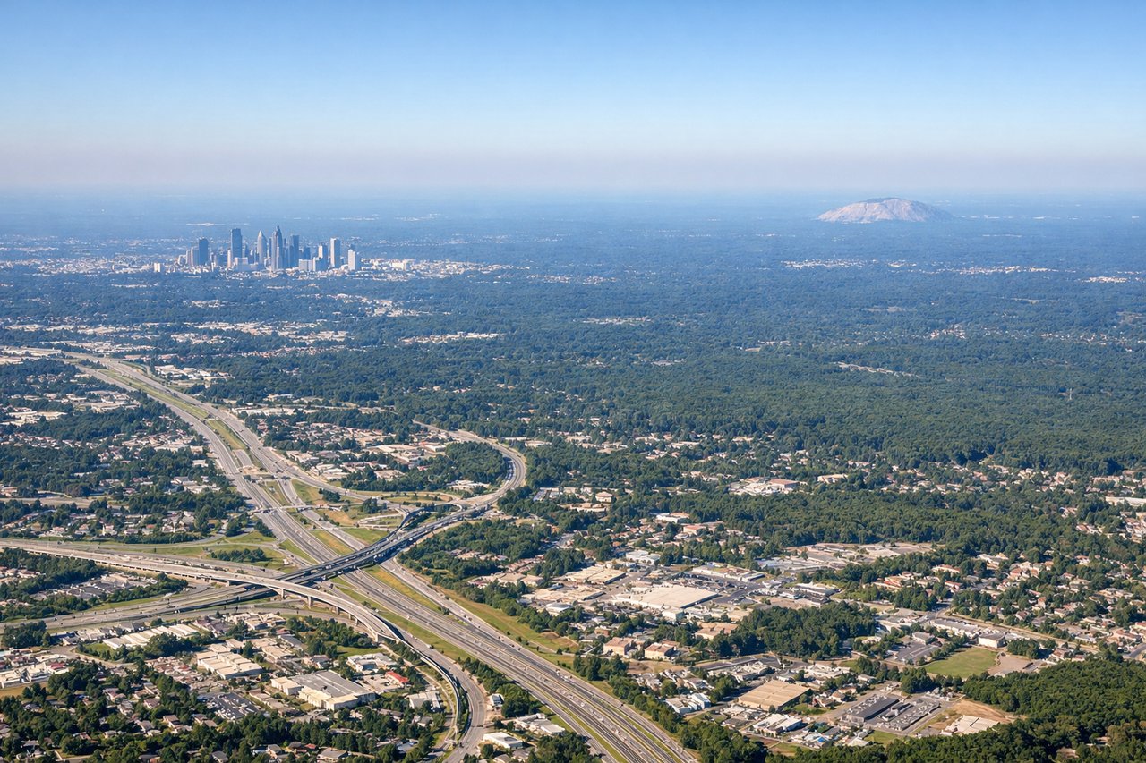
Takeoff from ATL
LEFTAtlanta's urban sprawl and the Piedmont terrain provide immediate visual interest during climb-out. The left side captures the city grid, surrounding forested hills, and the transition from urban to rural Georgia.
Landing at PAC
RIGHTThe approach to Panama City reveals the dramatic Caribbean coastline, the Panama Canal's Gatun Lake, and the lush tropical landscape of central Panama. The right side captures these distinctive features during descent and final approach.
Will your flight be in sunlight?
Pick a date and time in the Sun Map to watch the sun move across your whole flight.
About This Route
Which side of the plane should I sit on flying from The William B Hartsfield Atlanta International (ATL) to Marcos A Gelabert International (PAC)?
Sit on the Right side of the plane for the best views on flights from Atlanta to Panama City. While Atlanta's takeoff offers urban and Piedmont scenery, the landing approach to Panama dominates the flight experience. Gatun Lake, the Panama Canal infrastructure, and the transition from tropical forest to Caribbean coastline create significantly more visual drama and geographic variety than the cruise segment over the southeastern United States and Gulf of Mexico. The right side captures the most distinctive and memorable features of this route.
What can I see during takeoff from The William B Hartsfield Atlanta International in Atlanta?
During takeoff from The William B Hartsfield Atlanta International (ATL), sit on the Left side for the best views. Atlanta's urban sprawl and the Piedmont terrain provide immediate visual interest during climb-out. The left side captures the city grid, surrounding forested hills, and the transition from urban to rural Georgia. Notable sights include: Atlanta skyline (downtown towers visible from 8,000+ ft), Piedmont plateau terrain, Lake Lanier to the north, forested ridges of the Appalachian foothills.
What can I see when landing at Marcos A Gelabert International in Panama City?
When landing at Marcos A Gelabert International (PAC), sit on the Right side for the best views. The approach to Panama City reveals the dramatic Caribbean coastline, the Panama Canal's Gatun Lake, and the lush tropical landscape of central Panama. The right side captures these distinctive features during descent and final approach. Notable sights include: Gatun Lake (massive artificial reservoir visible as a bright blue body of water), Panama Canal locks and waterway, Caribbean coastline with mangrove forests, Soberanía National Park's dense tropical canopy.
How long is the flight from Atlanta to Panama City?
The flight from The William B Hartsfield Atlanta International (ATL) to Marcos A Gelabert International (PAC) takes about 4 hours 15 minutes. The shortest flight path between them is 1,732 miles (2,787 km); winds and air traffic control usually add a few percent.
What does the Atlanta to Panama City flight path pass over?
Gulf of Mexico (open water dominates the cruise segment for approximately 2.5 hours), Florida peninsula and coastline during departure (visible briefly), Yucatan Peninsula's northern coast and Caribbean waters, occasional cumulus cloud formations over warm tropical waters, the transition from temperate to tropical climate visible in vegetation changes as the aircraft approaches Central America