While takeoff offers Atlanta's urban scenery on the left, the landing approach on the right provides more visually distinctive natural terrain—the Ozark Plateau's rolling topography is more dramatic than the relatively flat terrain around Atlanta.
Flown ATL to SGF? Did we get it right?
Flight Path
Atlanta to Springfield is 562 miles (905 km), a flight of about 1 hour 15 minutes.
Tennessee River valley near Chattanooga, Cumberland Plateau escarpment, transition from Appalachian foothills to Ozark Plateau, Arkansas-Missouri border region with increasing topographic relief
Great circle distance and headings ›

Phase by phase
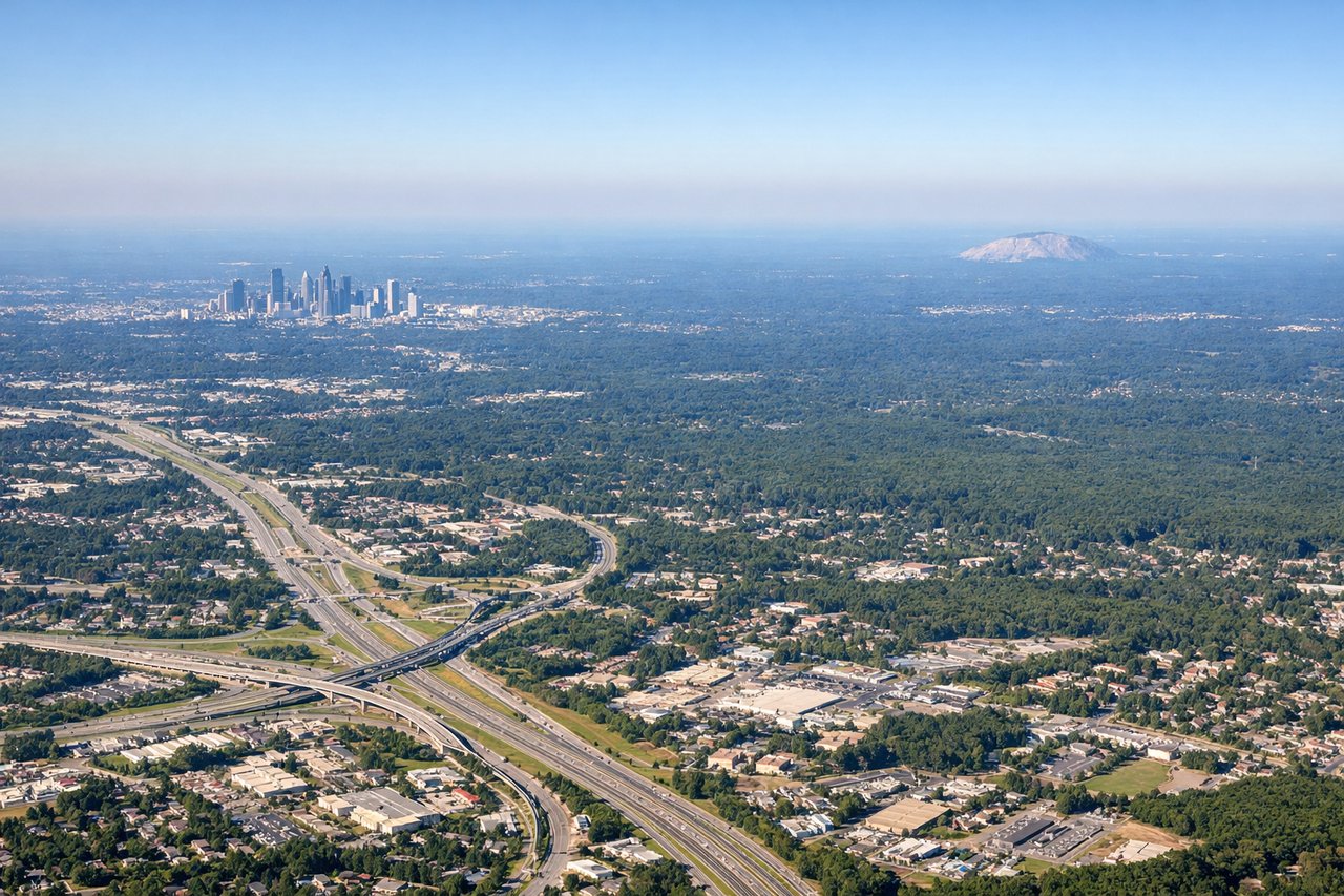
Takeoff from ATL
LEFTLeft side offers views of downtown Atlanta's skyline and the Chattahoochee River valley as you climb northwest. Right side faces suburban sprawl with fewer distinctive landmarks.
Landing at SGF
RIGHTRight side provides views of the Ozark Plateau's rolling terrain and the Springfield area as you descend from the northeast. The landscape transitions from flat plains to more distinctive topography.
Will your flight be in sunlight?
Pick a date and time in the Sun Map to watch the sun move across your whole flight.
About This Route
Which side of the plane should I sit on flying from The William B Hartsfield Atlanta International (ATL) to Springfield Branson National Airport (SGF)?
Sit on the Right side of the plane for the best views on flights from Atlanta to Springfield. While takeoff offers Atlanta's urban scenery on the left, the landing approach on the right provides more visually distinctive natural terrain—the Ozark Plateau's rolling topography is more dramatic than the relatively flat terrain around Atlanta.
What can I see during takeoff from The William B Hartsfield Atlanta International in Atlanta?
During takeoff from The William B Hartsfield Atlanta International (ATL), sit on the Left side for the best views. Left side offers views of downtown Atlanta's skyline and the Chattahoochee River valley as you climb northwest. Right side faces suburban sprawl with fewer distinctive landmarks. Notable sights include: Downtown Atlanta skyline, Chattahoochee River, Kennesaw Mountain (distant), suburban grid pattern.
What can I see when landing at Springfield Branson National Airport in Springfield?
When landing at Springfield Branson National Airport (SGF), sit on the Right side for the best views. Right side provides views of the Ozark Plateau's rolling terrain and the Springfield area as you descend from the northeast. The landscape transitions from flat plains to more distinctive topography. Notable sights include: Springfield city grid, Ozark Plateau rolling hills, James River valley, Greene County farmland.
How long is the flight from Atlanta to Springfield?
The flight from The William B Hartsfield Atlanta International (ATL) to Springfield Branson National Airport (SGF) takes about 1 hour 15 minutes. The shortest flight path between them is 562 miles (905 km); winds and air traffic control usually add a few percent.
What does the Atlanta to Springfield flight path pass over?
Tennessee River valley near Chattanooga, Cumberland Plateau escarpment, transition from Appalachian foothills to Ozark Plateau, Arkansas-Missouri border region with increasing topographic relief