The left side wins overall. While the right side has a slight edge at Atlanta departure, the left side delivers the spectacular Caribbean approach into SXM — one of the most visually dramatic airport approaches in the world — plus during cruise you track southeast over Cuba and the northern Caribbean, where the left side faces east toward Puerto Rico and the Virgin Islands chain as you descend.
Flown ATL to SXM? Did we get it right?
Flight Path
Atlanta to Philipsburg is 1,702 miles (2,739 km), a flight of about 3 hours 40 minutes.
The flight tracks southeast over Georgia and South Carolina, then out over the Atlantic near Savannah or Jacksonville. You cross the Bahamas island chain (Great Abaco, Eleuthera visible as thin pale strips in turquoise water), then Cuba's northern coast near Havana, then the deep blue of the Caribbean Sea passing north of Hispaniola and Puerto Rico before descending toward the Virgin Islands and Sint Maarten.
Great circle distance and headings ›Phase by phase

Takeoff from ATL
RIGHTATL primarily uses runways 8L/8R/9L/9R for eastbound departures or 26L/26R/27L/27R for westbound. On a southeast-bound departure toward SXM, aircraft typically climb out heading east-southeast. The right side gives you a clear view of downtown Atlanta's skyline as the plane banks south, plus the sprawling suburban grid of DeKalb and Gwinnett counties.
Landing at SXM
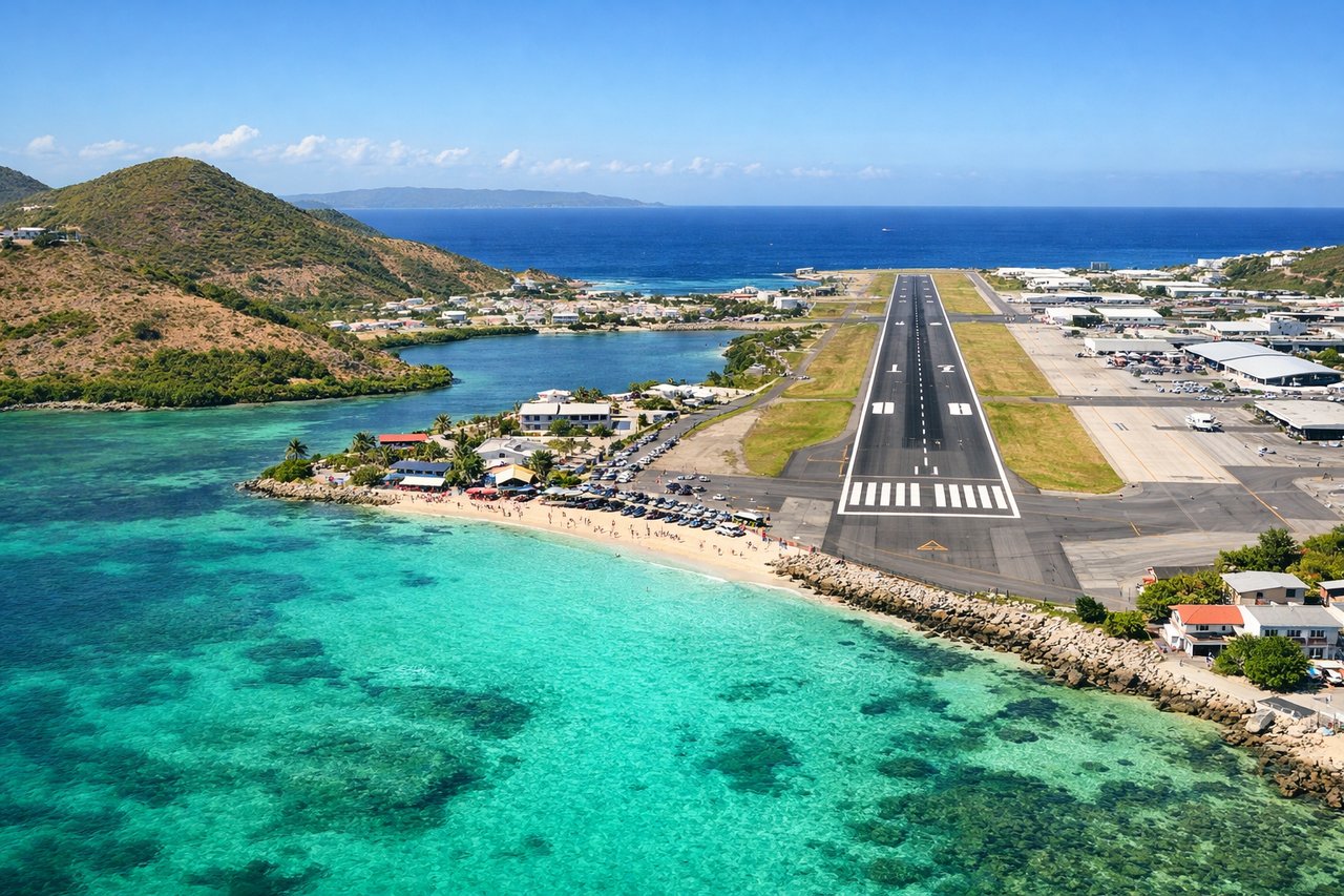
LEFTPrincess Juliana's runway 10 is the primary landing direction, with aircraft approaching from the west over Simpson Bay Lagoon and touching down heading east. On this approach, the left side faces north toward the Dutch side of Sint Maarten, giving you the best view of Simpson Bay Lagoon, the famous Maho Beach threshold, and the Caribbean coastline.
Will your flight be in sunlight?
Pick a date and time in the Sun Map to watch the sun move across your whole flight.
About This Route
Which side of the plane should I sit on flying from The William B Hartsfield Atlanta International (ATL) to Princess Juliana International (SXM)?
Sit on the Left side of the plane for the best views on flights from Atlanta to Philipsburg. The left side wins overall. While the right side has a slight edge at Atlanta departure, the left side delivers the spectacular Caribbean approach into SXM — one of the most visually dramatic airport approaches in the world — plus during cruise you track southeast over Cuba and the northern Caribbean, where the left side faces east toward Puerto Rico and the Virgin Islands chain as you descend.
What can I see during takeoff from The William B Hartsfield Atlanta International in Atlanta?
During takeoff from The William B Hartsfield Atlanta International (ATL), sit on the Right side for the best views. ATL primarily uses runways 8L/8R/9L/9R for eastbound departures or 26L/26R/27L/27R for westbound. On a southeast-bound departure toward SXM, aircraft typically climb out heading east-southeast. The right side gives you a clear view of downtown Atlanta's skyline as the plane banks south, plus the sprawling suburban grid of DeKalb and Gwinnett counties. Notable sights include: Downtown Atlanta skyline, Stone Mountain (the exposed granite dome 16 miles east of downtown), Lake Lanier to the northeast, Hartsfield's parallel runway complex below.
What can I see when landing at Princess Juliana International in Philipsburg?
When landing at Princess Juliana International (SXM), sit on the Left side for the best views. Princess Juliana's runway 10 is the primary landing direction, with aircraft approaching from the west over Simpson Bay Lagoon and touching down heading east. On this approach, the left side faces north toward the Dutch side of Sint Maarten, giving you the best view of Simpson Bay Lagoon, the famous Maho Beach threshold, and the Caribbean coastline. Notable sights include: Simpson Bay Lagoon, Maho Beach directly below the approach path, Sint Maarten's Dutch capital Philipsburg along Great Bay, the island of Anguilla visible to the north.
How long is the flight from Atlanta to Philipsburg?
The flight from The William B Hartsfield Atlanta International (ATL) to Princess Juliana International (SXM) takes about 3 hours 40 minutes. The shortest flight path between them is 1,702 miles (2,739 km); winds and air traffic control usually add a few percent.
What does the Atlanta to Philipsburg flight path pass over?
The flight tracks southeast over Georgia and South Carolina, then out over the Atlantic near Savannah or Jacksonville. You cross the Bahamas island chain (Great Abaco, Eleuthera visible as thin pale strips in turquoise water), then Cuba's northern coast near Havana, then the deep blue of the Caribbean Sea passing north of Hispaniola and Puerto Rico before descending toward the Virgin Islands and Sint Maarten.