The left side delivers the best views at both ends of the flight — Atlanta's skyline on departure and the spectacular low approach over Lake Ontario with Toronto's skyline dead ahead on arrival. The right side has little to compete with either of those moments.
Flight Path
The flight tracks northeast over the Appalachian Mountains of Tennessee and Kentucky, crossing the Cumberland Plateau and the Kentucky Bluegrass region. Over Ohio the terrain flattens into agricultural plains. The southern shore of Lake Erie may be briefly visible before crossing into Ontario. The route passes near Cincinnati, Columbus, and Cleveland at cruise altitude, visible as urban light clusters on clear days.
Great circle distance and headings ›.jpeg?width=600)

Phase by phase
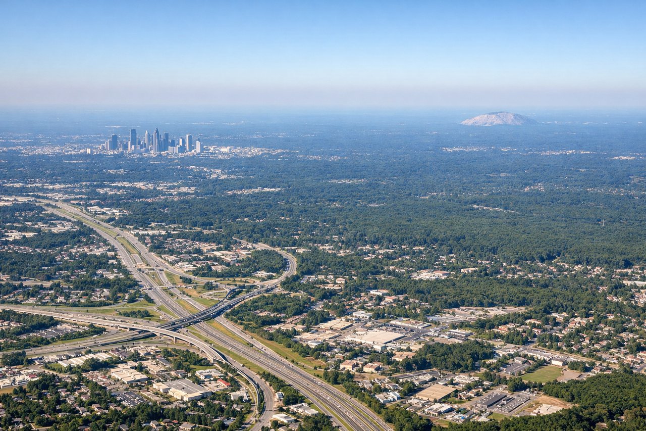
Takeoff from ATL
LEFTATL primarily uses its north-south runways. On a northbound departure climbing out heading north, the left (west) side gives you a clear view back over downtown Atlanta's skyline as the aircraft banks. The distinctive cluster of Midtown and Downtown skyscrapers is clearly visible to the northwest during the initial climb.
Landing at YTZ
LEFTYTZ (Billy Bishop) sits on the Toronto Islands, and aircraft typically approach from the southwest or northeast over Lake Ontario. On a northeast approach, the left side faces northwest toward the Toronto skyline — the CN Tower, Rogers Centre, and the downtown core are directly in view as you descend low over the lake. This is one of the most dramatic urban approaches in North America.
Landmarks on this routeAll landmarks →
Will your flight be in sunlight?
See exactly which side of the plane gets sun and shade at your departure time.
About This Route
Which side of the plane should I sit on flying from The William B Hartsfield Atlanta International (ATL) to City Centre (YTZ)?
Sit on the Left side of the plane for the best views on flights from Atlanta to Toronto. The left side delivers the best views at both ends of the flight — Atlanta's skyline on departure and the spectacular low approach over Lake Ontario with Toronto's skyline dead ahead on arrival. The right side has little to compete with either of those moments.
What can I see during takeoff from The William B Hartsfield Atlanta International in Atlanta?
During takeoff from The William B Hartsfield Atlanta International (ATL), sit on the Left side for the best views. ATL primarily uses its north-south runways. On a northbound departure climbing out heading north, the left (west) side gives you a clear view back over downtown Atlanta's skyline as the aircraft banks. The distinctive cluster of Midtown and Downtown skyscrapers is clearly visible to the northwest during the initial climb. Notable sights include: Downtown Atlanta skyline, Stone Mountain (granite dome 16 miles east, visible from left on northward climb-out), Chattahoochee River corridor, Lake Allatoona to the northwest.
What can I see when landing at City Centre in Toronto?
When landing at City Centre (YTZ), sit on the Left side for the best views. YTZ (Billy Bishop) sits on the Toronto Islands, and aircraft typically approach from the southwest or northeast over Lake Ontario. On a northeast approach, the left side faces northwest toward the Toronto skyline — the CN Tower, Rogers Centre, and the downtown core are directly in view as you descend low over the lake. This is one of the most dramatic urban approaches in North America. Notable sights include: CN Tower and Toronto downtown skyline, Lake Ontario, Toronto Islands, Rogers Centre.
How long is the flight from Atlanta to Toronto?
The flight from The William B Hartsfield Atlanta International (ATL) to City Centre (YTZ) takes Approximately 1 hour 45 minutes to 2 hours.
What does the Atlanta to Toronto flight path pass over?
The flight tracks northeast over the Appalachian Mountains of Tennessee and Kentucky, crossing the Cumberland Plateau and the Kentucky Bluegrass region. Over Ohio the terrain flattens into agricultural plains. The southern shore of Lake Erie may be briefly visible before crossing into Ontario. The route passes near Cincinnati, Columbus, and Cleveland at cruise altitude, visible as urban light clusters on clear days.