While takeoff offers Aruba's scenic island views, the landing approach into Panama City provides more dramatic and varied scenery—pristine rainforest, the engineering marvel of the Canal approach, and a major city's waterfront. The left side captures these highlights better during descent.
Flown AUA to PTY? Did we get it right?
Flight Path
Oranjestad to Panama City is 679 miles (1,092 km), a flight of about 2 hours 15 minutes.
Caribbean Sea (open water for most of flight), San Blas Islands archipelago (visible as small islands and cays off Panama's Caribbean coast during descent), Colombian coastline (Darién Gap region, visible far to the south on clear days), transition from open ocean to Central American mainland jungle
Great circle distance and headings ›


Phase by phase
Takeoff from AUA
RIGHTRight-side seats capture Aruba's southern coastline and the Caribbean Sea as you climb out. The island's distinctive shape and turquoise waters are immediately visible, with the Andes Mountains of South America visible on the distant horizon to the southwest.
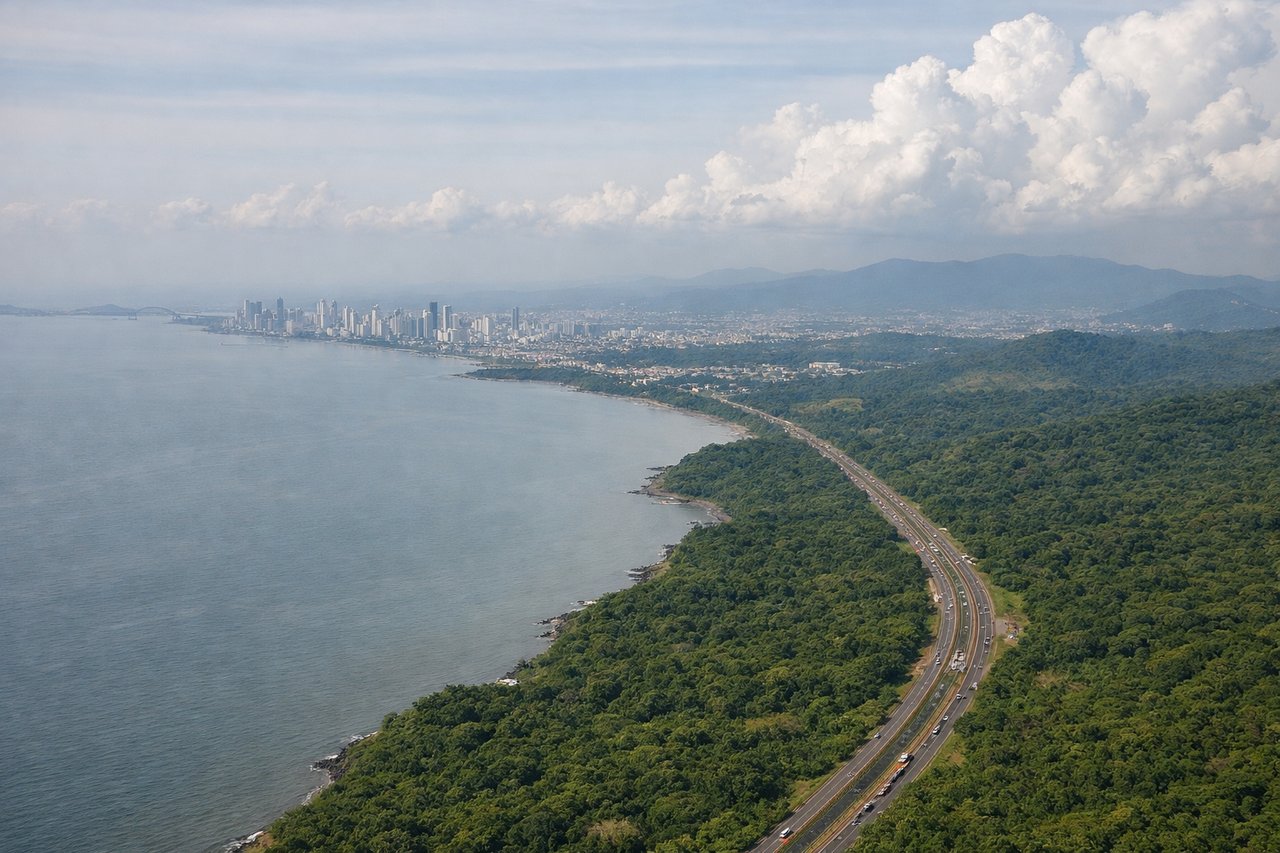
Landing at PTY
LEFTLeft-side seats offer views of the Panamanian mainland as you descend into Tocumen. You'll see the Darién region's dense jungle, the Panama Canal approach, and Panama City's urban sprawl along the Pacific coast.
Will your flight be in sunlight?
Pick a date and time in the Sun Map to watch the sun move across your whole flight.
About This Route
Which side of the plane should I sit on flying from Reina Beatrix International (AUA) to Tocumen International (PTY)?
Sit on the Left side of the plane for the best views on flights from Oranjestad to Panama City. While takeoff offers Aruba's scenic island views, the landing approach into Panama City provides more dramatic and varied scenery—pristine rainforest, the engineering marvel of the Canal approach, and a major city's waterfront. The left side captures these highlights better during descent.
What can I see during takeoff from Reina Beatrix International in Oranjestad?
During takeoff from Reina Beatrix International (AUA), sit on the Right side for the best views. Right-side seats capture Aruba's southern coastline and the Caribbean Sea as you climb out. The island's distinctive shape and turquoise waters are immediately visible, with the Andes Mountains of South America visible on the distant horizon to the southwest. Notable sights include: Aruba's southern coast and beaches, Caribbean Sea, Lake Maracaibo region (Venezuela, far horizon), Paraguaná Peninsula (Venezuela).
What can I see when landing at Tocumen International in Panama City?
When landing at Tocumen International (PTY), sit on the Left side for the best views. Left-side seats offer views of the Panamanian mainland as you descend into Tocumen. You'll see the Darién region's dense jungle, the Panama Canal approach, and Panama City's urban sprawl along the Pacific coast. Notable sights include: Darién jungle and rainforest, Panama Canal locks and approach channels, Panama City skyline and Pacific waterfront, Gatun Lake (if visible during descent corridor).
How long is the flight from Oranjestad to Panama City?
The flight from Reina Beatrix International (AUA) to Tocumen International (PTY) takes about 2 hours 15 minutes. The shortest flight path between them is 679 miles (1,092 km); winds and air traffic control usually add a few percent.
What does the Oranjestad to Panama City flight path pass over?
Caribbean Sea (open water for most of flight), San Blas Islands archipelago (visible as small islands and cays off Panama's Caribbean coast during descent), Colombian coastline (Darién Gap region, visible far to the south on clear days), transition from open ocean to Central American mainland jungle