Takeoff from Austin offers more dramatic and visually distinctive scenery with the Colorado River, Hill Country topography, and Lake Travis. Landing into Columbus is less scenic overall, making the outbound journey the stronger choice for window-seat viewing.
Flown AUS to CMH? Did we get it right?
Flight Path
Austin to Columbus is 1,072 miles (1,726 km), a flight of about 2 hours 45 minutes.
The flight path crosses central Tennessee, passing near or over the Cumberland Plateau and its dissected terrain. The Tennessee River valley and its reservoirs (Watts Bar Lake, Chickamauga Lake) may be visible depending on exact routing. The transition from the Appalachian foothills of Tennessee into the flatter glaciated terrain of Ohio occurs in the latter half of the flight. The Ohio River valley becomes visible approaching Columbus from the south.
Great circle distance and headings ›Phase by phase
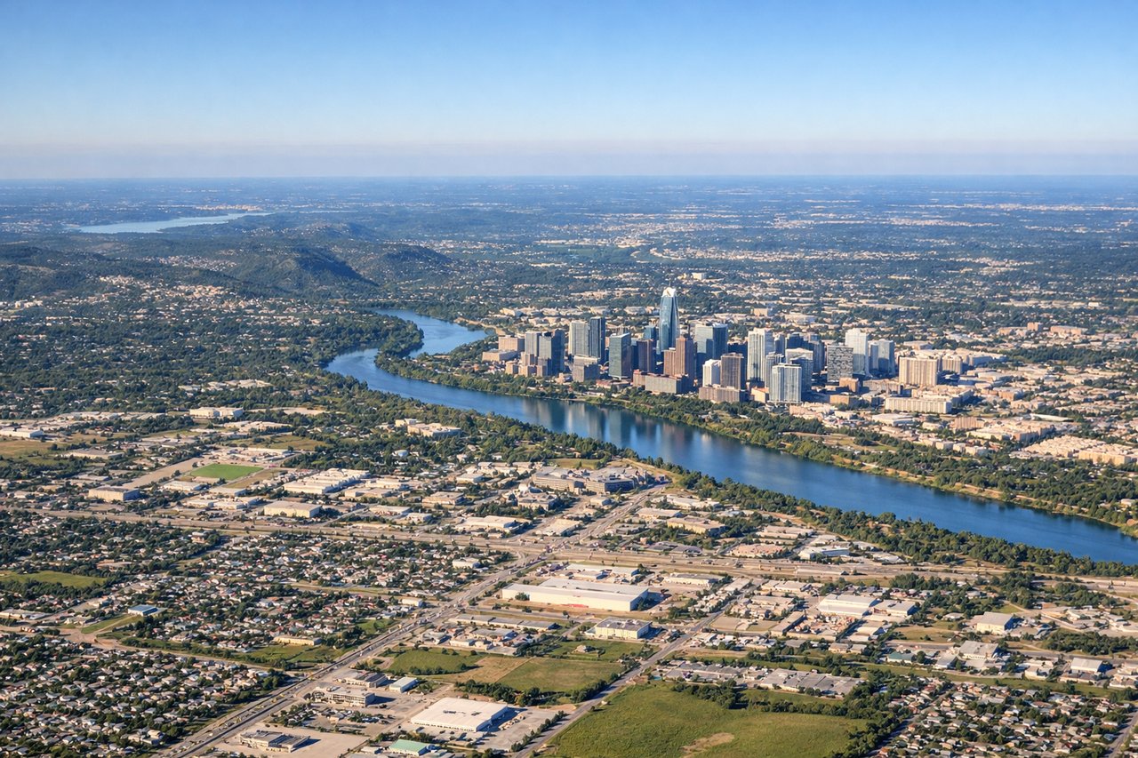
Takeoff from AUS
LEFTLeft side offers views of the Colorado River as it winds through central Austin and the Hill Country terrain beginning to rise northwest. Right side faces the flat suburban sprawl east toward the airport's approach zones.
Landing at CMH
RIGHTRight side provides views of the Scioto River valley and downtown Columbus's skyline during descent. Left side faces the flat, featureless farmland and suburban sprawl of central Ohio with minimal visual interest.
Will your flight be in sunlight?
Pick a date and time in the Sun Map to watch the sun move across your whole flight.
About This Route
Which side of the plane should I sit on flying from Austin Bergstrom International (AUS) to Port Columbus International (CMH)?
Sit on the Left side of the plane for the best views on flights from Austin to Columbus. Takeoff from Austin offers more dramatic and visually distinctive scenery with the Colorado River, Hill Country topography, and Lake Travis. Landing into Columbus is less scenic overall, making the outbound journey the stronger choice for window-seat viewing.
What can I see during takeoff from Austin Bergstrom International in Austin?
During takeoff from Austin Bergstrom International (AUS), sit on the Left side for the best views. Left side offers views of the Colorado River as it winds through central Austin and the Hill Country terrain beginning to rise northwest. Right side faces the flat suburban sprawl east toward the airport's approach zones. Notable sights include: Colorado River (threading through downtown Austin), Lake Travis (visible to the northwest at altitude), Hill Country limestone ridges, Barton Springs area.
What can I see when landing at Port Columbus International in Columbus?
When landing at Port Columbus International (CMH), sit on the Right side for the best views. Right side provides views of the Scioto River valley and downtown Columbus's skyline during descent. Left side faces the flat, featureless farmland and suburban sprawl of central Ohio with minimal visual interest. Notable sights include: Scioto River (flowing north through Columbus), downtown Columbus skyline, Olentangy River confluence, Ohio State University campus area.
How long is the flight from Austin to Columbus?
The flight from Austin Bergstrom International (AUS) to Port Columbus International (CMH) takes about 2 hours 45 minutes. The shortest flight path between them is 1,072 miles (1,726 km); winds and air traffic control usually add a few percent.
What does the Austin to Columbus flight path pass over?
The flight path crosses central Tennessee, passing near or over the Cumberland Plateau and its dissected terrain. The Tennessee River valley and its reservoirs (Watts Bar Lake, Chickamauga Lake) may be visible depending on exact routing. The transition from the Appalachian foothills of Tennessee into the flatter glaciated terrain of Ohio occurs in the latter half of the flight. The Ohio River valley becomes visible approaching Columbus from the south.