While takeoff favors the right for Cordillera views, the landing approach over Iceland's dramatic volcanic landscape and Atlantic coastline is the flight's most visually distinctive segment. Left seats dominate the longer, more memorable portion of the journey.
Flight Path
The flight crosses the Caribbean (southern Cuba visible on some routing), then the Atlantic over the Bahamas and open ocean. The Mid-Atlantic Ridge lies beneath the flight path but is not visible. As you approach Iceland, the Greenland Sea comes into view, followed by Iceland's southern coast with glacial features (Vatnajökull ice cap visible on clear days from the south), then the Reykjanes Peninsula's volcanic terrain on final approach.
Great circle distance and headings ›

Phase by phase
Takeoff from AXM
RIGHTEl Eden typically departs to the east or northeast. Right-side seats capture the Cordillera Central's dramatic escarpment rising immediately beyond the runway, with the Magdalena River valley visible in the middle distance to the left.
Landing at KEF
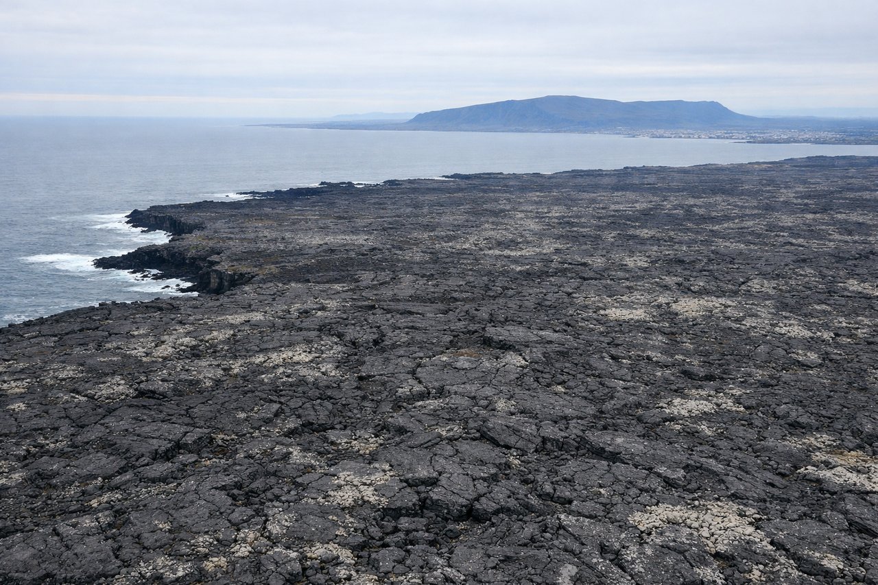
LEFTApproaching Keflavik from the southeast (typical arrival routing), left-side seats offer unobstructed views of Iceland's southwestern coast, the Reykjanes Peninsula's lava fields, and the Atlantic meeting the volcanic landscape. Right seats face inland toward less dramatic terrain.
Landmarks on this routeAll landmarks →
Will your flight be in sunlight?
See exactly which side of the plane gets sun and shade at your departure time.
About This Route
Which side of the plane should I sit on flying from El Eden (AXM) to Keflavik Nas (KEF)?
Sit on the Left side of the plane for the best views on flights from Armenia to Keflavik. While takeoff favors the right for Cordillera views, the landing approach over Iceland's dramatic volcanic landscape and Atlantic coastline is the flight's most visually distinctive segment. Left seats dominate the longer, more memorable portion of the journey.
What can I see during takeoff from El Eden in Armenia?
During takeoff from El Eden (AXM), sit on the Right side for the best views. El Eden typically departs to the east or northeast. Right-side seats capture the Cordillera Central's dramatic escarpment rising immediately beyond the runway, with the Magdalena River valley visible in the middle distance to the left. Notable sights include: Cordillera Central (eastern wall), Magdalena River valley, Cauca River confluence zone, local coffee region hills.
What can I see when landing at Keflavik Nas in Keflavik?
When landing at Keflavik Nas (KEF), sit on the Left side for the best views. Approaching Keflavik from the southeast (typical arrival routing), left-side seats offer unobstructed views of Iceland's southwestern coast, the Reykjanes Peninsula's lava fields, and the Atlantic meeting the volcanic landscape. Right seats face inland toward less dramatic terrain. Notable sights include: Reykjanes Peninsula lava fields (dark volcanic rock), Atlantic Ocean coastline, Keflavik airfield and surrounding geothermal areas, smaller lakes and geothermal steam vents.
How long is the flight from Armenia to Keflavik?
The flight from El Eden (AXM) to Keflavik Nas (KEF) takes Approximately 9.5 to 10.5 hours.
What does the Armenia to Keflavik flight path pass over?
The flight crosses the Caribbean (southern Cuba visible on some routing), then the Atlantic over the Bahamas and open ocean. The Mid-Atlantic Ridge lies beneath the flight path but is not visible. As you approach Iceland, the Greenland Sea comes into view, followed by Iceland's southern coast with glacial features (Vatnajökull ice cap visible on clear days from the south), then the Reykjanes Peninsula's volcanic terrain on final approach.