Takeoff views of the Taurus Mountains and Mediterranean are more visually dramatic than landing views of flat desert and urban sprawl. The climb-out scenery is the highlight of this route.
Flown AYT to DOH? Did we get it right?
Flight Path
Antalya to Doha is 1,465 miles (2,357 km), a flight of about 3 hours 15 minutes.
Over the eastern Mediterranean, you'll cross open water with Cyprus visible to the north (around 1 hour into flight). The flight path then transitions over Syria and Iraq's upper regions (avoid looking for specific landmarks here due to terrain obscurity and haze). The final approach crosses the flat Arabian Peninsula with minimal relief—only scattered wadis and salt flats visible before reaching the Persian Gulf coast near Doha.
Great circle distance and headings ›Phase by phase
Takeoff from AYT
LEFTLeft side offers immediate views of the Taurus Mountains rising directly north of Antalya, plus the Mediterranean coastline stretching eastward. Right side faces inland terrain with less dramatic relief.
Landing at DOH
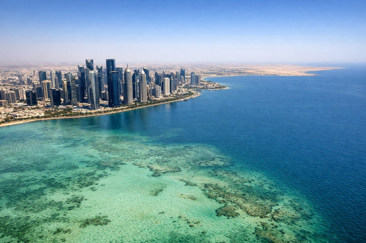
RIGHTRight side provides views of the Qatar coastline, the Persian Gulf's shallow waters, and Doha's waterfront development as you descend into Hamad International. Left side faces the flat inland desert with minimal visual interest.
Will your flight be in sunlight?
Pick a date and time in the Sun Map to watch the sun move across your whole flight.
About This Route
Which side of the plane should I sit on flying from Antalya (AYT) to Hamad International Airport (DOH)?
Sit on the Left side of the plane for the best views on flights from Antalya to Doha. Takeoff views of the Taurus Mountains and Mediterranean are more visually dramatic than landing views of flat desert and urban sprawl. The climb-out scenery is the highlight of this route.
What can I see during takeoff from Antalya in Antalya?
During takeoff from Antalya (AYT), sit on the Left side for the best views. Left side offers immediate views of the Taurus Mountains rising directly north of Antalya, plus the Mediterranean coastline stretching eastward. Right side faces inland terrain with less dramatic relief. Notable sights include: Taurus Mountains (north), Mediterranean Sea (south), Antalya city sprawl (beneath), Köprülü Canyon region (northeast distance).
What can I see when landing at Hamad International Airport in Doha?
When landing at Hamad International Airport (DOH), sit on the Right side for the best views. Right side provides views of the Qatar coastline, the Persian Gulf's shallow waters, and Doha's waterfront development as you descend into Hamad International. Left side faces the flat inland desert with minimal visual interest. Notable sights include: Persian Gulf (south and east), Doha's Corniche and West Bay skyline (east), Hamad International Airport grounds (north), shallow Gulf waters and coastal flats (surrounding).
How long is the flight from Antalya to Doha?
The flight from Antalya (AYT) to Hamad International Airport (DOH) takes about 3 hours 15 minutes. The shortest flight path between them is 1,465 miles (2,357 km); winds and air traffic control usually add a few percent.
What does the Antalya to Doha flight path pass over?
Over the eastern Mediterranean, you'll cross open water with Cyprus visible to the north (around 1 hour into flight). The flight path then transitions over Syria and Iraq's upper regions (avoid looking for specific landmarks here due to terrain obscurity and haze). The final approach crosses the flat Arabian Peninsula with minimal relief—only scattered wadis and salt flats visible before reaching the Persian Gulf coast near Doha.