Antalya to Istanbul is 322 miles (518 km), a flight of about 1 hour 20 minutes.
The right side combines a scenic mountain departure over the Taurus range with a rewarding urban and coastal arrival over the Sea of Marmara and Istanbul, while the left side offers mostly flat Anatolian plateau and less defined coastline.
Flight Path
Central Anatolian plateau, Sultan Mountains foothills, Lake Eğirdir region
Great circle distance and headings ›Phase by phase
Takeoff from AYT
RIGHTDeparting AYT, the initial climb offers views of the rugged Taurus Mountains rising inland to the northeast, a much more dramatic backdrop than the flatter coastal plain to the west. The right side also catches glimpses of Antalya Bay's turquoise water as the aircraft banks north.
Landing at IST
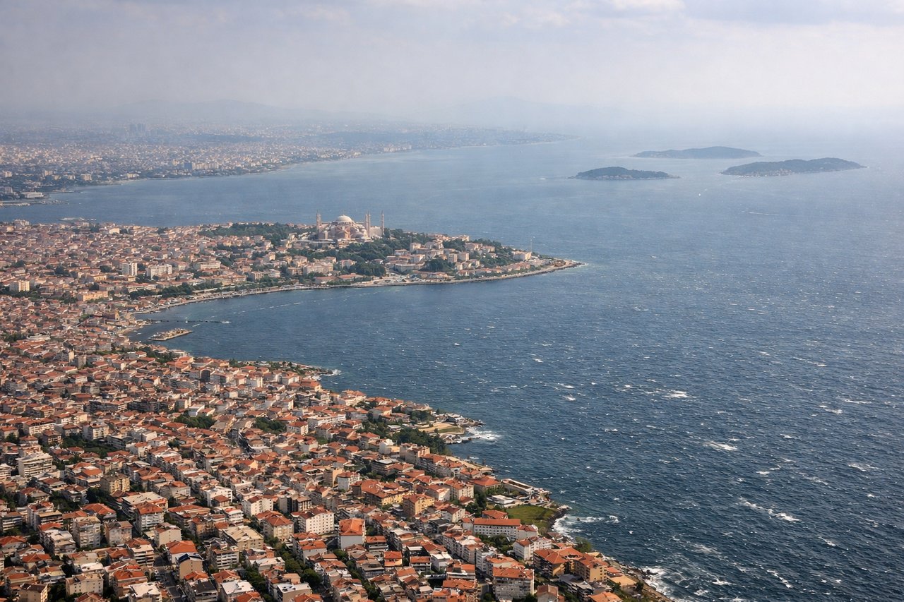
RIGHTOn approach to IST from the south, the right side gives passengers a sweeping view over the Sea of Marmara toward the Bosphorus strait and Istanbul's skyline, including the Asian and European shorelines. This urban and maritime scenery is far more compelling than the flatter, less distinctive terrain visible to the west.
Landmarks on this routeAll landmarks →
Will your flight be in sunlight?
Pick a date and time in the Sun Map to watch the sun move across your whole flight.
About This Route
Which side of the plane should I sit on flying from Antalya (AYT) to İstanbul Airport (IST)?
Sit on the Right side of the plane for the best views on flights from Antalya to Istanbul. The right side combines a scenic mountain departure over the Taurus range with a rewarding urban and coastal arrival over the Sea of Marmara and Istanbul, while the left side offers mostly flat Anatolian plateau and less defined coastline.
What can I see during takeoff from Antalya in Antalya?
During takeoff from Antalya (AYT), sit on the Right side for the best views. Departing AYT, the initial climb offers views of the rugged Taurus Mountains rising inland to the northeast, a much more dramatic backdrop than the flatter coastal plain to the west. The right side also catches glimpses of Antalya Bay's turquoise water as the aircraft banks north. Notable sights include: Taurus Mountains, Antalya Bay coastline, Düden waterfalls area, Antalya city outskirts.
What can I see when landing at İstanbul Airport in Istanbul?
When landing at İstanbul Airport (IST), sit on the Right side for the best views. On approach to IST from the south, the right side gives passengers a sweeping view over the Sea of Marmara toward the Bosphorus strait and Istanbul's skyline, including the Asian and European shorelines. This urban and maritime scenery is far more compelling than the flatter, less distinctive terrain visible to the west. Notable sights include: Sea of Marmara, Bosphorus strait, Istanbul skyline, Princes' Islands.
How long is the flight from Antalya to Istanbul?
The flight from Antalya (AYT) to İstanbul Airport (IST) takes about 1 hour 20 minutes. The shortest flight path between them is 322 miles (518 km); winds and air traffic control usually add a few percent.
What does the Antalya to Istanbul flight path pass over?
Central Anatolian plateau, Sultan Mountains foothills, Lake Eğirdir region