Balmaceda to Santiago is 867 miles (1,395 km), a flight of about 2 hours 15 minutes.
While takeoff favors the right for Patagonian plateau views, the landing approach dominates the flight experience, and left seats provide the superior and more dramatic perspective of the Andes cordillera and Santiago's setting. The descent views are more visually rewarding than the departure.
Flight Path
The flight path crosses the Patagonian steppe northward, passing east of the Andes foothills. Notable midpoint features include the Seno Otway inlet (visible if flying slightly westward), the transition from Patagonian steppe to the Central Valley near Talca, and the Andes cordillera becoming progressively more prominent as the aircraft approaches Santiago from the south. The Maule River valley and surrounding agricultural lands appear in the final approach phase.
Great circle distance and headings ›


Phase by phase
Takeoff from BBA
RIGHTBalmaceda's runway 09/27 typically favors departures to the north or south. Right-side seats capture the dramatic eastern escarpment of the Meseta del Lago Buenos Aires and the Andes foothills rising sharply from the Patagonian steppe during initial climb.
Landing at SCL
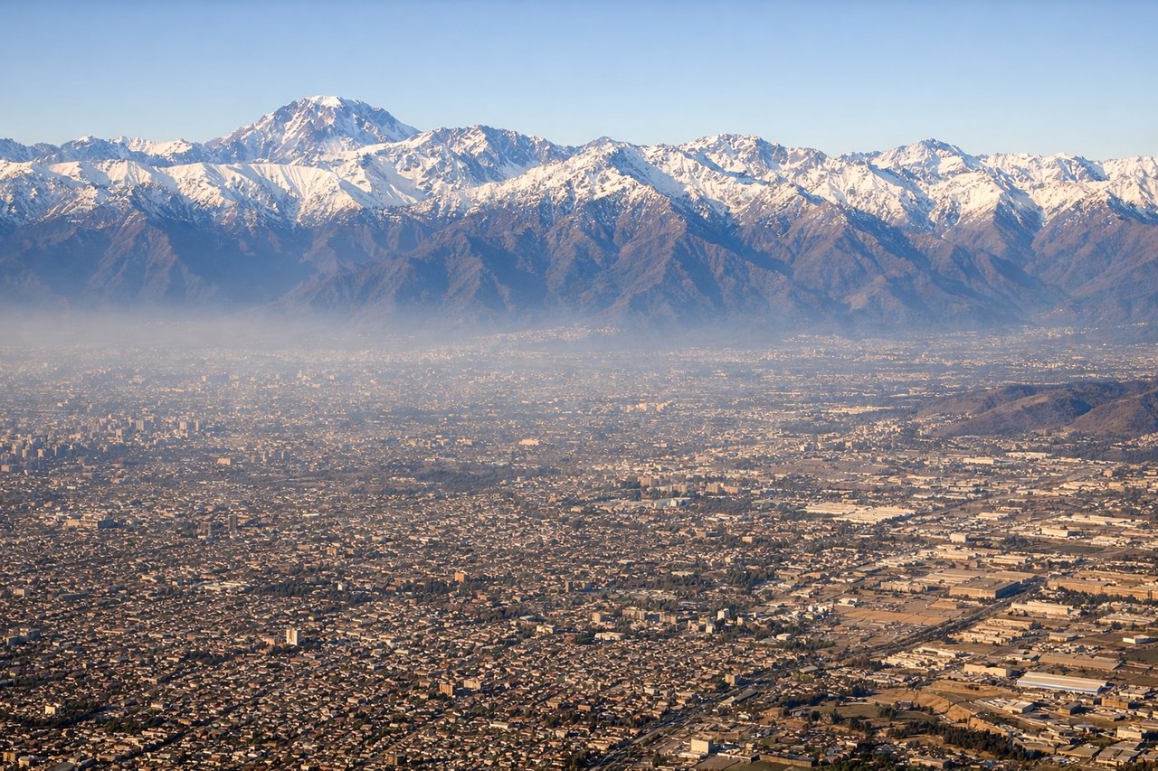
LEFTApproaching Santiago from the north, left-side seats offer unobstructed views of the Andes cordillera's main ridge and the pre-Andean foothills that frame the Santiago Basin. The descent path typically aligns with the Mapocho River valley, and left seats capture the western slopes of the Andes and the city's eastern boundary.
Landmarks on this routeAll landmarks →
Will your flight be in sunlight?
Pick a date and time in the Sun Map to watch the sun move across your whole flight.
About This Route
Which side of the plane should I sit on flying from Balmaceda (BBA) to Arturo Merino Benitez International (SCL)?
Sit on the Left side of the plane for the best views on flights from Balmaceda to Santiago. While takeoff favors the right for Patagonian plateau views, the landing approach dominates the flight experience, and left seats provide the superior and more dramatic perspective of the Andes cordillera and Santiago's setting. The descent views are more visually rewarding than the departure.
What can I see during takeoff from Balmaceda in Balmaceda?
During takeoff from Balmaceda (BBA), sit on the Right side for the best views. Balmaceda's runway 09/27 typically favors departures to the north or south. Right-side seats capture the dramatic eastern escarpment of the Meseta del Lago Buenos Aires and the Andes foothills rising sharply from the Patagonian steppe during initial climb. Notable sights include: Meseta del Lago Buenos Aires (eastern plateau edge), Andes foothills to the east, Rio Chubut valley system, Patagonian steppe extending westward.
What can I see when landing at Arturo Merino Benitez International in Santiago?
When landing at Arturo Merino Benitez International (SCL), sit on the Left side for the best views. Approaching Santiago from the north, left-side seats offer unobstructed views of the Andes cordillera's main ridge and the pre-Andean foothills that frame the Santiago Basin. The descent path typically aligns with the Mapocho River valley, and left seats capture the western slopes of the Andes and the city's eastern boundary. Notable sights include: Andes cordillera (main ridge with peaks 4,000-6,000m), San Cristóbal Hill (Cerro San Cristóbal) in central Santiago, Pre-Andean foothills, Mapocho River valley.
How long is the flight from Balmaceda to Santiago?
The flight from Balmaceda (BBA) to Arturo Merino Benitez International (SCL) takes about 2 hours 15 minutes. The shortest flight path between them is 867 miles (1,395 km); winds and air traffic control usually add a few percent.
What does the Balmaceda to Santiago flight path pass over?
The flight path crosses the Patagonian steppe northward, passing east of the Andes foothills. Notable midpoint features include the Seno Otway inlet (visible if flying slightly westward), the transition from Patagonian steppe to the Central Valley near Talca, and the Andes cordillera becoming progressively more prominent as the aircraft approaches Santiago from the south. The Maule River valley and surrounding agricultural lands appear in the final approach phase.