Santiago to Balmaceda is 867 miles (1,395 km), a flight of about 2 hours 15 minutes.
The takeoff climb provides superior scenic value with dramatic Andean views that dominate the early flight. While the landing approach offers Patagonian steppe scenery, the Andes departure is more visually striking and sustained.
Flight Path
The flight path traverses south-southeast across the Chilean landscape, passing over the Andes foothills and transitioning into the Patagonian region. Notable features include the transition from the Central Valley's agricultural lands to increasingly mountainous terrain around the Bío Bío and Araucanía regions, then into the Lake District (Región de Los Lagos) with visible lakes and forest coverage, before descending into the drier, more open steppe of Aysén. The Andes remain visible on the left (east) throughout much of the flight, with their elevation gradually decreasing toward the south.
Great circle distance and headings ›

Phase by phase
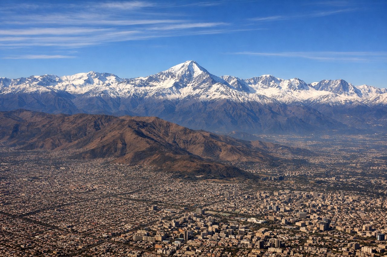
Takeoff from SCL
LEFTLeft side offers immediate views of the Andes cordillera rising to the east and southeast of Santiago. The Maipo River valley and pre-Andean foothills are visible during the initial climb, with snow-capped peaks becoming prominent within minutes of departure.
Landing at BBA
RIGHTRight side provides views of the Patagonian steppe landscape approaching Balmaceda, including the distinctive terrain of the Aysén Region. The descent path typically brings the Río Ibáñez valley and surrounding plateau into view on the right side.
Landmarks on this routeAll landmarks →
Will your flight be in sunlight?
Pick a date and time in the Sun Map to watch the sun move across your whole flight.
About This Route
Which side of the plane should I sit on flying from Arturo Merino Benitez International (SCL) to Balmaceda (BBA)?
Sit on the Left side of the plane for the best views on flights from Santiago to Balmaceda. The takeoff climb provides superior scenic value with dramatic Andean views that dominate the early flight. While the landing approach offers Patagonian steppe scenery, the Andes departure is more visually striking and sustained.
What can I see during takeoff from Arturo Merino Benitez International in Santiago?
During takeoff from Arturo Merino Benitez International (SCL), sit on the Left side for the best views. Left side offers immediate views of the Andes cordillera rising to the east and southeast of Santiago. The Maipo River valley and pre-Andean foothills are visible during the initial climb, with snow-capped peaks becoming prominent within minutes of departure. Notable sights include: Andes Mountains (eastern skyline), Maipo River valley, San Cristóbal Hill (Cerro San Cristóbal) in central Santiago, pre-Andean foothills.
What can I see when landing at Balmaceda in Balmaceda?
When landing at Balmaceda (BBA), sit on the Right side for the best views. Right side provides views of the Patagonian steppe landscape approaching Balmaceda, including the distinctive terrain of the Aysén Region. The descent path typically brings the Río Ibáñez valley and surrounding plateau into view on the right side. Notable sights include: Patagonian steppe (semi-arid plateau), Río Ibáñez valley, Balmaceda airfield and surrounding grassland, distant Andes foothills to the west.
How long is the flight from Santiago to Balmaceda?
The flight from Arturo Merino Benitez International (SCL) to Balmaceda (BBA) takes about 2 hours 15 minutes. The shortest flight path between them is 867 miles (1,395 km); winds and air traffic control usually add a few percent.
What does the Santiago to Balmaceda flight path pass over?
The flight path traverses south-southeast across the Chilean landscape, passing over the Andes foothills and transitioning into the Patagonian region. Notable features include the transition from the Central Valley's agricultural lands to increasingly mountainous terrain around the Bío Bío and Araucanía regions, then into the Lake District (Región de Los Lagos) with visible lakes and forest coverage, before descending into the drier, more open steppe of Aysén. The Andes remain visible on the left (east) throughout much of the flight, with their elevation gradually decreasing toward the south.