Right side scores higher due to superior scenery on both legs. Takeoff captures Barcelona's dramatic coastal-to-mountain transition with Montserrat's distinctive geology. Landing provides the more visually interesting approach over the Guayas estuary's mangrove patterns and Guayaquil's riverine urban layout. Left side faces open Mediterranean for much of cruise and offers less distinctive arrival scenery. The 9+ hour flight duration means cruise phase dominates, but the right side's departure and arrival sequences are substantially more scenic.
Flight Path
Atlantic crossing from Iberian Peninsula toward West Africa (Canary Islands visible if routed south), then across open Atlantic toward Caribbean. Potential routing over Morocco's Atlas Mountains or Anti-Atlas if northerly track used. Descent phase approaches northern South America with Caribbean islands (Aruba, Curaçao, or Margarita Island) potentially visible depending on exact flight path. Final approach into Ecuador crosses the Pacific coastal plain and Guayas River delta.
Great circle distance and headings ›


.jpg?width=600)
Phase by phase

Takeoff from BCN
RIGHTRight side captures Barcelona's Mediterranean coastline and the city's harbor during initial climb. The Montserrat massif becomes visible inland as the aircraft turns southwest, providing dramatic rocky terrain contrast against the coastal plain.
Landing at GYE
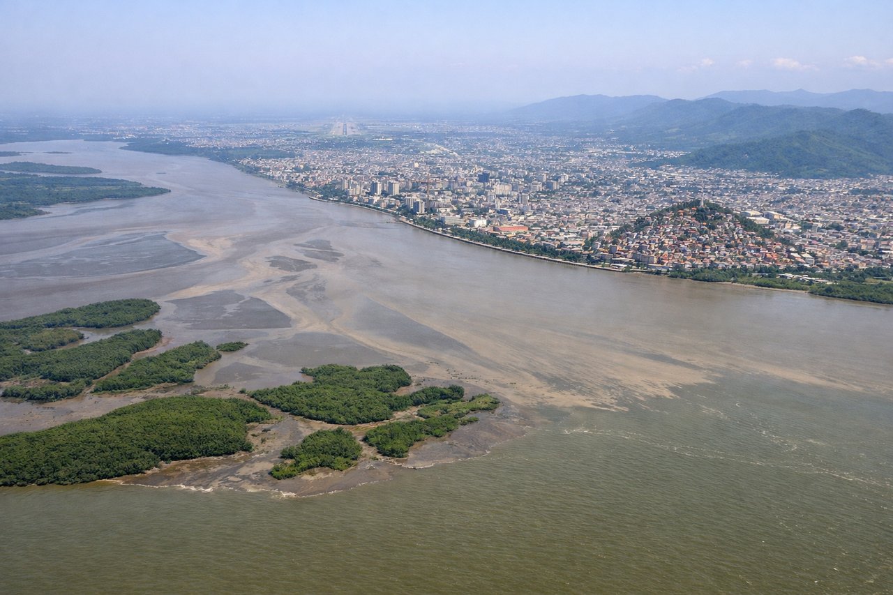
RIGHTRight side offers superior approach scenery into Guayaquil. The descent path over the Guayas River estuary and surrounding mangrove wetlands provides distinctive water and vegetation patterns. The Andes foothills become visible to the east during final approach, and the city's urban sprawl along the river is prominent.
Landmarks on this routeAll landmarks →
Will your flight be in sunlight?
See exactly which side of the plane gets sun and shade at your departure time.
About This Route
Which side of the plane should I sit on flying from Barcelona (BCN) to Simon Bolivar International (GYE)?
Sit on the Right side of the plane for the best views on flights from Barcelona to Guayaquil. Right side scores higher due to superior scenery on both legs. Takeoff captures Barcelona's dramatic coastal-to-mountain transition with Montserrat's distinctive geology. Landing provides the more visually interesting approach over the Guayas estuary's mangrove patterns and Guayaquil's riverine urban layout. Left side faces open Mediterranean for much of cruise and offers less distinctive arrival scenery. The 9+ hour flight duration means cruise phase dominates, but the right side's departure and arrival sequences are substantially more scenic.
What can I see during takeoff from Barcelona in Barcelona?
During takeoff from Barcelona (BCN), sit on the Right side for the best views. Right side captures Barcelona's Mediterranean coastline and the city's harbor during initial climb. The Montserrat massif becomes visible inland as the aircraft turns southwest, providing dramatic rocky terrain contrast against the coastal plain. Notable sights include: Barcelona harbor and breakwaters, Mediterranean Sea, Montserrat mountain range (inland to the west), Collserola Hills.
What can I see when landing at Simon Bolivar International in Guayaquil?
When landing at Simon Bolivar International (GYE), sit on the Right side for the best views. Right side offers superior approach scenery into Guayaquil. The descent path over the Guayas River estuary and surrounding mangrove wetlands provides distinctive water and vegetation patterns. The Andes foothills become visible to the east during final approach, and the city's urban sprawl along the river is prominent. Notable sights include: Guayas River estuary and mangrove forests, Guayaquil city sprawl along riverbanks, Andes foothills (distant eastern horizon), Salado River confluence.
How long is the flight from Barcelona to Guayaquil?
The flight from Barcelona (BCN) to Simon Bolivar International (GYE) takes 9h 35m.
What does the Barcelona to Guayaquil flight path pass over?
Atlantic crossing from Iberian Peninsula toward West Africa (Canary Islands visible if routed south), then across open Atlantic toward Caribbean. Potential routing over Morocco's Atlas Mountains or Anti-Atlas if northerly track used. Descent phase approaches northern South America with Caribbean islands (Aruba, Curaçao, or Margarita Island) potentially visible depending on exact flight path. Final approach into Ecuador crosses the Pacific coastal plain and Guayas River delta.