Right side scores marginally higher due to Brisbane's urban approach scenery and the Brisbane River's distinctive meanders visible during landing, which provide more visual interest than the flat inland views on the left. However, this is a short regional flight (approximately 50 minutes) over predominantly flat terrain with limited dramatic geography on either side, so both sides score in the lower range.
Flown BDB to BNE? Did we get it right?
Flight Path
Bundaberg to Brisbane is 178 miles (287 km), a flight of about 50 minutes.
Coastal plain between Bundaberg and Brisbane, Wide Bay region, scattered agricultural development, flat terrain with no significant mountains or dramatic topography. The flight path follows the Queensland coast northward, with Moreton Bay and its islands becoming visible as the aircraft approaches Brisbane.
Great circle distance and headings ›Phase by phase
Takeoff from BDB
RIGHTRight side captures Bundaberg's coastal position and the Wide Bay estuary during climb-out, offering brief water and agricultural patchwork views. Left side faces inland toward flat sugar cane plantations with minimal visual interest.
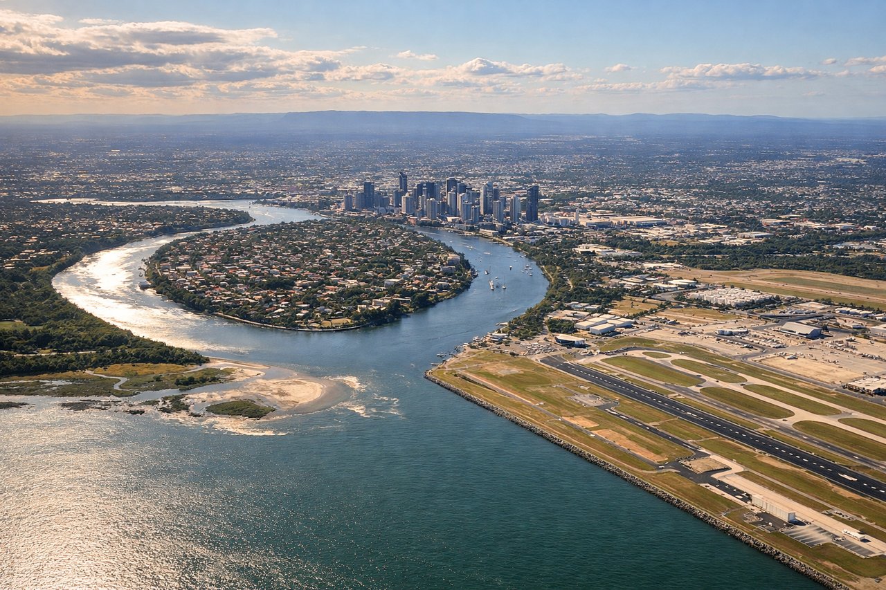
Landing at BNE
RIGHTRight side on approach to Brisbane captures the Brisbane River's distinctive meanders through the city, South Bank Parklands, and the central business district skyline. Left side shows suburban sprawl and inland plains with less dramatic urban definition.
Will your flight be in sunlight?
Pick a date and time in the Sun Map to watch the sun move across your whole flight.
About This Route
Which side of the plane should I sit on flying from Bundaberg Airport (BDB) to Brisbane International (BNE)?
Sit on the Right side of the plane for the best views on flights from Bundaberg to Brisbane. Right side scores marginally higher due to Brisbane's urban approach scenery and the Brisbane River's distinctive meanders visible during landing, which provide more visual interest than the flat inland views on the left. However, this is a short regional flight (approximately 50 minutes) over predominantly flat terrain with limited dramatic geography on either side, so both sides score in the lower range.
What can I see during takeoff from Bundaberg Airport in Bundaberg?
During takeoff from Bundaberg Airport (BDB), sit on the Right side for the best views. Right side captures Bundaberg's coastal position and the Wide Bay estuary during climb-out, offering brief water and agricultural patchwork views. Left side faces inland toward flat sugar cane plantations with minimal visual interest. Notable sights include: Wide Bay estuary, Bundaberg city grid, coastal agricultural strips, Pacific Ocean horizon.
What can I see when landing at Brisbane International in Brisbane?
When landing at Brisbane International (BNE), sit on the Right side for the best views. Right side on approach to Brisbane captures the Brisbane River's distinctive meanders through the city, South Bank Parklands, and the central business district skyline. Left side shows suburban sprawl and inland plains with less dramatic urban definition. Notable sights include: Brisbane River meanders, South Bank Parklands, Brisbane CBD skyline, Moreton Bay islands on distant horizon.
How long is the flight from Bundaberg to Brisbane?
The flight from Bundaberg Airport (BDB) to Brisbane International (BNE) takes about 50 minutes. The shortest flight path between them is 178 miles (287 km); winds and air traffic control usually add a few percent.
What does the Bundaberg to Brisbane flight path pass over?
Coastal plain between Bundaberg and Brisbane, Wide Bay region, scattered agricultural development, flat terrain with no significant mountains or dramatic topography. The flight path follows the Queensland coast northward, with Moreton Bay and its islands becoming visible as the aircraft approaches Brisbane.