While the takeoff offers modest Connecticut valley views, the landing provides far superior scenery with the dramatic Front Range mountains and the expansive Denver basin. The westbound flight path means the most visually striking segment occurs on approach.
Flown BDL to BJC? Did we get it right?
Flight Path
Windsor Locks to Denver is 1,689 miles (2,718 km), a flight of about 4 hours 15 minutes.
The flight crosses the Appalachian Mountains in Pennsylvania and Ohio, then transitions over the Great Plains of Indiana, Illinois, and Iowa. The Mississippi River is visible near the midpoint of the journey. As you progress westward, the terrain gradually flattens from forested hills to agricultural plains. The Missouri River appears in the final third of the flight as you approach the High Plains of eastern Colorado. Weather patterns and visibility permitting, you may see the transition from green vegetation in the east to drier grasslands in the west.
Great circle distance and headings ›


Phase by phase
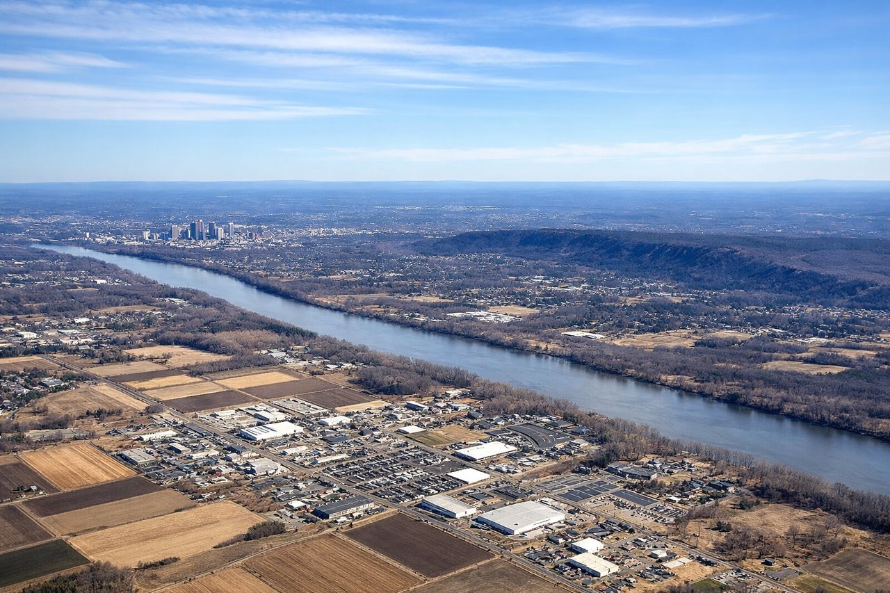
Takeoff from BDL
LEFTLeft seats offer views of the Connecticut River valley and the Appalachian foothills as the aircraft climbs westward. You'll see the river's meandering path and the forested terrain that characterizes central Connecticut.
Landing at BJC
RIGHTRight seats provide excellent views of the Front Range of the Rocky Mountains during descent into Denver. The dramatic eastern face of the Rockies rises prominently as you approach from the east, with the Denver metropolitan area sprawling across the plains below.
Will your flight be in sunlight?
Pick a date and time in the Sun Map to watch the sun move across your whole flight.
About This Route
Which side of the plane should I sit on flying from Bradley International (BDL) to Rocky Mountain Metropolitan Airport (BJC)?
Sit on the Right side of the plane for the best views on flights from Windsor Locks to Denver. While the takeoff offers modest Connecticut valley views, the landing provides far superior scenery with the dramatic Front Range mountains and the expansive Denver basin. The westbound flight path means the most visually striking segment occurs on approach.
What can I see during takeoff from Bradley International in Windsor Locks?
During takeoff from Bradley International (BDL), sit on the Left side for the best views. Left seats offer views of the Connecticut River valley and the Appalachian foothills as the aircraft climbs westward. You'll see the river's meandering path and the forested terrain that characterizes central Connecticut. Notable sights include: Connecticut River, Appalachian foothills, Hartford metropolitan area, Long Island Sound (distant).
What can I see when landing at Rocky Mountain Metropolitan Airport in Denver?
When landing at Rocky Mountain Metropolitan Airport (BJC), sit on the Right side for the best views. Right seats provide excellent views of the Front Range of the Rocky Mountains during descent into Denver. The dramatic eastern face of the Rockies rises prominently as you approach from the east, with the Denver metropolitan area sprawling across the plains below. Notable sights include: Front Range of the Rocky Mountains, Denver metropolitan area, South Platte River, High Plains.
How long is the flight from Windsor Locks to Denver?
The flight from Bradley International (BDL) to Rocky Mountain Metropolitan Airport (BJC) takes about 4 hours 15 minutes. The shortest flight path between them is 1,689 miles (2,718 km); winds and air traffic control usually add a few percent.
What does the Windsor Locks to Denver flight path pass over?
The flight crosses the Appalachian Mountains in Pennsylvania and Ohio, then transitions over the Great Plains of Indiana, Illinois, and Iowa. The Mississippi River is visible near the midpoint of the journey. As you progress westward, the terrain gradually flattens from forested hills to agricultural plains. The Missouri River appears in the final third of the flight as you approach the High Plains of eastern Colorado. Weather patterns and visibility permitting, you may see the transition from green vegetation in the east to drier grasslands in the west.