While takeoff offers pleasant New England scenery, the landing approach into Chicago provides more dramatic and recognizable urban and water features. Lake Michigan and Chicago's skyline are more visually striking than the Connecticut River valley, making left-side seats the better choice for the overall flight.
Flown BDL to MDW? Did we get it right?
Flight Path
Windsor Locks to Chicago is 774 miles (1,246 km), a flight of about 2 hours 15 minutes.
The flight path crosses the Appalachian foothills of Pennsylvania and Ohio, passing over the ridge-and-valley terrain of the Allegheny Mountains (visible as parallel ridges running northeast-southwest), then transitions into the glaciated plains of Ohio and Indiana. The Great Lakes region becomes visible as the aircraft approaches Illinois, with Lake Erie potentially visible on clear days from the northern route corridor. Major cities along the path include Cleveland and Columbus, Ohio, visible as urban clusters from altitude. The landscape transitions from forested Appalachian terrain to increasingly flat agricultural plains as the flight progresses westward into the Midwest.
Great circle distance and headings ›


Phase by phase

Takeoff from BDL
RIGHTRight-side seats offer views of the Connecticut River valley and the transition from New England terrain into the broader landscape. The aircraft climbs northwest from BDL, and right-side windows capture the river system and forested hills that define the region immediately west of the airport.
Landing at MDW
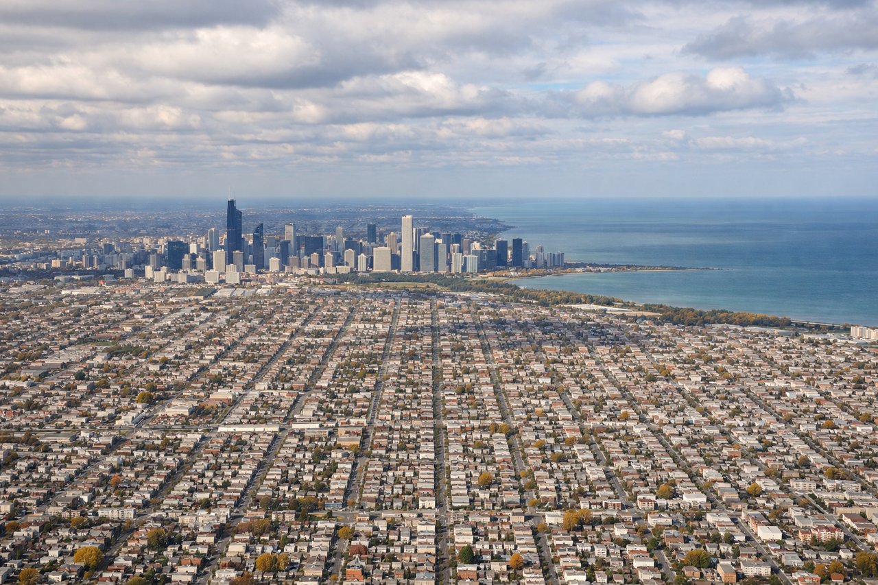
LEFTLeft-side seats provide excellent views during the descent into Chicago. Aircraft approach MDW from the east, and left windows capture Lake Michigan, the Chicago shoreline, and the city's downtown skyline and grid pattern as the plane descends toward the airport on the city's southwest side.
Will your flight be in sunlight?
Pick a date and time in the Sun Map to watch the sun move across your whole flight.
About This Route
Which side of the plane should I sit on flying from Bradley International (BDL) to Chicago Midway International (MDW)?
Sit on the Left side of the plane for the best views on flights from Windsor Locks to Chicago. While takeoff offers pleasant New England scenery, the landing approach into Chicago provides more dramatic and recognizable urban and water features. Lake Michigan and Chicago's skyline are more visually striking than the Connecticut River valley, making left-side seats the better choice for the overall flight.
What can I see during takeoff from Bradley International in Windsor Locks?
During takeoff from Bradley International (BDL), sit on the Right side for the best views. Right-side seats offer views of the Connecticut River valley and the transition from New England terrain into the broader landscape. The aircraft climbs northwest from BDL, and right-side windows capture the river system and forested hills that define the region immediately west of the airport. Notable sights include: Connecticut River, Metacomet Ridge (traprock ridges visible as linear features), Hartford metropolitan area, New England deciduous forest canopy.
What can I see when landing at Chicago Midway International in Chicago?
When landing at Chicago Midway International (MDW), sit on the Left side for the best views. Left-side seats provide excellent views during the descent into Chicago. Aircraft approach MDW from the east, and left windows capture Lake Michigan, the Chicago shoreline, and the city's downtown skyline and grid pattern as the plane descends toward the airport on the city's southwest side. Notable sights include: Lake Michigan, Chicago downtown skyline and grid street pattern, Des Plaines River, industrial and residential neighborhoods of southwest Chicago.
How long is the flight from Windsor Locks to Chicago?
The flight from Bradley International (BDL) to Chicago Midway International (MDW) takes about 2 hours 15 minutes. The shortest flight path between them is 774 miles (1,246 km); winds and air traffic control usually add a few percent.
What does the Windsor Locks to Chicago flight path pass over?
The flight path crosses the Appalachian foothills of Pennsylvania and Ohio, passing over the ridge-and-valley terrain of the Allegheny Mountains (visible as parallel ridges running northeast-southwest), then transitions into the glaciated plains of Ohio and Indiana. The Great Lakes region becomes visible as the aircraft approaches Illinois, with Lake Erie potentially visible on clear days from the northern route corridor. Major cities along the path include Cleveland and Columbus, Ohio, visible as urban clusters from altitude. The landscape transitions from forested Appalachian terrain to increasingly flat agricultural plains as the flight progresses westward into the Midwest.