Right side wins for the complete journey. Takeoff offers the Connecticut River valley views, and landing provides the dramatic Tampa Bay estuary approach—one of the most visually distinctive features of this route.
Flown BDL to TPA? Did we get it right?
Flight Path
Windsor Locks to Tampa is 1,112 miles (1,790 km), a flight of about 2 hours 50 minutes.
The flight path crosses the Appalachian foothills of Pennsylvania and West Virginia (visible as ridgelines and valleys), the Ohio River valley, and transitions into the Piedmont region of the Carolinas. Around midpoint near the Virginia-North Carolina border, you'll see the Blue Ridge Mountains as a distant ridge line to the west. The Piedmont's rolling terrain and scattered lakes become visible in the Carolinas. As you approach Florida, the landscape flattens dramatically, with the coastal plain becoming increasingly visible. The Atlantic coastal areas of Georgia and northern Florida show barrier islands and inlets before the final approach to Tampa Bay.
Great circle distance and headings ›

Phase by phase

Takeoff from BDL
RIGHTRight side offers views of the Connecticut River valley and the surrounding New England terrain as the aircraft climbs southwestward. You'll see the river's meandering path and the transition from urban Windsor Locks to rural Connecticut landscape.
Landing at TPA
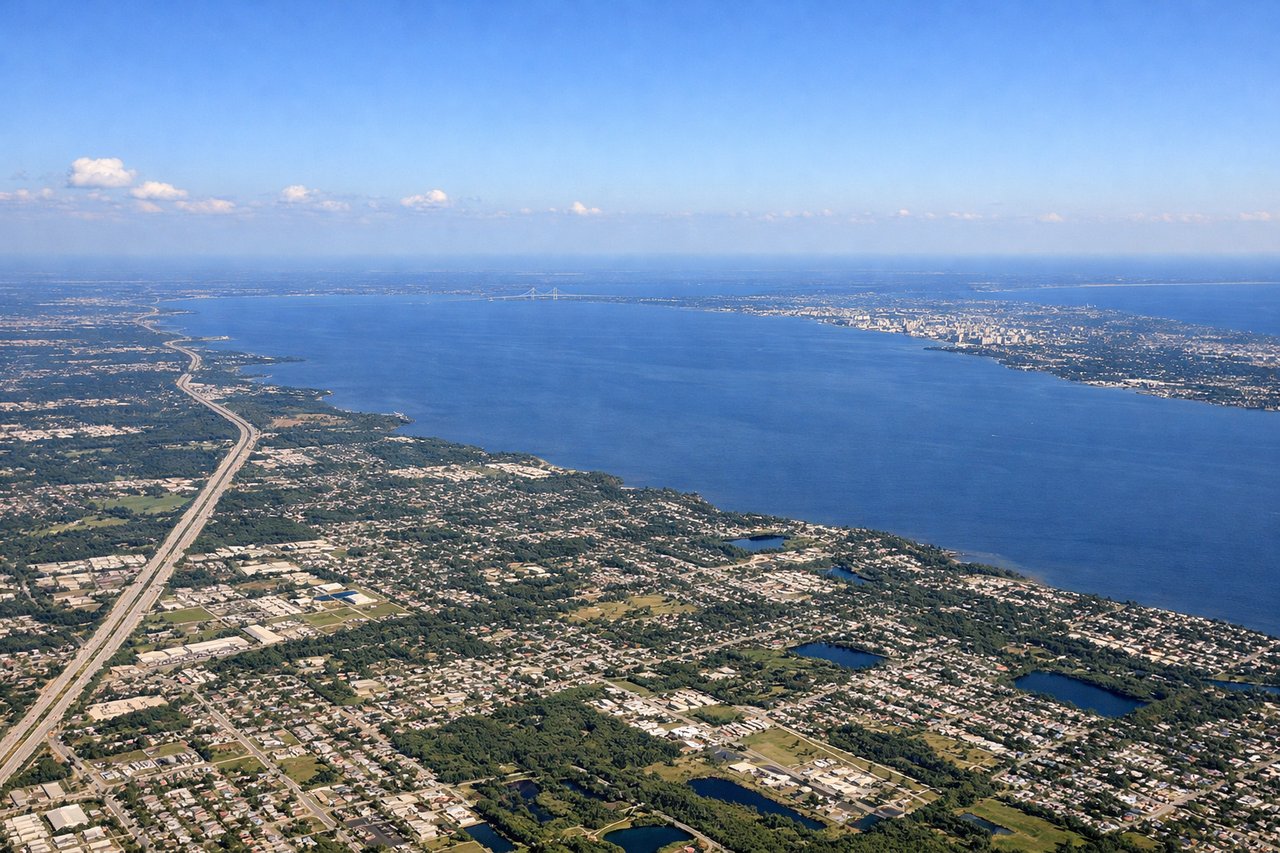
RIGHTRight side provides excellent views during descent into Tampa. You'll see the Tampa Bay estuary, Hillsborough Bay, and the distinctive shape of the bay's islands and peninsulas as you approach from the north.
Will your flight be in sunlight?
Pick a date and time in the Sun Map to watch the sun move across your whole flight.
About This Route
Which side of the plane should I sit on flying from Bradley International (BDL) to Tampa International (TPA)?
Sit on the Right side of the plane for the best views on flights from Windsor Locks to Tampa. Right side wins for the complete journey. Takeoff offers the Connecticut River valley views, and landing provides the dramatic Tampa Bay estuary approach—one of the most visually distinctive features of this route.
What can I see during takeoff from Bradley International in Windsor Locks?
During takeoff from Bradley International (BDL), sit on the Right side for the best views. Right side offers views of the Connecticut River valley and the surrounding New England terrain as the aircraft climbs southwestward. You'll see the river's meandering path and the transition from urban Windsor Locks to rural Connecticut landscape. Notable sights include: Connecticut River, Hartford metropolitan area to the south, New England forested hills, Long Island Sound (visible at higher altitude).
What can I see when landing at Tampa International in Tampa?
When landing at Tampa International (TPA), sit on the Right side for the best views. Right side provides excellent views during descent into Tampa. You'll see the Tampa Bay estuary, Hillsborough Bay, and the distinctive shape of the bay's islands and peninsulas as you approach from the north. Notable sights include: Tampa Bay and Hillsborough Bay, Clearwater area to the west, Florida's Gulf Coast barrier islands, downtown Tampa skyline.
How long is the flight from Windsor Locks to Tampa?
The flight from Bradley International (BDL) to Tampa International (TPA) takes about 2 hours 50 minutes. The shortest flight path between them is 1,112 miles (1,790 km); winds and air traffic control usually add a few percent.
What does the Windsor Locks to Tampa flight path pass over?
The flight path crosses the Appalachian foothills of Pennsylvania and West Virginia (visible as ridgelines and valleys), the Ohio River valley, and transitions into the Piedmont region of the Carolinas. Around midpoint near the Virginia-North Carolina border, you'll see the Blue Ridge Mountains as a distant ridge line to the west. The Piedmont's rolling terrain and scattered lakes become visible in the Carolinas. As you approach Florida, the landscape flattens dramatically, with the coastal plain becoming increasingly visible. The Atlantic coastal areas of Georgia and northern Florida show barrier islands and inlets before the final approach to Tampa Bay.