The landing approach over the Smoky Mountains foothills and Tennessee Valley provides significantly more dramatic terrain variety and visual interest than the takeoff from Connecticut. While the Connecticut departure offers river scenery, the Appalachian ridgelines and valley topography during descent to Knoxville deliver more pronounced elevation changes and landmark density. The right side captures the transition from mountain terrain to urban valley, scoring higher overall.
Flown BDL to TYS? Did we get it right?
Flight Path
Windsor Locks to Knoxville is 740 miles (1,191 km), a flight of about 1 hour 35 minutes.
Appalachian ridge-and-valley system dominates the entire route. The flight path crosses the Blue Ridge Mountains and Cumberland Plateau regions. The New River (West Virginia), Shenandoah Valley (Virginia), and multiple parallel ridgelines of the Appalachian chain are visible during cruise. The terrain transitions from Connecticut's lower New England hills through Pennsylvania's ridge system, then into the higher Appalachian ranges of West Virginia and eastern Tennessee.
Great circle distance and headings ›

Phase by phase
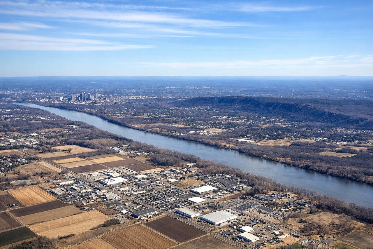
Takeoff from BDL
LEFTBradley International sits in central Connecticut with the Connecticut River valley visible immediately after departure. Left-side views capture the river's meandering path northward and the transition from urban Hartford area to forested New England terrain.
Landing at TYS
RIGHTThe approach to McGhee Tyson descends over the Great Smoky Mountains foothills and the Tennessee Valley. Right-side views showcase the dramatic ridge-and-valley topography of the Appalachian system, with the Holston River visible and Knoxville's urban footprint in the valley floor.
Will your flight be in sunlight?
Pick a date and time in the Sun Map to watch the sun move across your whole flight.
About This Route
Which side of the plane should I sit on flying from Bradley International (BDL) to Mc Ghee Tyson (TYS)?
Sit on the Right side of the plane for the best views on flights from Windsor Locks to Knoxville. The landing approach over the Smoky Mountains foothills and Tennessee Valley provides significantly more dramatic terrain variety and visual interest than the takeoff from Connecticut. While the Connecticut departure offers river scenery, the Appalachian ridgelines and valley topography during descent to Knoxville deliver more pronounced elevation changes and landmark density. The right side captures the transition from mountain terrain to urban valley, scoring higher overall.
What can I see during takeoff from Bradley International in Windsor Locks?
During takeoff from Bradley International (BDL), sit on the Left side for the best views. Bradley International sits in central Connecticut with the Connecticut River valley visible immediately after departure. Left-side views capture the river's meandering path northward and the transition from urban Hartford area to forested New England terrain. Notable sights include: Connecticut River valley, Hartford metropolitan area, Farmington River confluence, forested Connecticut uplands.
What can I see when landing at Mc Ghee Tyson in Knoxville?
When landing at Mc Ghee Tyson (TYS), sit on the Right side for the best views. The approach to McGhee Tyson descends over the Great Smoky Mountains foothills and the Tennessee Valley. Right-side views showcase the dramatic ridge-and-valley topography of the Appalachian system, with the Holston River visible and Knoxville's urban footprint in the valley floor. Notable sights include: Great Smoky Mountains foothills, Holston River, Knoxville urban area, Tennessee Valley ridgelines.
How long is the flight from Windsor Locks to Knoxville?
The flight from Bradley International (BDL) to Mc Ghee Tyson (TYS) takes about 1 hour 35 minutes. The shortest flight path between them is 740 miles (1,191 km); winds and air traffic control usually add a few percent.
What does the Windsor Locks to Knoxville flight path pass over?
Appalachian ridge-and-valley system dominates the entire route. The flight path crosses the Blue Ridge Mountains and Cumberland Plateau regions. The New River (West Virginia), Shenandoah Valley (Virginia), and multiple parallel ridgelines of the Appalachian chain are visible during cruise. The terrain transitions from Connecticut's lower New England hills through Pennsylvania's ridge system, then into the higher Appalachian ranges of West Virginia and eastern Tennessee.