Takeoff from Bardufoss offers more dramatic and visually distinctive geography (the Lyngen Alps are striking). While landing at LGA favors the left, the takeoff experience is more rewarding for window-seat geography enthusiasts.
Flight Path
This transatlantic route crosses the Norwegian Sea, then passes over the North Atlantic. Notable waypoints include: the Norwegian coast near Tromsø (departing), the Shetland Islands (far to the south of track), the open Atlantic with occasional weather systems visible, Greenland's southern tip (far north of typical track), and the Canadian Maritime provinces before descending into the New York area. At cruise altitude (typically 35,000-37,000 feet), the curvature of the Earth becomes subtly visible, and the Atlantic appears as a vast, featureless expanse with occasional cloud formations. No major landmarks are visible in the mid-ocean portion.
Great circle distance and headings ›
.jpeg?width=600)
.jpg?width=600)
Phase by phase
Takeoff from BDU
RIGHTBardufoss typically departs to the north or northeast. Right-side seats offer views of the Lyngen Alps and the dramatic fjord system of northern Troms, which rise steeply from sea level immediately north of the airport.
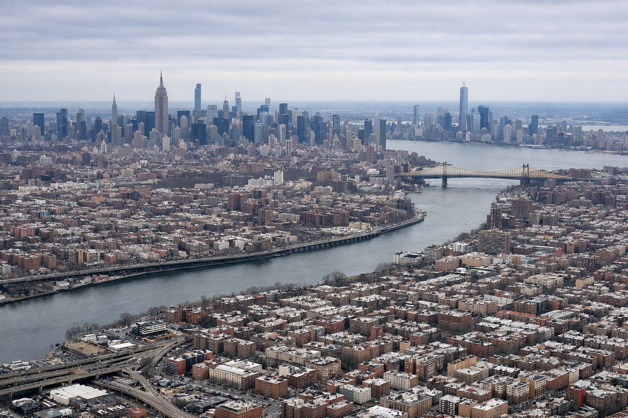
Landing at LGA
LEFTApproach to LGA typically uses runways 04 or 13 depending on wind. Left-side seats on descent into the New York area offer views of Manhattan's skyline, the East River, and the distinctive geography of the lower Hudson Valley and Upper New York Bay.
Landmarks on this routeAll landmarks →
Will your flight be in sunlight?
See exactly which side of the plane gets sun and shade at your departure time.
About This Route
Which side of the plane should I sit on flying from Bardufoss (BDU) to La Guardia (LGA)?
Sit on the Right side of the plane for the best views on flights from Bardufoss to New York. Takeoff from Bardufoss offers more dramatic and visually distinctive geography (the Lyngen Alps are striking). While landing at LGA favors the left, the takeoff experience is more rewarding for window-seat geography enthusiasts.
What can I see during takeoff from Bardufoss in Bardufoss?
During takeoff from Bardufoss (BDU), sit on the Right side for the best views. Bardufoss typically departs to the north or northeast. Right-side seats offer views of the Lyngen Alps and the dramatic fjord system of northern Troms, which rise steeply from sea level immediately north of the airport. Notable sights include: Lyngen Alps (sharp peaks directly north), Ulvesund fjord (narrow water passage below), Bardufoss valley floor (receding southward), Arctic Ocean coastline (northern horizon).
What can I see when landing at La Guardia in New York?
When landing at La Guardia (LGA), sit on the Left side for the best views. Approach to LGA typically uses runways 04 or 13 depending on wind. Left-side seats on descent into the New York area offer views of Manhattan's skyline, the East River, and the distinctive geography of the lower Hudson Valley and Upper New York Bay. Notable sights include: Manhattan skyline (cluster of tall buildings on the horizon), East River (dark water channel), Upper New York Bay (broad water body), Bronx and Queens residential areas (grid pattern below).
How long is the flight from Bardufoss to New York?
The flight from Bardufoss (BDU) to La Guardia (LGA) takes Approximately 7.5 to 8.5 hours.
What does the Bardufoss to New York flight path pass over?
This transatlantic route crosses the Norwegian Sea, then passes over the North Atlantic. Notable waypoints include: the Norwegian coast near Tromsø (departing), the Shetland Islands (far to the south of track), the open Atlantic with occasional weather systems visible, Greenland's southern tip (far north of typical track), and the Canadian Maritime provinces before descending into the New York area. At cruise altitude (typically 35,000-37,000 feet), the curvature of the Earth becomes subtly visible, and the Atlantic appears as a vast, featureless expanse with occasional cloud formations. No major landmarks are visible in the mid-ocean portion.