While left offers good New York departure views, right provides superior scenery for the majority of the flight. The transatlantic crossing features the North Atlantic, and the approach to Bardufoss showcases dramatic Scandinavian mountain terrain and Arctic landscape that dominates the final 2-3 hours of flight.
Flight Path
North Atlantic Ocean (open water with no major landmarks for roughly 4-5 hours), southern Greenland coast (if visible on northern routing—Greenland Ice Sheet edge and fjord systems), Iceland (if routed south—Vatnajökull glacier and volcanic terrain visible), Norwegian Sea, and the approach to northern Scandinavia showing the Norwegian coastline with fjords, islands, and the transition from coastal terrain to inland mountains and tundra
Great circle distance and headings ›.jpg?width=600)
.jpeg?width=600)

Phase by phase
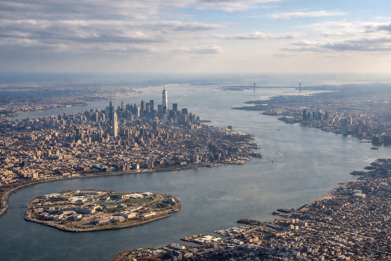
Takeoff from LGA
LEFTLeft side captures the East River, Manhattan skyline, and the initial climb over the Atlantic approaches. You'll see the Hudson River valley and New Jersey terrain receding as you gain altitude.
Landing at BDU
RIGHTRight side offers the best views during approach to Bardufoss. You'll see the Bardufoss valley, the surrounding Scandinavian mountains, and the approach over northern Norwegian terrain with fjords and tundra landscape.
Landmarks on this routeAll landmarks →
Will your flight be in sunlight?
See exactly which side of the plane gets sun and shade at your departure time.
About This Route
Which side of the plane should I sit on flying from La Guardia (LGA) to Bardufoss (BDU)?
Sit on the Right side of the plane for the best views on flights from New York to Bardufoss. While left offers good New York departure views, right provides superior scenery for the majority of the flight. The transatlantic crossing features the North Atlantic, and the approach to Bardufoss showcases dramatic Scandinavian mountain terrain and Arctic landscape that dominates the final 2-3 hours of flight.
What can I see during takeoff from La Guardia in New York?
During takeoff from La Guardia (LGA), sit on the Left side for the best views. Left side captures the East River, Manhattan skyline, and the initial climb over the Atlantic approaches. You'll see the Hudson River valley and New Jersey terrain receding as you gain altitude. Notable sights include: East River, Manhattan skyline (Empire State Building district visible at distance), Hudson River, New Jersey Palisades.
What can I see when landing at Bardufoss in Bardufoss?
When landing at Bardufoss (BDU), sit on the Right side for the best views. Right side offers the best views during approach to Bardufoss. You'll see the Bardufoss valley, the surrounding Scandinavian mountains, and the approach over northern Norwegian terrain with fjords and tundra landscape. Notable sights include: Bardufoss valley and airfield, Scandinavian mountain ranges (Lyngen Alps to the east), Barents Sea coastline, Arctic tundra and moorland.
How long is the flight from New York to Bardufoss?
The flight from La Guardia (LGA) to Bardufoss (BDU) takes Approximately 7.5 to 8.5 hours.
What does the New York to Bardufoss flight path pass over?
North Atlantic Ocean (open water with no major landmarks for roughly 4-5 hours), southern Greenland coast (if visible on northern routing—Greenland Ice Sheet edge and fjord systems), Iceland (if routed south—Vatnajökull glacier and volcanic terrain visible), Norwegian Sea, and the approach to northern Scandinavia showing the Norwegian coastline with fjords, islands, and the transition from coastal terrain to inland mountains and tundra