While takeoff favors the left for Cascade views, the right side wins overall because the Alaska Range and Tanana River valley during the long descent into Fairbanks provide more sustained visual interest across the majority of the flight's final hours. The northern route offers extended views of the Alaska interior.
Flown BFI to FAI? Did we get it right?
Flight Path
Seattle to Fairbanks is 1,525 miles (2,454 km), a flight of about 3 hours.
The flight path crosses the Talkeetna Mountains and the Alaska Range foothills. Around the midpoint (roughly over the Susitna River valley), you'll see the transition from Cascade/coastal geography to interior Alaska terrain. The Chugach Mountains appear to the east around 90 minutes into the flight. As you progress north, the landscape becomes increasingly boreal forest with scattered lakes and rivers. The Denali area (Mount Denali/McKinley) may be visible to the west on clear days, though it's typically 50+ miles off the standard flight path. The final hour shows increasing braided river systems and the characteristic flat-to-rolling terrain of the Tanana Valley.
Great circle distance and headings ›


Phase by phase
Takeoff from BFI
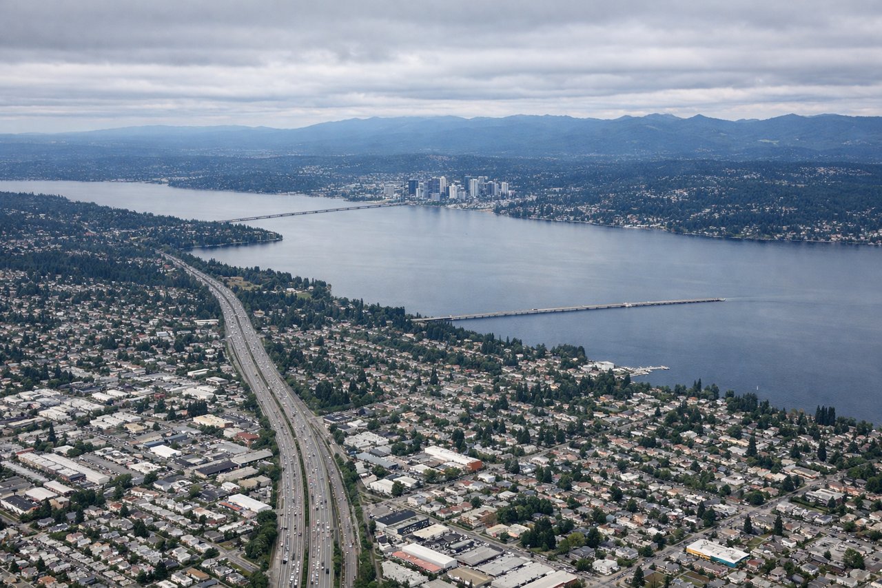
LEFTBFI typically departs north or northeast. Left-side seats offer immediate views of the Cascade Range rising to the east, with Mount Rainier visible on clear days roughly 50 miles southeast. You'll also see Puget Sound and the Olympic Mountains to the west as you climb.
Landing at FAI
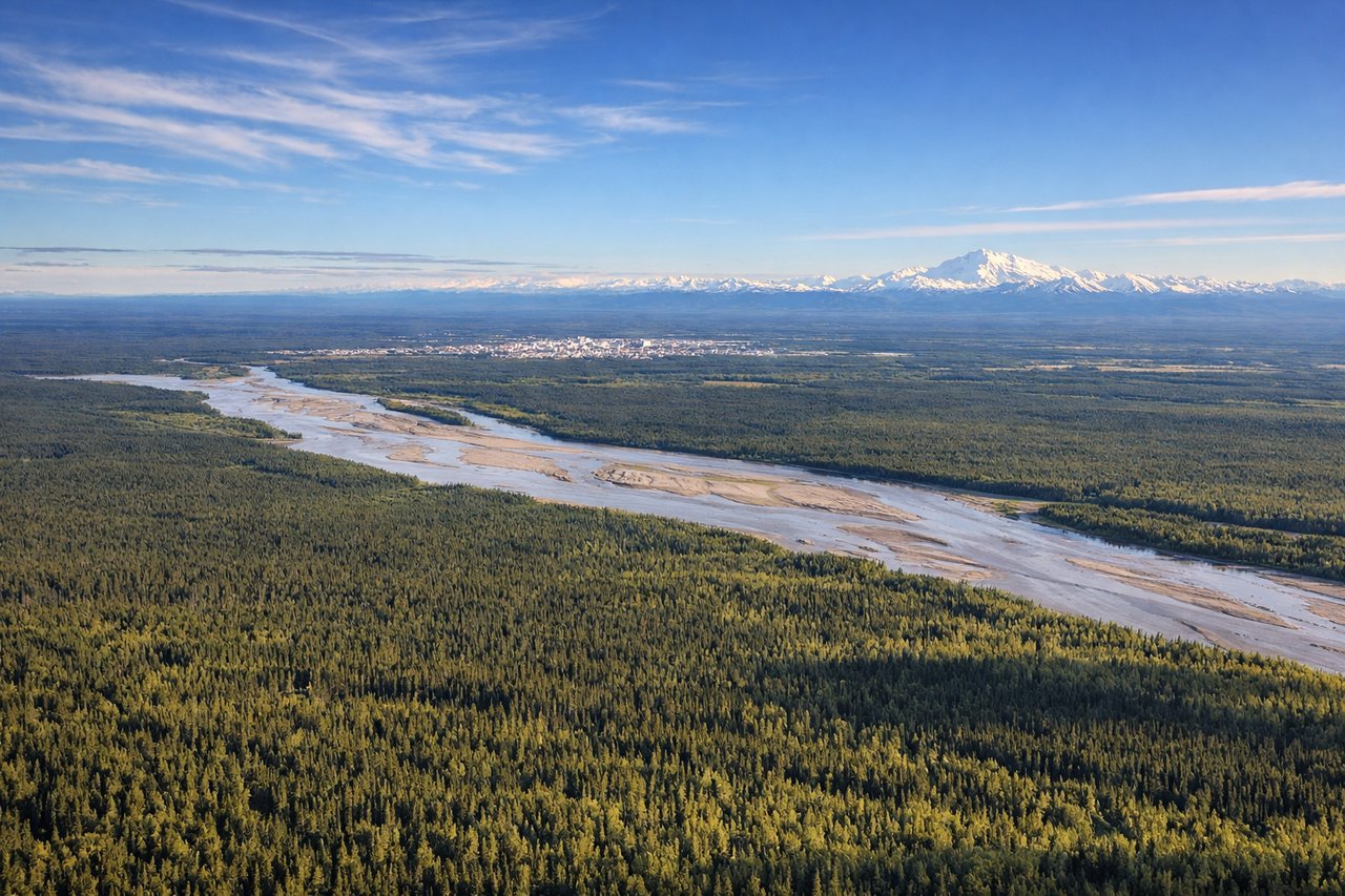
RIGHTFairbanks typically lands on runways aligned roughly north-south. Right-side seats during descent offer views of the Tanana River valley and the Alaska Range to the south. The terrain becomes increasingly visible as you descend, showing boreal forest and the river's distinctive braided channels.
Will your flight be in sunlight?
Pick a date and time in the Sun Map to watch the sun move across your whole flight.
About This Route
Which side of the plane should I sit on flying from Boeing Fld King Co International (BFI) to Fairbanks International (FAI)?
Sit on the Right side of the plane for the best views on flights from Seattle to Fairbanks. While takeoff favors the left for Cascade views, the right side wins overall because the Alaska Range and Tanana River valley during the long descent into Fairbanks provide more sustained visual interest across the majority of the flight's final hours. The northern route offers extended views of the Alaska interior.
What can I see during takeoff from Boeing Fld King Co International in Seattle?
During takeoff from Boeing Fld King Co International (BFI), sit on the Left side for the best views. BFI typically departs north or northeast. Left-side seats offer immediate views of the Cascade Range rising to the east, with Mount Rainier visible on clear days roughly 50 miles southeast. You'll also see Puget Sound and the Olympic Mountains to the west as you climb. Notable sights include: Mount Rainier (southeast, ~50 miles), Cascade Range (east), Puget Sound (west), Olympic Mountains (northwest).
What can I see when landing at Fairbanks International in Fairbanks?
When landing at Fairbanks International (FAI), sit on the Right side for the best views. Fairbanks typically lands on runways aligned roughly north-south. Right-side seats during descent offer views of the Tanana River valley and the Alaska Range to the south. The terrain becomes increasingly visible as you descend, showing boreal forest and the river's distinctive braided channels. Notable sights include: Alaska Range (south, distant), Tanana River (braided channels), boreal forest, Fairbanks city grid.
How long is the flight from Seattle to Fairbanks?
The flight from Boeing Fld King Co International (BFI) to Fairbanks International (FAI) takes about 3 hours. The shortest flight path between them is 1,525 miles (2,454 km); winds and air traffic control usually add a few percent.
What does the Seattle to Fairbanks flight path pass over?
The flight path crosses the Talkeetna Mountains and the Alaska Range foothills. Around the midpoint (roughly over the Susitna River valley), you'll see the transition from Cascade/coastal geography to interior Alaska terrain. The Chugach Mountains appear to the east around 90 minutes into the flight. As you progress north, the landscape becomes increasingly boreal forest with scattered lakes and rivers. The Denali area (Mount Denali/McKinley) may be visible to the west on clear days, though it's typically 50+ miles off the standard flight path. The final hour shows increasing braided river systems and the characteristic flat-to-rolling terrain of the Tanana Valley.