Seattle to Wichita is 1,437 miles (2,312 km), a flight of about 3 hours 15 minutes.
The takeoff view of Mount Rainier and the Cascade Range is more visually dramatic and distinctive than the landing approach over flat prairie and river valley. The volcanic peak and mountain spine provide the most memorable scenic highlight of this route.
Flight Path
Columbia River (visible around Spokane area if flight passes north of direct route), Blue Mountains of Oregon/Washington border, Snake River valley in Idaho, transition from Pacific Northwest forests to high desert plateau, then gradual descent into Great Plains with increasing agricultural development and decreasing elevation
Great circle distance and headings ›
.jpg?width=600)

.jpg?width=600)
Phase by phase
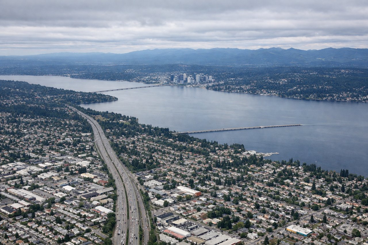
Takeoff from BFI
LEFTLeft side offers immediate views of the Cascade Range and Mount Rainier during climb-out. The aircraft departs eastbound from BFI, and the Cascades dominate the eastern horizon from Seattle.
Landing at IAB
RIGHTRight side provides views of the Arkansas River and Wichita's urban layout during descent into McConnell AFB. The aircraft approaches from the west, and the river valley and city are positioned to the right of the descent corridor.
Landmarks on this routeAll landmarks →
Will your flight be in sunlight?
Pick a date and time in the Sun Map to watch the sun move across your whole flight.
About This Route
Which side of the plane should I sit on flying from Boeing Fld King Co International (BFI) to Mc Connell Afb (IAB)?
Sit on the Left side of the plane for the best views on flights from Seattle to Wichita. The takeoff view of Mount Rainier and the Cascade Range is more visually dramatic and distinctive than the landing approach over flat prairie and river valley. The volcanic peak and mountain spine provide the most memorable scenic highlight of this route.
What can I see during takeoff from Boeing Fld King Co International in Seattle?
During takeoff from Boeing Fld King Co International (BFI), sit on the Left side for the best views. Left side offers immediate views of the Cascade Range and Mount Rainier during climb-out. The aircraft departs eastbound from BFI, and the Cascades dominate the eastern horizon from Seattle. Notable sights include: Mount Rainier (14,411 ft, ~60 miles southeast), Cascade Range spine, Lake Washington (below during initial climb), Puget Sound to the west.
What can I see when landing at Mc Connell Afb in Wichita?
When landing at Mc Connell Afb (IAB), sit on the Right side for the best views. Right side provides views of the Arkansas River and Wichita's urban layout during descent into McConnell AFB. The aircraft approaches from the west, and the river valley and city are positioned to the right of the descent corridor. Notable sights include: Arkansas River (visible as a meandering ribbon through central Kansas), Wichita city center and urban sprawl, flat Kansas prairie extending to the horizon, McConnell AFB runways.
How long is the flight from Seattle to Wichita?
The flight from Boeing Fld King Co International (BFI) to Mc Connell Afb (IAB) takes about 3 hours 15 minutes. The shortest flight path between them is 1,437 miles (2,312 km); winds and air traffic control usually add a few percent.
What does the Seattle to Wichita flight path pass over?
Columbia River (visible around Spokane area if flight passes north of direct route), Blue Mountains of Oregon/Washington border, Snake River valley in Idaho, transition from Pacific Northwest forests to high desert plateau, then gradual descent into Great Plains with increasing agricultural development and decreasing elevation