Takeoff views of Mount Rainier and the Cascades from the right side are more dramatic and geographically distinctive than landing views. While PVG's left-side approach offers urban interest, the volcanic peak and mountain scenery from BFI is the more memorable segment of this transpacific route.
Flown BFI to PVG? Did we get it right?
Flight Path
Seattle to Shanghai is 5,706 miles (9,183 km), a flight of about 11 hours 30 minutes.
The flight path crosses the North Pacific, passing north of the Hawaiian Islands (typically 200+ miles north), then approaches the Asian continent over the East China Sea. Notable midpoint geography includes the Aleutian Islands region (far north, not directly on route), the vast open Pacific Ocean, and the approach to mainland China via the Yangtze River estuary. The route typically crosses the International Date Line around 8-9 hours into flight. Approaching Asia, pilots descend over the shallow waters of the East China Sea with the Yangtze Delta's flat terrain becoming visible 100+ miles out.
Great circle distance and headings ›


Phase by phase
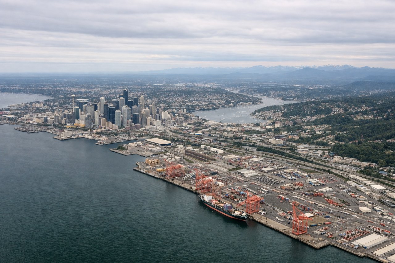
Takeoff from BFI
RIGHTBFI typically departs runways 16L/R or 34L/R depending on wind. Right-side seats offer views of the Cascade Range and Mount Rainier during the initial climb-out over Puget Sound, while left seats face the urban sprawl of Seattle proper.
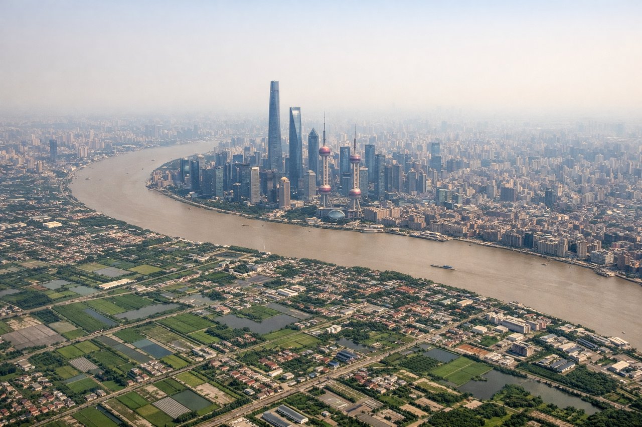
Landing at PVG
LEFTApproaching PVG typically uses runways 08L/R or 26L/R. Left-side seats during descent over the Yangtze River Delta provide views of the Huangpu River's distinctive curves through Shanghai's urban core, the Pudong skyline, and the East China Sea coastline.
Will your flight be in sunlight?
Pick a date and time in the Sun Map to watch the sun move across your whole flight.
About This Route
Which side of the plane should I sit on flying from Boeing Fld King Co International (BFI) to Shanghai Pudong International (PVG)?
Sit on the Right side of the plane for the best views on flights from Seattle to Shanghai. Takeoff views of Mount Rainier and the Cascades from the right side are more dramatic and geographically distinctive than landing views. While PVG's left-side approach offers urban interest, the volcanic peak and mountain scenery from BFI is the more memorable segment of this transpacific route.
What can I see during takeoff from Boeing Fld King Co International in Seattle?
During takeoff from Boeing Fld King Co International (BFI), sit on the Right side for the best views. BFI typically departs runways 16L/R or 34L/R depending on wind. Right-side seats offer views of the Cascade Range and Mount Rainier during the initial climb-out over Puget Sound, while left seats face the urban sprawl of Seattle proper. Notable sights include: Mount Rainier (14,411 ft, visible 50+ miles southeast), Cascade Range spine, Puget Sound waterway, Lake Washington.
What can I see when landing at Shanghai Pudong International in Shanghai?
When landing at Shanghai Pudong International (PVG), sit on the Left side for the best views. Approaching PVG typically uses runways 08L/R or 26L/R. Left-side seats during descent over the Yangtze River Delta provide views of the Huangpu River's distinctive curves through Shanghai's urban core, the Pudong skyline, and the East China Sea coastline. Notable sights include: Huangpu River with its characteristic bends, Pudong financial district skyline, Yangtze River estuary, East China Sea coastline.
How long is the flight from Seattle to Shanghai?
The flight from Boeing Fld King Co International (BFI) to Shanghai Pudong International (PVG) takes about 11 hours 30 minutes. The shortest flight path between them is 5,706 miles (9,183 km); winds and air traffic control usually add a few percent.
What does the Seattle to Shanghai flight path pass over?
The flight path crosses the North Pacific, passing north of the Hawaiian Islands (typically 200+ miles north), then approaches the Asian continent over the East China Sea. Notable midpoint geography includes the Aleutian Islands region (far north, not directly on route), the vast open Pacific Ocean, and the approach to mainland China via the Yangtze River estuary. The route typically crosses the International Date Line around 8-9 hours into flight. Approaching Asia, pilots descend over the shallow waters of the East China Sea with the Yangtze Delta's flat terrain becoming visible 100+ miles out.