Left side wins both ends of the flight. Departing Seattle you get the full Puget Sound and Olympic Mountains panorama, and arriving Toronto you get Lake Ontario and the CN Tower skyline. The right side offers suburban and industrial views at both airports.
Flown BFI to YYZ? Did we get it right?
Flight Path
Seattle to Toronto is 2,054 miles (3,305 km), a flight of about 4 hours.
The route tracks northeast over the Canadian Rockies and foothills near Jasper and Banff (visible as a dramatic snow-capped ridgeline), then crosses the broad flat Canadian Prairies of Alberta and Saskatchewan with their geometric agricultural grid, then the boreal forest and lakes of Manitoba and Ontario, and finally the Great Lakes region approaching Toronto. The Rockies crossing roughly 45-60 minutes after departure is the most dramatic visual feature of the entire route.
Great circle distance and headings ›


Phase by phase
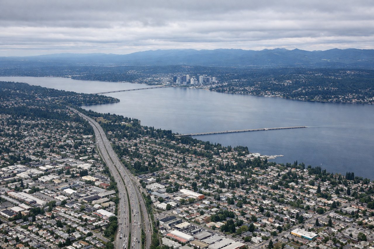
Takeoff from BFI
LEFTBFI's primary departure runway 13R sends aircraft southeast before turning northeast. The left side captures Elliott Bay, downtown Seattle's skyline, and the Olympic Peninsula across Puget Sound. Right side faces industrial South Seattle and the Duwamish corridor.
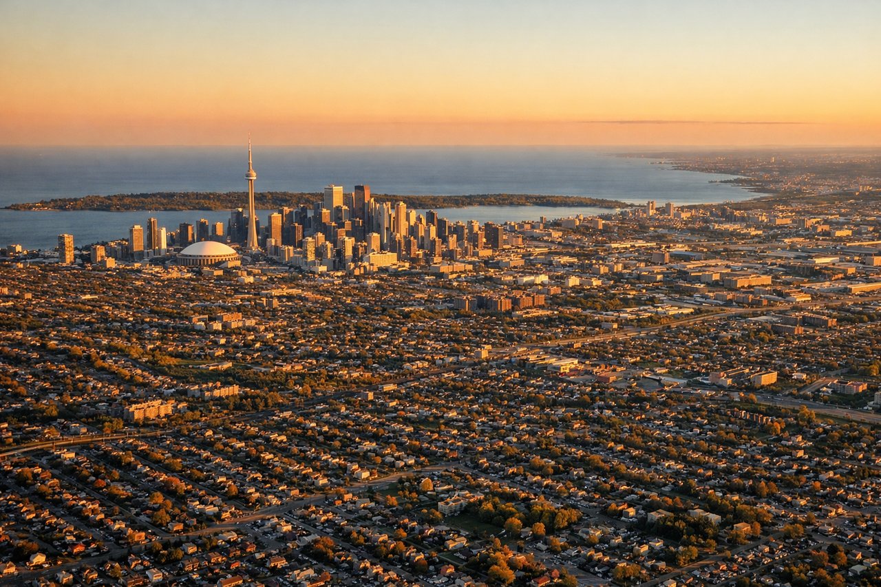
Landing at YYZ
LEFTYYZ runways 05/23 and 06L/24R are most common. Approaches from the west on runway 05 or 06L bring aircraft over Lake Ontario's north shore. The left side looks south over Lake Ontario's open water and the Toronto Islands, while the right faces suburban sprawl north of the city.
Will your flight be in sunlight?
Pick a date and time in the Sun Map to watch the sun move across your whole flight.
About This Route
Which side of the plane should I sit on flying from Boeing Fld King Co International (BFI) to Lester B Pearson International (YYZ)?
Sit on the Left side of the plane for the best views on flights from Seattle to Toronto. Left side wins both ends of the flight. Departing Seattle you get the full Puget Sound and Olympic Mountains panorama, and arriving Toronto you get Lake Ontario and the CN Tower skyline. The right side offers suburban and industrial views at both airports.
What can I see during takeoff from Boeing Fld King Co International in Seattle?
During takeoff from Boeing Fld King Co International (BFI), sit on the Left side for the best views. BFI's primary departure runway 13R sends aircraft southeast before turning northeast. The left side captures Elliott Bay, downtown Seattle's skyline, and the Olympic Peninsula across Puget Sound. Right side faces industrial South Seattle and the Duwamish corridor. Notable sights include: Elliott Bay and downtown Seattle waterfront, Puget Sound with ferry wakes, Olympic Mountains across the water, Lake Washington to the east.
What can I see when landing at Lester B Pearson International in Toronto?
When landing at Lester B Pearson International (YYZ), sit on the Left side for the best views. YYZ runways 05/23 and 06L/24R are most common. Approaches from the west on runway 05 or 06L bring aircraft over Lake Ontario's north shore. The left side looks south over Lake Ontario's open water and the Toronto Islands, while the right faces suburban sprawl north of the city. Notable sights include: Lake Ontario open water and Toronto Islands, downtown Toronto skyline with CN Tower, Humber Bay shoreline, Billy Bishop Toronto City Airport on the islands.
How long is the flight from Seattle to Toronto?
The flight from Boeing Fld King Co International (BFI) to Lester B Pearson International (YYZ) takes about 4 hours. The shortest flight path between them is 2,054 miles (3,305 km); winds and air traffic control usually add a few percent.
What does the Seattle to Toronto flight path pass over?
The route tracks northeast over the Canadian Rockies and foothills near Jasper and Banff (visible as a dramatic snow-capped ridgeline), then crosses the broad flat Canadian Prairies of Alberta and Saskatchewan with their geometric agricultural grid, then the boreal forest and lakes of Manitoba and Ontario, and finally the Great Lakes region approaching Toronto. The Rockies crossing roughly 45-60 minutes after departure is the most dramatic visual feature of the entire route.