Bakersfield to Charlotte is 2,135 miles (3,436 km), a flight of about 4 hours 30 minutes.
The left side delivers the more dramatic takeoff view with the Tehachapi Mountains and San Joaquin Valley, and during the cruise over the Southwest and mid-South you get better views of the terrain transitions. The landing view advantage on the right is real but brief. Left wins on total scenic value across the flight.
Flight Path
After clearing the Tehachapis, the route tracks east-northeast over the Mojave Desert, then crosses Arizona's high desert plateau and the transition into New Mexico. The flight passes over or near Albuquerque and the Rio Grande valley, then crosses the Texas Panhandle's flat plains, the rolling Cross Timbers of Oklahoma and north Texas, the Ouachita Mountains of Arkansas, and the Mississippi River before entering the Tennessee Valley and descending through the Appalachian foothills into the Carolina Piedmont.
Great circle distance and headings ›


.jpeg?width=600)
.jpg?width=600)
.jpg?width=600)

.jpeg?width=600)
Phase by phase
Takeoff from BFL
LEFTMeadows Field typically departs runway 30 (northwest), so a left-side seat faces south toward the southern San Joaquin Valley floor and the Tehachapi Mountains. You get a clear view of the valley's agricultural grid and the mountain barrier separating the Central Valley from the LA Basin. The right side faces north up the flat valley with less dramatic terrain.
Landing at CLT
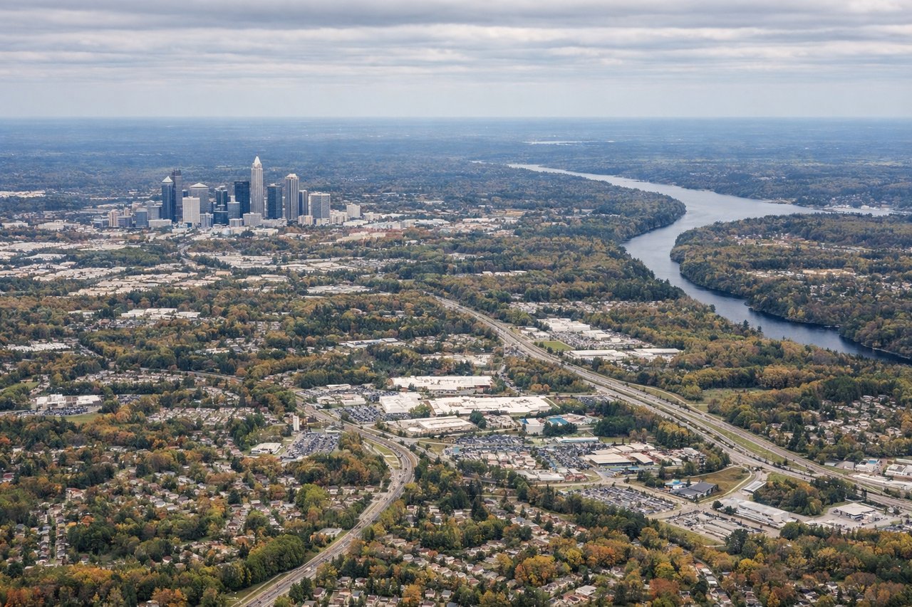
RIGHTCharlotte Douglas primarily lands on runways 18C/18L/18R (southbound) or 36 (northbound). On the more common southbound approach, right-side seats face west toward uptown Charlotte's skyline, which sits just northwest of the airport. Left-side seats face east toward suburban sprawl with no distinctive landmarks.
Landmarks on this routeAll landmarks →
Will your flight be in sunlight?
Pick a date and time in the Sun Map to watch the sun move across your whole flight.
About This Route
Which side of the plane should I sit on flying from Meadows Fld (BFL) to Charlotte Douglas International (CLT)?
Sit on the Left side of the plane for the best views on flights from Bakersfield to Charlotte. The left side delivers the more dramatic takeoff view with the Tehachapi Mountains and San Joaquin Valley, and during the cruise over the Southwest and mid-South you get better views of the terrain transitions. The landing view advantage on the right is real but brief. Left wins on total scenic value across the flight.
What can I see during takeoff from Meadows Fld in Bakersfield?
During takeoff from Meadows Fld (BFL), sit on the Left side for the best views. Meadows Field typically departs runway 30 (northwest), so a left-side seat faces south toward the southern San Joaquin Valley floor and the Tehachapi Mountains. You get a clear view of the valley's agricultural grid and the mountain barrier separating the Central Valley from the LA Basin. The right side faces north up the flat valley with less dramatic terrain. Notable sights include: Tehachapi Mountains to the south, San Joaquin Valley agricultural grid directly below, Kern River oil fields visible as dense pump-jack clusters east of the airport, Bakersfield city grid.
What can I see when landing at Charlotte Douglas International in Charlotte?
When landing at Charlotte Douglas International (CLT), sit on the Right side for the best views. Charlotte Douglas primarily lands on runways 18C/18L/18R (southbound) or 36 (northbound). On the more common southbound approach, right-side seats face west toward uptown Charlotte's skyline, which sits just northwest of the airport. Left-side seats face east toward suburban sprawl with no distinctive landmarks. Notable sights include: Uptown Charlotte skyline to the northwest, Lake Norman reservoir visible to the north on approach, Catawba River corridor, Charlotte Motor Speedway visible to the northeast on clear days.
How long is the flight from Bakersfield to Charlotte?
The flight from Meadows Fld (BFL) to Charlotte Douglas International (CLT) takes about 4 hours 30 minutes. The shortest flight path between them is 2,135 miles (3,436 km); winds and air traffic control usually add a few percent.
What does the Bakersfield to Charlotte flight path pass over?
After clearing the Tehachapis, the route tracks east-northeast over the Mojave Desert, then crosses Arizona's high desert plateau and the transition into New Mexico. The flight passes over or near Albuquerque and the Rio Grande valley, then crosses the Texas Panhandle's flat plains, the rolling Cross Timbers of Oklahoma and north Texas, the Ouachita Mountains of Arkansas, and the Mississippi River before entering the Tennessee Valley and descending through the Appalachian foothills into the Carolina Piedmont.