Charlotte to Bakersfield is 2,135 miles (3,436 km), a flight of about 4 hours 15 minutes.
While the landing approach favors the left, the takeoff and the majority of the westbound flight path over the Appalachian foothills and then the Great Plains offer more consistent scenic interest on the right side. The right side captures the Blue Ridge Mountains at departure and the gradual transition across America's interior.
Flight Path
The flight path crosses the Appalachian Mountains (visible as ridgelines in Tennessee and Kentucky), then transitions over the Cumberland Plateau, continues across the Mississippi River valley, and eventually reaches the Great Plains of Oklahoma and Texas. The southern Rocky Mountains and Colorado Plateau appear on the horizon in the final approach phase. The most dramatic midpoint feature is the Mississippi River valley, visible as a distinct green corridor running north-south, typically appearing around 2 hours into the flight.
Great circle distance and headings ›.jpeg?width=600)

.jpg?width=600)
.jpg?width=600)
.jpeg?width=600)


Phase by phase
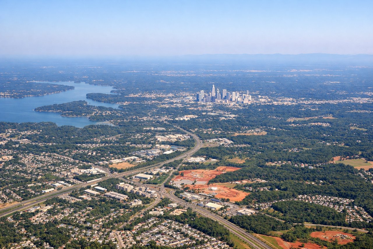
Takeoff from CLT
RIGHTRight-side seats offer views of the Piedmont region's rolling terrain and the Blue Ridge Mountains to the northwest as the aircraft climbs westbound. Left side faces the flat coastal plain with fewer distinctive features.
Landing at BFL
LEFTLeft-side seats provide excellent views of the southern Sierra Nevada foothills and the Kern River valley as the aircraft descends eastbound toward Bakersfield. Right side faces the flat San Joaquin Valley with minimal visual interest.
Landmarks on this routeAll landmarks →
Will your flight be in sunlight?
Pick a date and time in the Sun Map to watch the sun move across your whole flight.
About This Route
Which side of the plane should I sit on flying from Charlotte Douglas International (CLT) to Meadows Fld (BFL)?
Sit on the Right side of the plane for the best views on flights from Charlotte to Bakersfield. While the landing approach favors the left, the takeoff and the majority of the westbound flight path over the Appalachian foothills and then the Great Plains offer more consistent scenic interest on the right side. The right side captures the Blue Ridge Mountains at departure and the gradual transition across America's interior.
What can I see during takeoff from Charlotte Douglas International in Charlotte?
During takeoff from Charlotte Douglas International (CLT), sit on the Right side for the best views. Right-side seats offer views of the Piedmont region's rolling terrain and the Blue Ridge Mountains to the northwest as the aircraft climbs westbound. Left side faces the flat coastal plain with fewer distinctive features. Notable sights include: Blue Ridge Mountains (distant northwest), Catawba River valley, Charlotte urban sprawl, Piedmont foothills.
What can I see when landing at Meadows Fld in Bakersfield?
When landing at Meadows Fld (BFL), sit on the Left side for the best views. Left-side seats provide excellent views of the southern Sierra Nevada foothills and the Kern River valley as the aircraft descends eastbound toward Bakersfield. Right side faces the flat San Joaquin Valley with minimal visual interest. Notable sights include: Southern Sierra Nevada mountains, Kern River valley, Bakersfield urban area, San Joaquin Valley agricultural grid.
How long is the flight from Charlotte to Bakersfield?
The flight from Charlotte Douglas International (CLT) to Meadows Fld (BFL) takes about 4 hours 15 minutes. The shortest flight path between them is 2,135 miles (3,436 km); winds and air traffic control usually add a few percent.
What does the Charlotte to Bakersfield flight path pass over?
The flight path crosses the Appalachian Mountains (visible as ridgelines in Tennessee and Kentucky), then transitions over the Cumberland Plateau, continues across the Mississippi River valley, and eventually reaches the Great Plains of Oklahoma and Texas. The southern Rocky Mountains and Colorado Plateau appear on the horizon in the final approach phase. The most dramatic midpoint feature is the Mississippi River valley, visible as a distinct green corridor running north-south, typically appearing around 2 hours into the flight.