Bakersfield to Doha is 8,198 miles (13,194 km), a flight of about 16 hours 30 minutes.
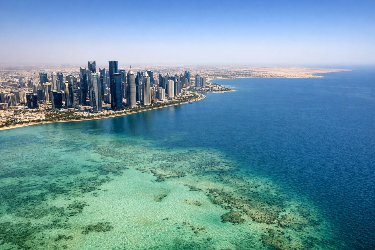
The Doha arrival on the right side delivers a genuinely spectacular view of the Persian Gulf's surreal shallow-water colors combined with the Doha skyline. The Bakersfield departure left side is interesting but the San Joaquin Valley is flat and agricultural. The Gulf approach is the visual highlight of the journey.
Flight Path
The route tracks northeast from California over the Rocky Mountains, then across the Great Plains, then typically arcs over the North Atlantic or more likely a polar-adjacent great circle route over Canada and Greenland, then descends over Europe and Turkey, crosses the Anatolian plateau, passes over the Zagros Mountains of Iran, and descends across the Persian Gulf coastal lowlands of Kuwait and eastern Saudi Arabia before reaching Qatar
Great circle distance and headings ›.jpg?width=600)


Phase by phase
Takeoff from BFL
LEFTMeadows Field typically departs runway 30L/30R heading northwest, then aircraft turn eastbound. The left side faces south toward the Tehachapi Mountains and the southern San Joaquin Valley floor. You get a clear look at the valley's agricultural patchwork and the Tehachapi range rising to around 7,000 feet.
Landing at DOH
RIGHTDoha's old Doha International Airport (now largely decommissioned but still the listed DOH) had approaches typically from the north or northeast over the Gulf. On a right-side seat you face west toward the Doha city skyline and the shallow turquoise waters of the Persian Gulf inner bay. The West Bay skyscraper cluster and the distinctive blue-green shallow Gulf waters are clearly visible on approach.
Landmarks on this routeAll landmarks →
Will your flight be in sunlight?
Pick a date and time in the Sun Map to watch the sun move across your whole flight.
About This Route
Which side of the plane should I sit on flying from Meadows Fld (BFL) to Hamad International Airport (DOH)?
Sit on the Right side of the plane for the best views on flights from Bakersfield to Doha. The Doha arrival on the right side delivers a genuinely spectacular view of the Persian Gulf's surreal shallow-water colors combined with the Doha skyline. The Bakersfield departure left side is interesting but the San Joaquin Valley is flat and agricultural. The Gulf approach is the visual highlight of the journey.
What can I see during takeoff from Meadows Fld in Bakersfield?
During takeoff from Meadows Fld (BFL), sit on the Left side for the best views. Meadows Field typically departs runway 30L/30R heading northwest, then aircraft turn eastbound. The left side faces south toward the Tehachapi Mountains and the southern San Joaquin Valley floor. You get a clear look at the valley's agricultural patchwork and the Tehachapi range rising to around 7,000 feet. Notable sights include: Tehachapi Mountains to the south, San Joaquin Valley agricultural grid below, Kern River oil fields visible as dense pump-jack clusters near Bakersfield, Buena Vista Lake bed (dry lakebed) to the southwest.
What can I see when landing at Hamad International Airport in Doha?
When landing at Hamad International Airport (DOH), sit on the Right side for the best views. Doha's old Doha International Airport (now largely decommissioned but still the listed DOH) had approaches typically from the north or northeast over the Gulf. On a right-side seat you face west toward the Doha city skyline and the shallow turquoise waters of the Persian Gulf inner bay. The West Bay skyscraper cluster and the distinctive blue-green shallow Gulf waters are clearly visible on approach. Notable sights include: West Bay skyscraper district of Doha, Persian Gulf shallow turquoise inner bay, Qatar peninsula coastline, Palm Tree Island (Simaisma area visible further north).
How long is the flight from Bakersfield to Doha?
The flight from Meadows Fld (BFL) to Hamad International Airport (DOH) takes about 16 hours 30 minutes. The shortest flight path between them is 8,198 miles (13,194 km); winds and air traffic control usually add a few percent.
What does the Bakersfield to Doha flight path pass over?
The route tracks northeast from California over the Rocky Mountains, then across the Great Plains, then typically arcs over the North Atlantic or more likely a polar-adjacent great circle route over Canada and Greenland, then descends over Europe and Turkey, crosses the Anatolian plateau, passes over the Zagros Mountains of Iran, and descends across the Persian Gulf coastal lowlands of Kuwait and eastern Saudi Arabia before reaching Qatar