Left side wins both ends of the flight. During the cruise portion tracking northwest up the San Joaquin Valley, the left side also keeps the Coast Ranges in view as they rise toward the Bay Area, making it the consistently better seat for the full journey.
Flown BFL to SFO? Did we get it right?
Flight Path
Bakersfield to San Francisco is 238 miles (383 km), a flight of about 50 minutes.
The flight tracks northwest up the central San Joaquin Valley, passing over the flat agricultural expanse between Fresno and Stockton. The Coast Ranges are visible to the left (west) throughout cruise, while the Sierra Nevada foothills appear to the right (east) in the distance. The valley floor is dominated by irrigated farmland, orchards, and occasional small cities. As the flight approaches the Bay Area, the Diablo Range becomes prominent ahead and to the left before the aircraft descends toward the bay.
Great circle distance and headings ›Phase by phase
Takeoff from BFL
LEFTBFL typically departs runway 30L/30R heading northwest. The left (south) side gives you a clear look back at the southern San Joaquin Valley floor, the Tehachapi Mountains to the south, and the broad flat agricultural patchwork of Kern County. The right side faces open valley with less visual interest.
Landing at SFO
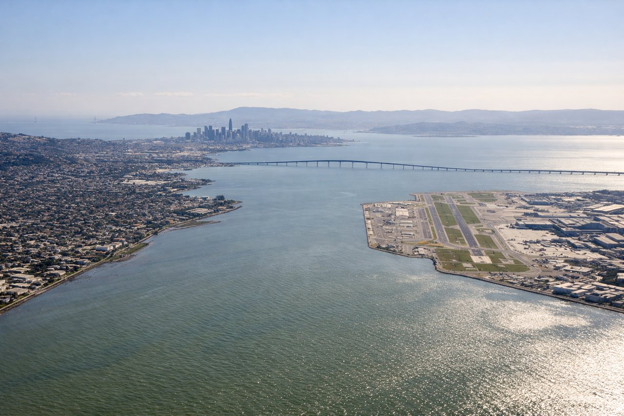
LEFTSFO primarily lands on runways 28L/28R approaching from the east, meaning the aircraft tracks westward over the Bay Area. The left (south) side gives you San Francisco Bay, the San Mateo Bridge, and the South Bay spread out below. The right side faces inland hills with less dramatic scenery on final approach.
Will your flight be in sunlight?
Pick a date and time in the Sun Map to watch the sun move across your whole flight.
About This Route
Which side of the plane should I sit on flying from Meadows Fld (BFL) to San Francisco International (SFO)?
Sit on the Left side of the plane for the best views on flights from Bakersfield to San Francisco. Left side wins both ends of the flight. During the cruise portion tracking northwest up the San Joaquin Valley, the left side also keeps the Coast Ranges in view as they rise toward the Bay Area, making it the consistently better seat for the full journey.
What can I see during takeoff from Meadows Fld in Bakersfield?
During takeoff from Meadows Fld (BFL), sit on the Left side for the best views. BFL typically departs runway 30L/30R heading northwest. The left (south) side gives you a clear look back at the southern San Joaquin Valley floor, the Tehachapi Mountains to the south, and the broad flat agricultural patchwork of Kern County. The right side faces open valley with less visual interest. Notable sights include: Tehachapi Mountains to the south, Kern River oil fields and agricultural grid of the San Joaquin Valley, Buena Vista Lake bed (dry lakebed visible as pale flat expanse southwest of Bakersfield).
What can I see when landing at San Francisco International in San Francisco?
When landing at San Francisco International (SFO), sit on the Left side for the best views. SFO primarily lands on runways 28L/28R approaching from the east, meaning the aircraft tracks westward over the Bay Area. The left (south) side gives you San Francisco Bay, the San Mateo Bridge, and the South Bay spread out below. The right side faces inland hills with less dramatic scenery on final approach. Notable sights include: San Francisco Bay and its open water expanse, San Mateo Bridge, South Bay shoreline and salt evaporation ponds (vivid geometric colors), Peninsula cities of San Mateo and Redwood City.
How long is the flight from Bakersfield to San Francisco?
The flight from Meadows Fld (BFL) to San Francisco International (SFO) takes about 50 minutes. The shortest flight path between them is 238 miles (383 km); winds and air traffic control usually add a few percent.
What does the Bakersfield to San Francisco flight path pass over?
The flight tracks northwest up the central San Joaquin Valley, passing over the flat agricultural expanse between Fresno and Stockton. The Coast Ranges are visible to the left (west) throughout cruise, while the Sierra Nevada foothills appear to the right (east) in the distance. The valley floor is dominated by irrigated farmland, orchards, and occasional small cities. As the flight approaches the Bay Area, the Diablo Range becomes prominent ahead and to the left before the aircraft descends toward the bay.