Right side wins overall because the takeoff view over Birmingham and the Appalachian terrain is more visually distinctive than the landing approach. The climb-out offers better geographic variety and clearer landmark definition.
Flown BHM to DTW? Did we get it right?
Flight Path
Birmingham to Detroit is 626 miles (1,007 km), a flight of about 2 hours 15 minutes.
The flight path crosses the Cumberland Plateau region of Tennessee and Kentucky, with the Tennessee River visible in places, transitioning through the Appalachian ridges. You'll pass over central Kentucky's rolling terrain and eventually reach the flatter glaciated landscape of Ohio and Michigan. Lake Michigan becomes visible on the left side during the final descent phase into Michigan.
Great circle distance and headings ›Phase by phase
Takeoff from BHM
RIGHTRight side seats capture the climb-out northward over Birmingham's urban core and the Appalachian foothills. You'll see the city grid fall away and the terrain transition from developed areas to forested ridges.
Landing at DTW
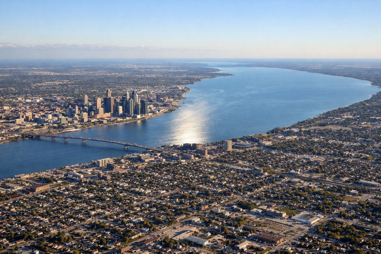
LEFTLeft side provides the best views during descent into DTW. You'll see the Detroit metropolitan area, the Great Lakes shoreline, and the approach over Lake St. Clair before landing.
Will your flight be in sunlight?
Pick a date and time in the Sun Map to watch the sun move across your whole flight.
About This Route
Which side of the plane should I sit on flying from Birmingham International (BHM) to Detroit Metro Wayne Co (DTW)?
Sit on the Right side of the plane for the best views on flights from Birmingham to Detroit. Right side wins overall because the takeoff view over Birmingham and the Appalachian terrain is more visually distinctive than the landing approach. The climb-out offers better geographic variety and clearer landmark definition.
What can I see during takeoff from Birmingham International in Birmingham?
During takeoff from Birmingham International (BHM), sit on the Right side for the best views. Right side seats capture the climb-out northward over Birmingham's urban core and the Appalachian foothills. You'll see the city grid fall away and the terrain transition from developed areas to forested ridges. Notable sights include: Birmingham city center and industrial corridor, Red Mountain (the ridge running southwest-northeast through the city), Vulcan Park area, transition to Appalachian foothills north of the airport.
What can I see when landing at Detroit Metro Wayne Co in Detroit?
When landing at Detroit Metro Wayne Co (DTW), sit on the Left side for the best views. Left side provides the best views during descent into DTW. You'll see the Detroit metropolitan area, the Great Lakes shoreline, and the approach over Lake St. Clair before landing. Notable sights include: Lake St. Clair and its shoreline, Detroit River, Detroit metropolitan sprawl extending south and west, Canadian shoreline across the river.
How long is the flight from Birmingham to Detroit?
The flight from Birmingham International (BHM) to Detroit Metro Wayne Co (DTW) takes about 2 hours 15 minutes. The shortest flight path between them is 626 miles (1,007 km); winds and air traffic control usually add a few percent.
What does the Birmingham to Detroit flight path pass over?
The flight path crosses the Cumberland Plateau region of Tennessee and Kentucky, with the Tennessee River visible in places, transitioning through the Appalachian ridges. You'll pass over central Kentucky's rolling terrain and eventually reach the flatter glaciated landscape of Ohio and Michigan. Lake Michigan becomes visible on the left side during the final descent phase into Michigan.