While left offers good takeoff views of the Rockies, right dominates the flight overall due to the spectacular island approach and landing sequence over Oahu's windward cliffs and coastal features—the most visually distinctive portion of this 5-hour transpacific route.
Flown BJC to HNL? Did we get it right?
Flight Path
Denver to Honolulu is 3,337 miles (5,371 km), a flight of about 5 hours 15 minutes.
After climbing out of Denver and crossing the Colorado Plateau, the flight path takes you over Utah's desert landscape (visible: the Wasatch Range to the west, Great Salt Lake if on northern routing). Crossing into Nevada and California, you'll see the Sierra Nevada range receding to the south. The Pacific Ocean dominates the final 2+ hours, with no significant landmarks until the Hawaiian Islands appear on the horizon approximately 200 miles out from Honolulu.
Great circle distance and headings ›


Phase by phase
Takeoff from BJC
LEFTLeft side offers immediate views of the Front Range as you climb northwest out of Denver. You'll see the dramatic eastern escarpment of the Rocky Mountains rising directly ahead and to your left, with the city sprawling below.
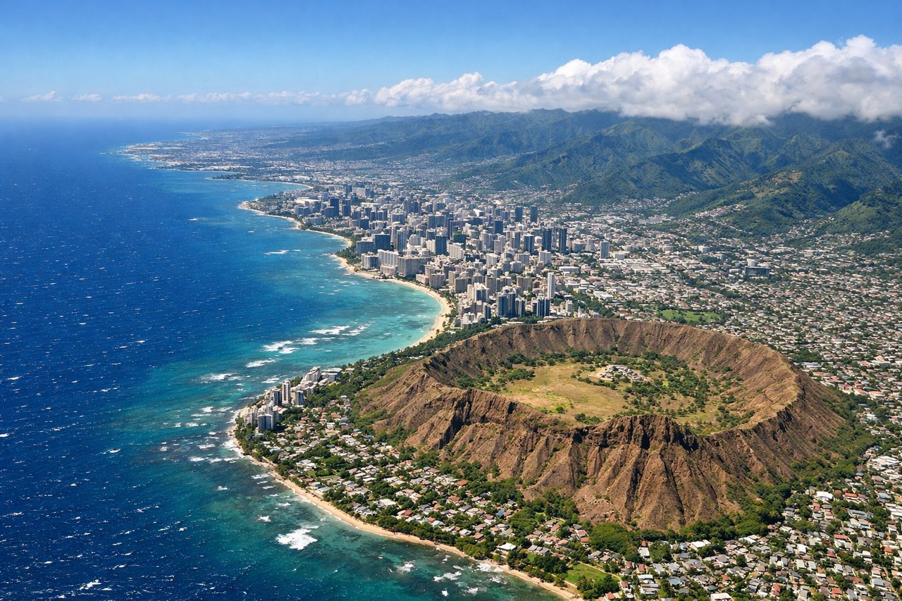
Landing at HNL
RIGHTRight side provides the best approach views of the Hawaiian Islands. As you descend toward Honolulu, you'll see the windward cliffs of the Ko'olau Range and the island's dramatic volcanic topography before crossing over Pearl Harbor and the coastal approach.
Will your flight be in sunlight?
Pick a date and time in the Sun Map to watch the sun move across your whole flight.
About This Route
Which side of the plane should I sit on flying from Rocky Mountain Metropolitan Airport (BJC) to Honolulu International (HNL)?
Sit on the Right side of the plane for the best views on flights from Denver to Honolulu. While left offers good takeoff views of the Rockies, right dominates the flight overall due to the spectacular island approach and landing sequence over Oahu's windward cliffs and coastal features—the most visually distinctive portion of this 5-hour transpacific route.
What can I see during takeoff from Rocky Mountain Metropolitan Airport in Denver?
During takeoff from Rocky Mountain Metropolitan Airport (BJC), sit on the Left side for the best views. Left side offers immediate views of the Front Range as you climb northwest out of Denver. You'll see the dramatic eastern escarpment of the Rocky Mountains rising directly ahead and to your left, with the city sprawling below. Notable sights include: Front Range (Rocky Mountains), Denver metropolitan area, South Platte River valley, Pikes Peak (visible on clear days to the south).
What can I see when landing at Honolulu International in Honolulu?
When landing at Honolulu International (HNL), sit on the Right side for the best views. Right side provides the best approach views of the Hawaiian Islands. As you descend toward Honolulu, you'll see the windward cliffs of the Ko'olau Range and the island's dramatic volcanic topography before crossing over Pearl Harbor and the coastal approach. Notable sights include: Ko'olau Range (windward cliffs), Pearl Harbor, Honolulu city lights and harbor, Kailua Bay and windward coast.
How long is the flight from Denver to Honolulu?
The flight from Rocky Mountain Metropolitan Airport (BJC) to Honolulu International (HNL) takes about 5 hours 15 minutes. The shortest flight path between them is 3,337 miles (5,371 km); winds and air traffic control usually add a few percent.
What does the Denver to Honolulu flight path pass over?
After climbing out of Denver and crossing the Colorado Plateau, the flight path takes you over Utah's desert landscape (visible: the Wasatch Range to the west, Great Salt Lake if on northern routing). Crossing into Nevada and California, you'll see the Sierra Nevada range receding to the south. The Pacific Ocean dominates the final 2+ hours, with no significant landmarks until the Hawaiian Islands appear on the horizon approximately 200 miles out from Honolulu.