The right side strings together a coherent scenic sequence: Nashville's skyline at takeoff, the Black Hills, Badlands, and Montana's Rocky Mountain Front along the northern edge of the route, and a postcard Puget Sound and Seattle skyline view on arrival. The left side is dominated by flat Great Plains farmland for most of the cruise with less consistent scenery.
Flown BNA to SEA? Did we get it right?
Flight Path
Nashville to Seattle is 1,974 miles (3,176 km), a flight of about 4 hours 40 minutes.
Route passes near the Black Hills and Badlands of South Dakota before crossing the Rocky Mountain Front in Montana and the Idaho panhandle en route to the Cascades in Washington
Great circle distance and headings ›


Phase by phase
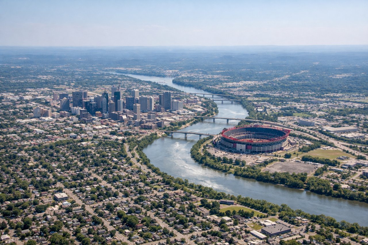
Takeoff from BNA
RIGHTDeparting BNA to the south before turning onto a northwest heading, the right side catches downtown Nashville's skyline and the bend of the Cumberland River just after liftoff. The left side mostly shows flat farmland and suburban sprawl east of the airport.
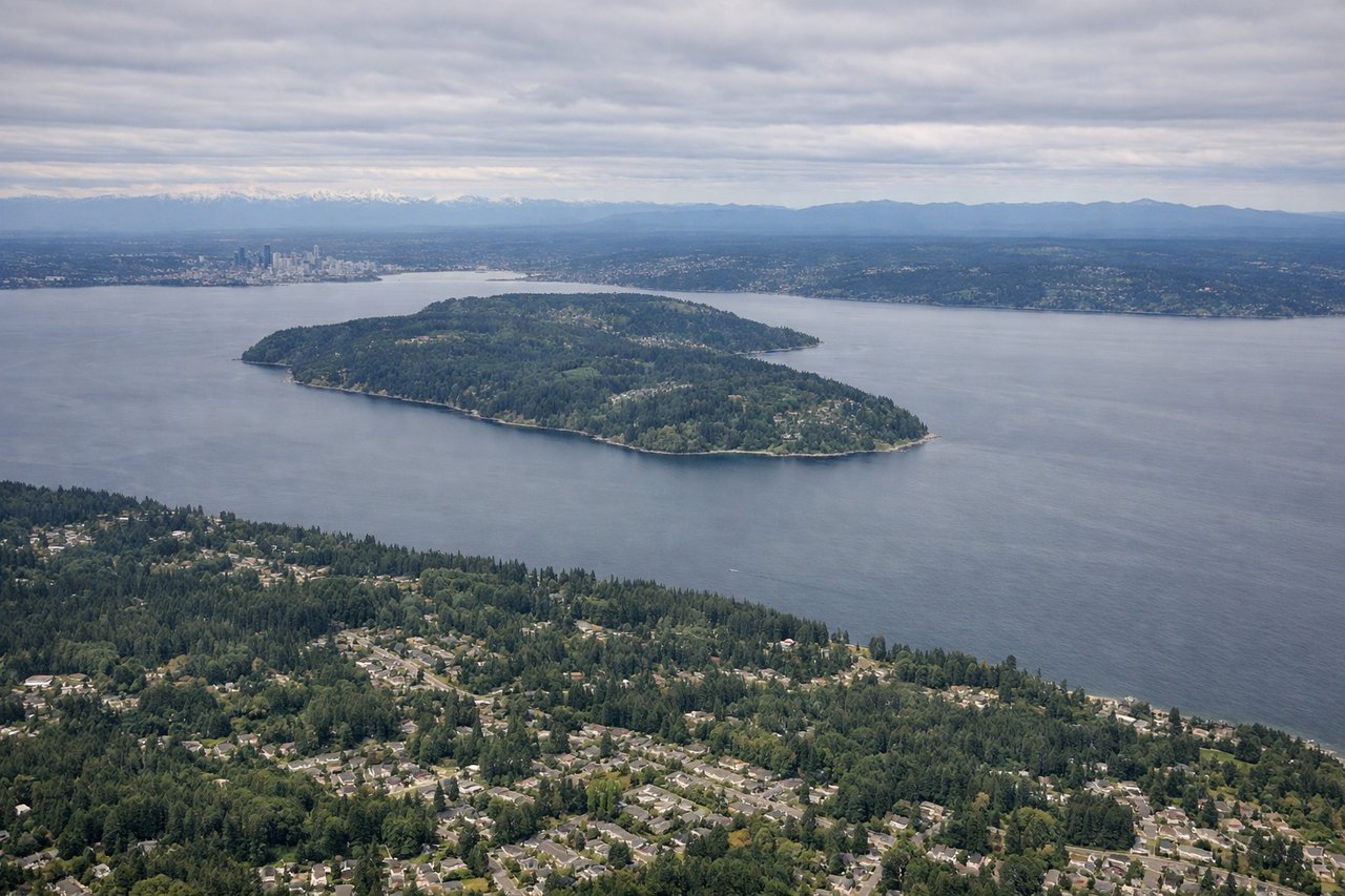
Landing at SEA
RIGHTOn the southbound final approach into SEA (runway 16, into south winds), the right side faces west over Puget Sound, giving a clear view of Elliott Bay, downtown Seattle's skyline, and the Olympic Mountains beyond the water. The left side mostly shows Lake Washington and the eastside suburbs.
Will your flight be in sunlight?
Pick a date and time in the Sun Map to watch the sun move across your whole flight.
About This Route
Which side of the plane should I sit on flying from Nashville International (BNA) to Seattle Tacoma International (SEA)?
Sit on the Right side of the plane for the best views on flights from Nashville to Seattle. The right side strings together a coherent scenic sequence: Nashville's skyline at takeoff, the Black Hills, Badlands, and Montana's Rocky Mountain Front along the northern edge of the route, and a postcard Puget Sound and Seattle skyline view on arrival. The left side is dominated by flat Great Plains farmland for most of the cruise with less consistent scenery.
What can I see during takeoff from Nashville International in Nashville?
During takeoff from Nashville International (BNA), sit on the Right side for the best views. Departing BNA to the south before turning onto a northwest heading, the right side catches downtown Nashville's skyline and the bend of the Cumberland River just after liftoff. The left side mostly shows flat farmland and suburban sprawl east of the airport. Notable sights include: Downtown Nashville skyline, Cumberland River, Percy Priest Lake, Tennessee hill country.
What can I see when landing at Seattle Tacoma International in Seattle?
When landing at Seattle Tacoma International (SEA), sit on the Right side for the best views. On the southbound final approach into SEA (runway 16, into south winds), the right side faces west over Puget Sound, giving a clear view of Elliott Bay, downtown Seattle's skyline, and the Olympic Mountains beyond the water. The left side mostly shows Lake Washington and the eastside suburbs. Notable sights include: Puget Sound, Elliott Bay, downtown Seattle skyline, Olympic Mountains.
How long is the flight from Nashville to Seattle?
The flight from Nashville International (BNA) to Seattle Tacoma International (SEA) takes about 4 hours 40 minutes. The shortest flight path between them is 1,974 miles (3,176 km); winds and air traffic control usually add a few percent.
What does the Nashville to Seattle flight path pass over?
Route passes near the Black Hills and Badlands of South Dakota before crossing the Rocky Mountain Front in Montana and the Idaho panhandle en route to the Cascades in Washington