The right side wins on the strength of Mount Rainier at takeoff and the chance to see the northern Rockies' foothills and Great Plains terrain change during cruise, giving it more variety than the left side's mostly flat farmland until the Nashville skyline appears at the very end.
Flown SEA to BNA? Did we get it right?
Flight Path
Seattle to Nashville is 1,974 miles (3,176 km), a flight of about 4 hours 5 minutes.
The great-circle route crosses the northern Rockies near the Montana-Wyoming border, passes north of the Bighorn Mountains, then flattens out over the Great Plains of South Dakota, Nebraska, and Iowa before crossing the Missouri and Mississippi Rivers and the rolling hills of the Ozark Plateau on approach to Tennessee.
Great circle distance and headings ›


Phase by phase
Takeoff from SEA
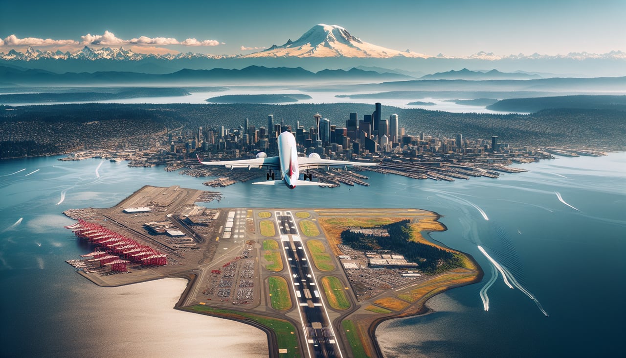
RIGHTSEA eastbound departures typically roll south then bank left onto an easterly heading, putting Mount Rainier's glaciated dome squarely on the right side of the cabin as the plane climbs out over the Green River valley. The left side only offers a brief glimpse of Elliott Bay and downtown Seattle before the turn.
Landing at BNA
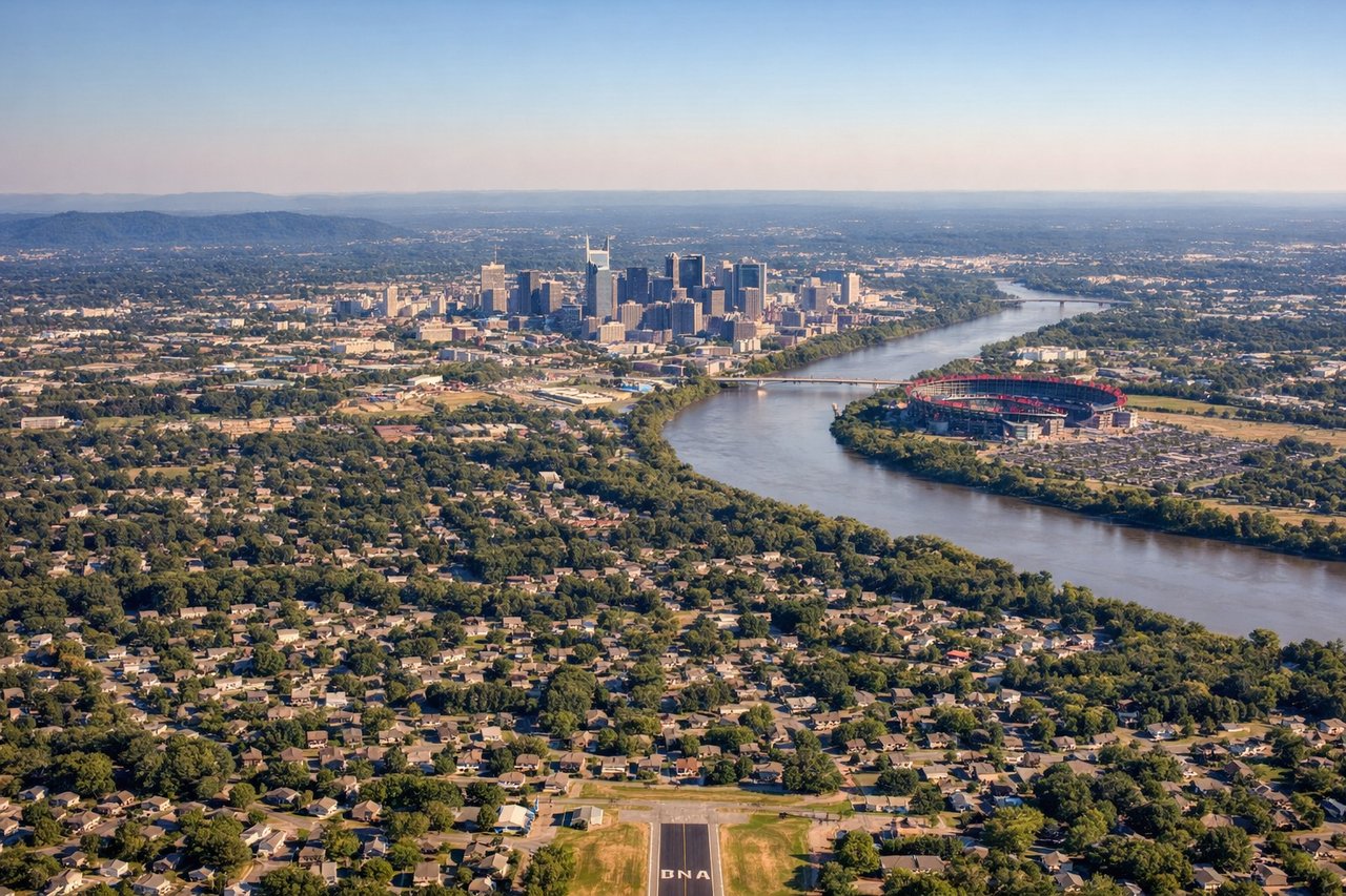
LEFTBNA's typical south-flowing approach in prevailing winds has aircraft descending from the north and landing on the 20-series runways, so the final turns put downtown Nashville and the Cumberland River on the left side of the cabin. Passengers get a clear look at the skyline and river bends just before touchdown.
Will your flight be in sunlight?
Pick a date and time in the Sun Map to watch the sun move across your whole flight.
About This Route
Which side of the plane should I sit on flying from Seattle Tacoma International (SEA) to Nashville International (BNA)?
Sit on the Right side of the plane for the best views on flights from Seattle to Nashville. The right side wins on the strength of Mount Rainier at takeoff and the chance to see the northern Rockies' foothills and Great Plains terrain change during cruise, giving it more variety than the left side's mostly flat farmland until the Nashville skyline appears at the very end.
What can I see during takeoff from Seattle Tacoma International in Seattle?
During takeoff from Seattle Tacoma International (SEA), sit on the Right side for the best views. SEA eastbound departures typically roll south then bank left onto an easterly heading, putting Mount Rainier's glaciated dome squarely on the right side of the cabin as the plane climbs out over the Green River valley. The left side only offers a brief glimpse of Elliott Bay and downtown Seattle before the turn. Notable sights include: Mount Rainier, Cascade foothills, Green River valley, Puget Sound lowlands.
What can I see when landing at Nashville International in Nashville?
When landing at Nashville International (BNA), sit on the Left side for the best views. BNA's typical south-flowing approach in prevailing winds has aircraft descending from the north and landing on the 20-series runways, so the final turns put downtown Nashville and the Cumberland River on the left side of the cabin. Passengers get a clear look at the skyline and river bends just before touchdown. Notable sights include: Downtown Nashville skyline, Cumberland River, Percy Priest Lake, Tennessee hill country.
How long is the flight from Seattle to Nashville?
The flight from Seattle Tacoma International (SEA) to Nashville International (BNA) takes about 4 hours 5 minutes. The shortest flight path between them is 1,974 miles (3,176 km); winds and air traffic control usually add a few percent.
What does the Seattle to Nashville flight path pass over?
The great-circle route crosses the northern Rockies near the Montana-Wyoming border, passes north of the Bighorn Mountains, then flattens out over the Great Plains of South Dakota, Nebraska, and Iowa before crossing the Missouri and Mississippi Rivers and the rolling hills of the Ozark Plateau on approach to Tennessee.