Right-side seats capture the most dramatic scenery: the Brisbane departure over Moreton Bay and coastal islands, then the long transpacific crossing offers occasional views of the Coral Sea, and finally the approach into Colombia's Caribbean lowlands. The takeoff scenery is particularly strong on the right.
Flown BNE to APO? Did we get it right?
Flight Path
Brisbane to Carepa is 8,916 miles (14,349 km), a flight of about 15 hours.
The flight crosses the Coral Sea (minimal landmarks), passes near or over Fiji or Samoa depending on routing, then crosses the equatorial Pacific. As the aircraft approaches Central America, the Andes Mountains become visible on the left (east) side during descent into Colombian airspace. The Caribbean coast and Darién Gap region appear in the final descent phase.
Great circle distance and headings ›Phase by phase
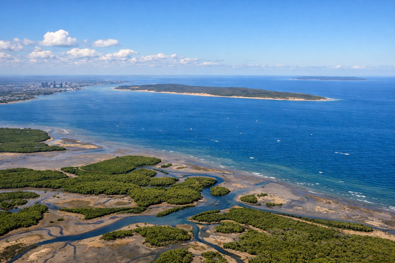
Takeoff from BNE
RIGHTRight-side seats offer views of Moreton Bay's islands and the Brisbane River delta as the aircraft climbs northwestward. The coastal geography and island formations are distinctive during the initial climb-out phase.
Landing at APO
LEFTLeft-side seats provide views of the Cauca River valley and the approach into Carepa from the southeast. The river's distinctive meanders and the surrounding tropical lowlands are visible during descent into Antonio Roldán Betancur Airport.
Will your flight be in sunlight?
Pick a date and time in the Sun Map to watch the sun move across your whole flight.
About This Route
Which side of the plane should I sit on flying from Brisbane International (BNE) to Antonio Roldán Betancur Airport (APO)?
Sit on the Right side of the plane for the best views on flights from Brisbane to Carepa. Right-side seats capture the most dramatic scenery: the Brisbane departure over Moreton Bay and coastal islands, then the long transpacific crossing offers occasional views of the Coral Sea, and finally the approach into Colombia's Caribbean lowlands. The takeoff scenery is particularly strong on the right.
What can I see during takeoff from Brisbane International in Brisbane?
During takeoff from Brisbane International (BNE), sit on the Right side for the best views. Right-side seats offer views of Moreton Bay's islands and the Brisbane River delta as the aircraft climbs northwestward. The coastal geography and island formations are distinctive during the initial climb-out phase. Notable sights include: Moreton Bay islands (North Stradbroke Island, Bribie Island), Brisbane River estuary, Lamington National Park (distant, southwest).
What can I see when landing at Antonio Roldán Betancur Airport in Carepa?
When landing at Antonio Roldán Betancur Airport (APO), sit on the Left side for the best views. Left-side seats provide views of the Cauca River valley and the approach into Carepa from the southeast. The river's distinctive meanders and the surrounding tropical lowlands are visible during descent into Antonio Roldán Betancur Airport. Notable sights include: Cauca River and its meanders, Darién Gap tropical forest canopy, Caribbean coastal plains, Carepa airfield.
How long is the flight from Brisbane to Carepa?
The flight from Brisbane International (BNE) to Antonio Roldán Betancur Airport (APO) takes about 15 hours. The shortest flight path between them is 8,916 miles (14,349 km); winds and air traffic control usually add a few percent.
What does the Brisbane to Carepa flight path pass over?
The flight crosses the Coral Sea (minimal landmarks), passes near or over Fiji or Samoa depending on routing, then crosses the equatorial Pacific. As the aircraft approaches Central America, the Andes Mountains become visible on the left (east) side during descent into Colombian airspace. The Caribbean coast and Darién Gap region appear in the final descent phase.