The right side holds the scenic advantage through the entire flight: Moreton Bay's islands at departure, the Gulf of Carpentaria and Arnhem Land coastline in cruise, the volcanic arc of eastern Indonesia, and finally Bali's Agung and Batur volcanoes on arrival. The left side is dominated by flat Australian outback and long stretches of open sea.
Flown BNE to DPS? Did we get it right?
Flight Path
Brisbane to Denpasar is 2,789 miles (4,488 km), a flight of about 5 hours 40 minutes.
The flight's midpoint lies over the flat red-earth outback of the Northern Territory's Gulf Country, giving way to the Arafura and Timor Seas. As the route continues northwest, the volcanic islands of eastern Indonesia—Timor, Sumba, Flores, Sumbawa, and Lombok with its towering Mount Rinjani—come into view along the horizon before the final approach into Bali.
Great circle distance and headings ›


Phase by phase
Takeoff from BNE
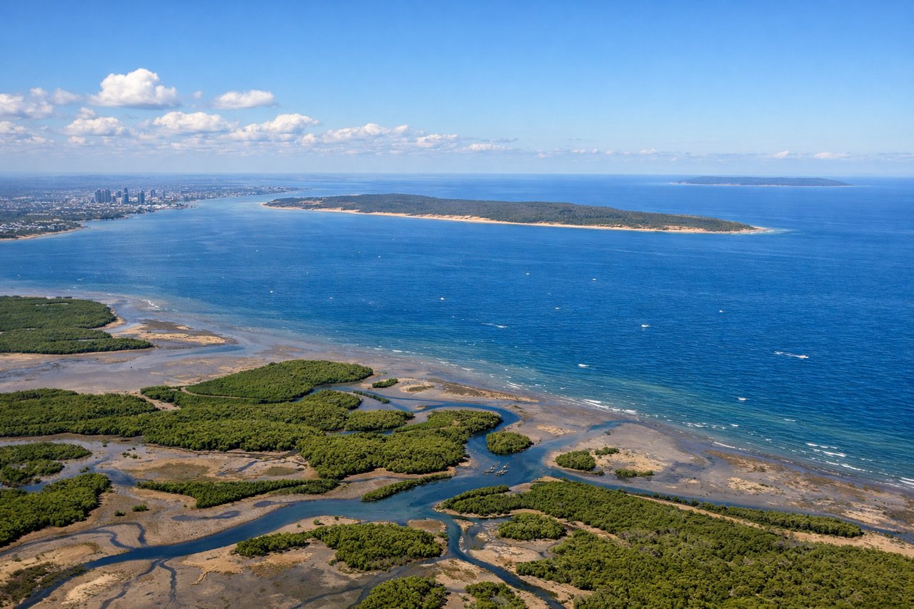
RIGHTBNE departures on runway 01 climb north over Moreton Bay before banking left onto the northwest track toward Indonesia, putting the bay's islands and sandbars on the right side of the aircraft. Left-side passengers get a brief look at the Brisbane skyline before it's replaced by flat farmland heading inland.
Landing at DPS
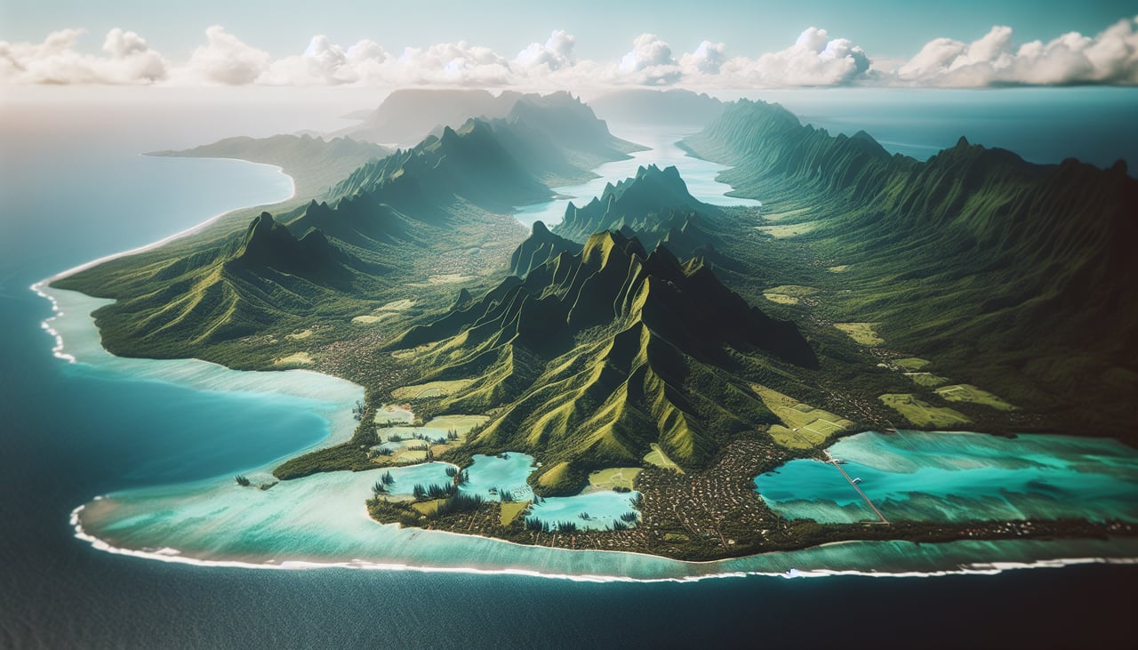
RIGHTArriving from Australia, aircraft typically line up for runway 27 with the approach path curving in over the ocean southeast of Denpasar, putting Bali's volcanic interior on the right side of the plane. Mount Agung and Mount Batur are visible rising beyond the coastal plain, while the left side shows only open sea until touchdown.
Will your flight be in sunlight?
Pick a date and time in the Sun Map to watch the sun move across your whole flight.
About This Route
Which side of the plane should I sit on flying from Brisbane International (BNE) to Denpasar I Gusti Ngurah Rai International Airport (DPS)?
Sit on the Right side of the plane for the best views on flights from Brisbane to Denpasar. The right side holds the scenic advantage through the entire flight: Moreton Bay's islands at departure, the Gulf of Carpentaria and Arnhem Land coastline in cruise, the volcanic arc of eastern Indonesia, and finally Bali's Agung and Batur volcanoes on arrival. The left side is dominated by flat Australian outback and long stretches of open sea.
What can I see during takeoff from Brisbane International in Brisbane?
During takeoff from Brisbane International (BNE), sit on the Right side for the best views. BNE departures on runway 01 climb north over Moreton Bay before banking left onto the northwest track toward Indonesia, putting the bay's islands and sandbars on the right side of the aircraft. Left-side passengers get a brief look at the Brisbane skyline before it's replaced by flat farmland heading inland. Notable sights include: Moreton Bay, Moreton Island, Bribie Island, Glass House Mountains.
What can I see when landing at Denpasar I Gusti Ngurah Rai International Airport in Denpasar?
When landing at Denpasar I Gusti Ngurah Rai International Airport (DPS), sit on the Right side for the best views. Arriving from Australia, aircraft typically line up for runway 27 with the approach path curving in over the ocean southeast of Denpasar, putting Bali's volcanic interior on the right side of the plane. Mount Agung and Mount Batur are visible rising beyond the coastal plain, while the left side shows only open sea until touchdown. Notable sights include: Mount Agung, Mount Batur, Sanur coastline, coral reefs near Nusa Dua.
How long is the flight from Brisbane to Denpasar?
The flight from Brisbane International (BNE) to Denpasar I Gusti Ngurah Rai International Airport (DPS) takes about 5 hours 40 minutes. The shortest flight path between them is 2,789 miles (4,488 km); winds and air traffic control usually add a few percent.
What does the Brisbane to Denpasar flight path pass over?
The flight's midpoint lies over the flat red-earth outback of the Northern Territory's Gulf Country, giving way to the Arafura and Timor Seas. As the route continues northwest, the volcanic islands of eastern Indonesia—Timor, Sumba, Flores, Sumbawa, and Lombok with its towering Mount Rinjani—come into view along the horizon before the final approach into Bali.