The right side wins both takeoff and landing segments with Moreton Bay's coastal scenery on departure and Guadalcanal's mountainous, volcanic approach into Honiara, while the long Coral Sea cruise offers little differentiation between sides.
Flown BNE to HIR? Did we get it right?
Flight Path
Brisbane to Honiara is 1,321 miles (2,125 km), a flight of about 3 hours 15 minutes.
Open Coral Sea with no significant landmasses directly on the flight path; Vanuatu's outer islands may be visible far to the south on very clear days but are not consistently seen
Great circle distance and headings ›Phase by phase
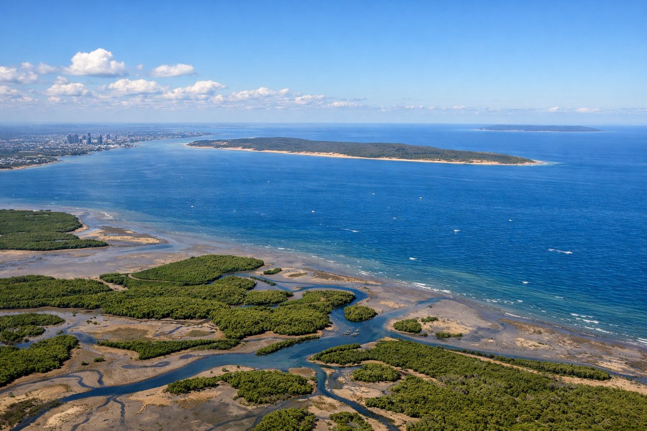
Takeoff from BNE
RIGHTDeparting BNE to the north before turning northeast toward the Coral Sea, the right side captures Moreton Bay, Moreton Island's dunes, and the Brisbane coastline sliding away below. The left side shows only the flat suburban sprawl west of the city.
Landing at HIR
RIGHTOn the typical runway 06 approach into Honiara, the aircraft tracks east along Guadalcanal's north coast with the island's forested mountains rising on the right side, while Iron Bottom Sound's open water and Savo Island's volcanic cone sit further out. The left side mostly shows flat coastal plain and open sea with less relief.
Will your flight be in sunlight?
Pick a date and time in the Sun Map to watch the sun move across your whole flight.
About This Route
Which side of the plane should I sit on flying from Brisbane International (BNE) to Honiara International Airport (HIR)?
Sit on the Right side of the plane for the best views on flights from Brisbane to Honiara. The right side wins both takeoff and landing segments with Moreton Bay's coastal scenery on departure and Guadalcanal's mountainous, volcanic approach into Honiara, while the long Coral Sea cruise offers little differentiation between sides.
What can I see during takeoff from Brisbane International in Brisbane?
During takeoff from Brisbane International (BNE), sit on the Right side for the best views. Departing BNE to the north before turning northeast toward the Coral Sea, the right side captures Moreton Bay, Moreton Island's dunes, and the Brisbane coastline sliding away below. The left side shows only the flat suburban sprawl west of the city. Notable sights include: Moreton Bay, Moreton Island, Brisbane River mouth, North Stradbroke Island.
What can I see when landing at Honiara International Airport in Honiara?
When landing at Honiara International Airport (HIR), sit on the Right side for the best views. On the typical runway 06 approach into Honiara, the aircraft tracks east along Guadalcanal's north coast with the island's forested mountains rising on the right side, while Iron Bottom Sound's open water and Savo Island's volcanic cone sit further out. The left side mostly shows flat coastal plain and open sea with less relief. Notable sights include: Guadalcanal's central mountain range, Iron Bottom Sound, Savo Island volcano, Honiara coastline.
How long is the flight from Brisbane to Honiara?
The flight from Brisbane International (BNE) to Honiara International Airport (HIR) takes about 3 hours 15 minutes. The shortest flight path between them is 1,321 miles (2,125 km); winds and air traffic control usually add a few percent.
What does the Brisbane to Honiara flight path pass over?
Open Coral Sea with no significant landmasses directly on the flight path; Vanuatu's outer islands may be visible far to the south on very clear days but are not consistently seen