Brisbane to Norfolk Island is 909 miles (1,463 km), a flight of about 2 hours 15 minutes.
Right-side seats deliver superior scenery on both legs: Brisbane's urban and coastal features during departure, and better angles on Norfolk Island's volcanic profile during approach. The right side captures more of the journey's geographic drama.
Flight Path
The flight path crosses the Tasman Sea heading east-northeast. Notable features include the Queensland coast receding westward, the open ocean with occasional cloud formations, and the gradual emergence of Norfolk Island from the horizon. The route passes over deep ocean with no significant landmasses between Brisbane and Norfolk Island—visibility of the sea surface, cloud patterns, and distant horizon dominate the midpoint segment.
Great circle distance and headings ›Phase by phase
Takeoff from BNE
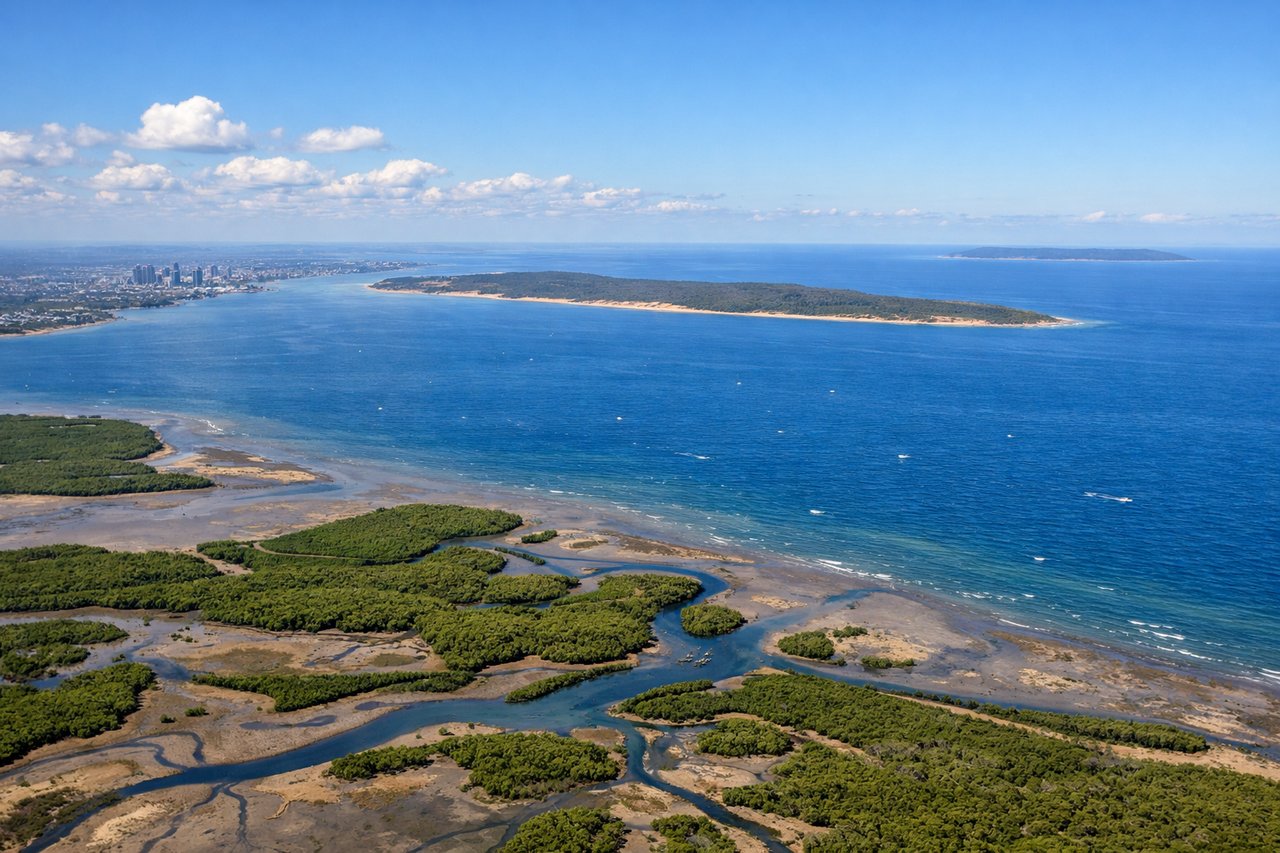
RIGHTRight-side seats capture the Brisbane River meanders through the city and Moreton Bay's islands during the initial climb-out heading northeast. The left side faces inland toward the western suburbs with less dramatic scenery.
Landing at NLK
LEFTLeft-side seats offer views of Norfolk Island's distinctive volcanic landscape and the surrounding Tasman Sea during approach from the west. The island's rugged terrain and isolation create striking visual contrast against the ocean.
Will your flight be in sunlight?
Pick a date and time in the Sun Map to watch the sun move across your whole flight.
About This Route
Which side of the plane should I sit on flying from Brisbane International (BNE) to Norfolk Island International (NLK)?
Sit on the Right side of the plane for the best views on flights from Brisbane to Norfolk Island. Right-side seats deliver superior scenery on both legs: Brisbane's urban and coastal features during departure, and better angles on Norfolk Island's volcanic profile during approach. The right side captures more of the journey's geographic drama.
What can I see during takeoff from Brisbane International in Brisbane?
During takeoff from Brisbane International (BNE), sit on the Right side for the best views. Right-side seats capture the Brisbane River meanders through the city and Moreton Bay's islands during the initial climb-out heading northeast. The left side faces inland toward the western suburbs with less dramatic scenery. Notable sights include: Brisbane River (winding through CBD and suburbs), Moreton Bay with North Stradbroke Island and Moreton Island, Brisbane city skyline.
What can I see when landing at Norfolk Island International in Norfolk Island?
When landing at Norfolk Island International (NLK), sit on the Left side for the best views. Left-side seats offer views of Norfolk Island's distinctive volcanic landscape and the surrounding Tasman Sea during approach from the west. The island's rugged terrain and isolation create striking visual contrast against the ocean. Notable sights include: Norfolk Island's volcanic ridges and peaks, Tasman Sea, the island's forested interior, coastal cliffs.
How long is the flight from Brisbane to Norfolk Island?
The flight from Brisbane International (BNE) to Norfolk Island International (NLK) takes about 2 hours 15 minutes. The shortest flight path between them is 909 miles (1,463 km); winds and air traffic control usually add a few percent.
What does the Brisbane to Norfolk Island flight path pass over?
The flight path crosses the Tasman Sea heading east-northeast. Notable features include the Queensland coast receding westward, the open ocean with occasional cloud formations, and the gradual emergence of Norfolk Island from the horizon. The route passes over deep ocean with no significant landmasses between Brisbane and Norfolk Island—visibility of the sea surface, cloud patterns, and distant horizon dominate the midpoint segment.