Right-side seats capture the most dramatic scenery: Brisbane's coastal departure over Moreton Bay, then the open Pacific crossing, and finally the approach to Rarotonga's volcanic profile. Left seats miss the Brisbane departure entirely and only gain advantage during the final descent.
Flown BNE to RAR? Did we get it right?
Flight Path
Brisbane to Avarua is 2,978 miles (4,793 km), a flight of about 6 hours 10 minutes.
The flight path crosses the Tasman Sea and open Pacific Ocean with no significant landmarks visible for roughly 2.5 hours after leaving the Queensland coast. The route passes well east of any major island groups. Rarotonga becomes visible on the horizon approximately 30-40 minutes before landing, initially appearing as a small dark peak that gradually enlarges as the aircraft descends on approach from the northeast.
Great circle distance and headings ›Phase by phase
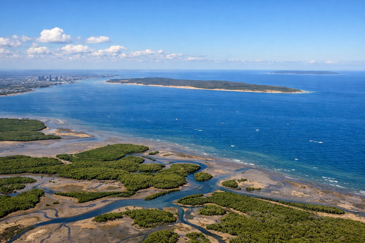
Takeoff from BNE
RIGHTRight-side seats capture Brisbane's coastal geography as the aircraft climbs northeast. You'll see Moreton Bay's islands and the city sprawl receding, with the Pacific Ocean opening up ahead.
Landing at RAR
LEFTLeft-side seats offer the best approach views into Rarotonga. As the aircraft descends from the northeast, you'll see the island's volcanic peaks and the surrounding lagoon's distinctive turquoise waters against deep ocean blue.
Will your flight be in sunlight?
Pick a date and time in the Sun Map to watch the sun move across your whole flight.
About This Route
Which side of the plane should I sit on flying from Brisbane International (BNE) to Rarotonga International (RAR)?
Sit on the Right side of the plane for the best views on flights from Brisbane to Avarua. Right-side seats capture the most dramatic scenery: Brisbane's coastal departure over Moreton Bay, then the open Pacific crossing, and finally the approach to Rarotonga's volcanic profile. Left seats miss the Brisbane departure entirely and only gain advantage during the final descent.
What can I see during takeoff from Brisbane International in Brisbane?
During takeoff from Brisbane International (BNE), sit on the Right side for the best views. Right-side seats capture Brisbane's coastal geography as the aircraft climbs northeast. You'll see Moreton Bay's islands and the city sprawl receding, with the Pacific Ocean opening up ahead. Notable sights include: Moreton Bay (immediate offshore waters with visible islands), Brisbane River and CBD (city grid visible briefly), Stradbroke Island (long sandy barrier island to the east).
What can I see when landing at Rarotonga International in Avarua?
When landing at Rarotonga International (RAR), sit on the Left side for the best views. Left-side seats offer the best approach views into Rarotonga. As the aircraft descends from the northeast, you'll see the island's volcanic peaks and the surrounding lagoon's distinctive turquoise waters against deep ocean blue. Notable sights include: Te Manga (Rarotonga's highest peak, 2,139 meters, visible as a sharp central summit), Rarotonga's lagoon (bright turquoise shallow waters encircling the island), the island's rugged interior ridgeline, the fringing coral reef (visible as a darker line marking the lagoon boundary).
How long is the flight from Brisbane to Avarua?
The flight from Brisbane International (BNE) to Rarotonga International (RAR) takes about 6 hours 10 minutes. The shortest flight path between them is 2,978 miles (4,793 km); winds and air traffic control usually add a few percent.
What does the Brisbane to Avarua flight path pass over?
The flight path crosses the Tasman Sea and open Pacific Ocean with no significant landmarks visible for roughly 2.5 hours after leaving the Queensland coast. The route passes well east of any major island groups. Rarotonga becomes visible on the horizon approximately 30-40 minutes before landing, initially appearing as a small dark peak that gradually enlarges as the aircraft descends on approach from the northeast.