The right side wins overall because the Bogota departure over the Eastern Cordillera and Monserrate is one of the most dramatic urban-mountain departures in South America, and during the long Atlantic crossing the right side also faces south toward the Caribbean islands as the aircraft tracks northeast. The Frankfurt arrival view on the left is good but relatively modest compared to the Andean departure scenery.
Flown BOG to FRA? Did we get it right?
Flight Path
Bogota to Frankfurt is 5,646 miles (9,086 km), a flight of about 10 hours 30 minutes.
After departing Bogota the route tracks northeast over the Colombian llanos and then the Caribbean Sea near the Venezuelan coast. The aircraft crosses the Atlantic roughly between the Cape Verde Islands and the Canary Islands to the east — both may be faintly visible as small dark landmasses on clear days. The route then crosses the Iberian Peninsula or passes north of it depending on routing, with the Bay of Biscay and the Pyrenees potentially visible before entering French airspace and descending toward the Rhine-Main plain.
Great circle distance and headings ›


Phase by phase
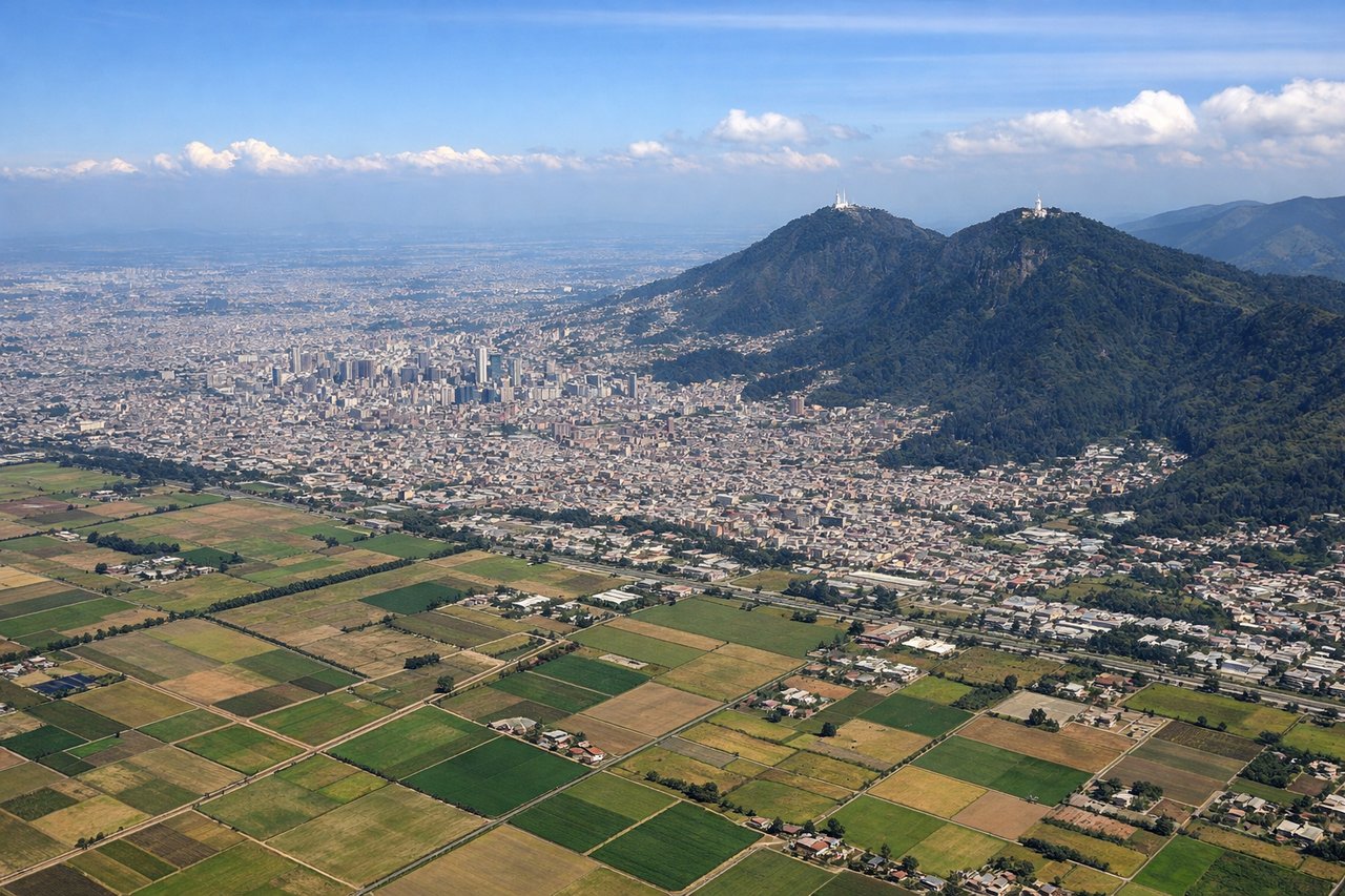
Takeoff from BOG
RIGHTEl Dorado typically departs northward on runway 13L/31R or uses runway headings that send the aircraft northeast over the Bogota savanna. A right-side seat gives you the Eastern Cordillera rising sharply above the city, including Monserrate and the dense urban grid of Bogota below before the aircraft banks northeast. The Andes terrain is dramatically visible on the right as you climb out of the 2,600-meter plateau.
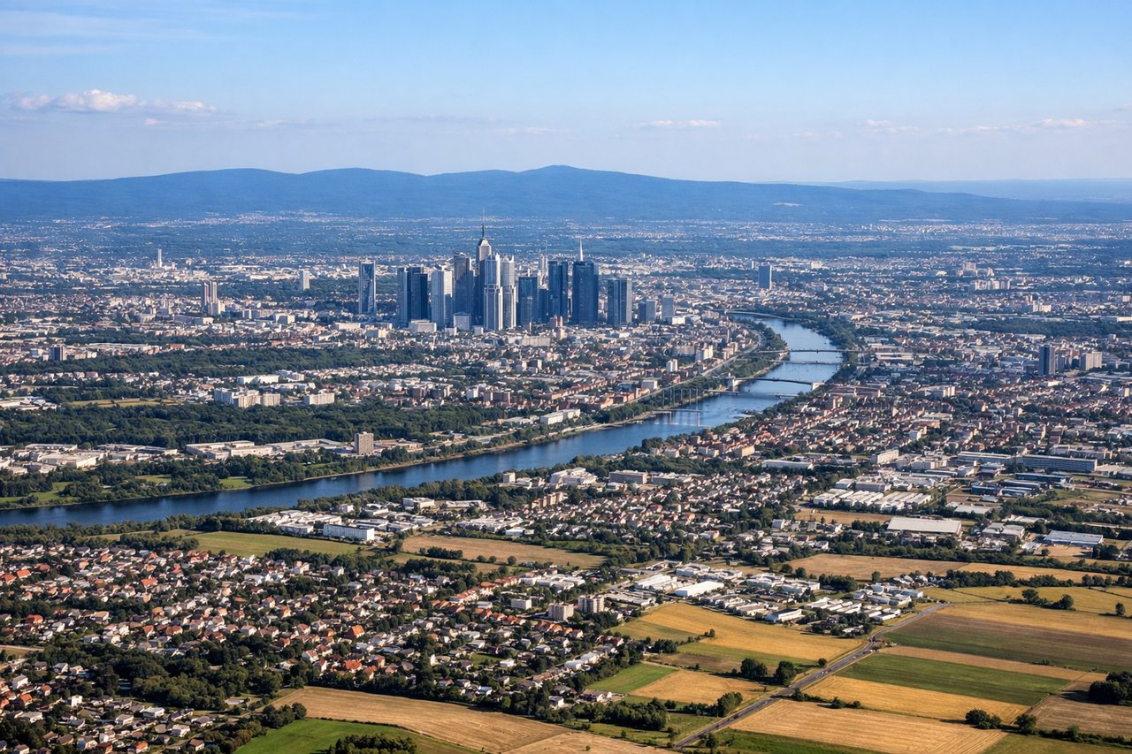
Landing at FRA
LEFTFrankfurt typically lands on runways 25L/25C from the east, meaning the aircraft approaches from the east-northeast over the Rhine-Main region. Left-side seats get the Rhine River valley, the Frankfurt skyline, and the Taunus hills to the north as the aircraft descends on final. The right side faces south toward flat agricultural land with fewer distinctive features.
Will your flight be in sunlight?
Pick a date and time in the Sun Map to watch the sun move across your whole flight.
About This Route
Which side of the plane should I sit on flying from Eldorado International (BOG) to Frankfurt Main (FRA)?
Sit on the Right side of the plane for the best views on flights from Bogota to Frankfurt. The right side wins overall because the Bogota departure over the Eastern Cordillera and Monserrate is one of the most dramatic urban-mountain departures in South America, and during the long Atlantic crossing the right side also faces south toward the Caribbean islands as the aircraft tracks northeast. The Frankfurt arrival view on the left is good but relatively modest compared to the Andean departure scenery.
What can I see during takeoff from Eldorado International in Bogota?
During takeoff from Eldorado International (BOG), sit on the Right side for the best views. El Dorado typically departs northward on runway 13L/31R or uses runway headings that send the aircraft northeast over the Bogota savanna. A right-side seat gives you the Eastern Cordillera rising sharply above the city, including Monserrate and the dense urban grid of Bogota below before the aircraft banks northeast. The Andes terrain is dramatically visible on the right as you climb out of the 2,600-meter plateau. Notable sights include: Cerro Monserrate (visible white church on ridgeline east of city), the Bogota urban grid on the savanna, the Eastern Cordillera ridgeline, Torca wetlands north of the city.
What can I see when landing at Frankfurt Main in Frankfurt?
When landing at Frankfurt Main (FRA), sit on the Left side for the best views. Frankfurt typically lands on runways 25L/25C from the east, meaning the aircraft approaches from the east-northeast over the Rhine-Main region. Left-side seats get the Rhine River valley, the Frankfurt skyline, and the Taunus hills to the north as the aircraft descends on final. The right side faces south toward flat agricultural land with fewer distinctive features. Notable sights include: Frankfurt city skyline (Bankenviertel skyscrapers), the Rhine River bend near Mainz-Wiesbaden, the Taunus hill range to the north, the Main River winding through the city.
How long is the flight from Bogota to Frankfurt?
The flight from Eldorado International (BOG) to Frankfurt Main (FRA) takes about 10 hours 30 minutes. The shortest flight path between them is 5,646 miles (9,086 km); winds and air traffic control usually add a few percent.
What does the Bogota to Frankfurt flight path pass over?
After departing Bogota the route tracks northeast over the Colombian llanos and then the Caribbean Sea near the Venezuelan coast. The aircraft crosses the Atlantic roughly between the Cape Verde Islands and the Canary Islands to the east — both may be faintly visible as small dark landmasses on clear days. The route then crosses the Iberian Peninsula or passes north of it depending on routing, with the Bay of Biscay and the Pyrenees potentially visible before entering French airspace and descending toward the Rhine-Main plain.