While left gives a good Frankfurt departure, the right side wins overall. Over the Atlantic the views are similar on both sides, but as the flight crosses the Caribbean and enters Colombian airspace, the right side tracks the northern coast of South America and then delivers the spectacular Eastern Cordillera approach into Bogota, which is one of the more dramatic mountain-city arrivals in commercial aviation.
Flown FRA to BOG? Did we get it right?
Flight Path
Frankfurt to Bogota is 5,646 miles (9,086 km), a flight of about 11 hours 30 minutes.
The flight tracks southwest over France and the Bay of Biscay, crosses the Iberian Peninsula or passes south of it, then crosses the Canary Islands region over the Atlantic. The route then crosses the Caribbean Sea, passing north of Venezuela and the Venezuelan coast, before entering Colombian airspace and climbing over the Eastern Cordillera of the Andes to reach the Bogota savanna. The Atlantic crossing offers occasional views of isolated mid-ocean cloud systems but no land features. The Venezuelan and Colombian coastline and the Andes approach are the most visually dramatic segments of the second half.
Great circle distance and headings ›


Phase by phase
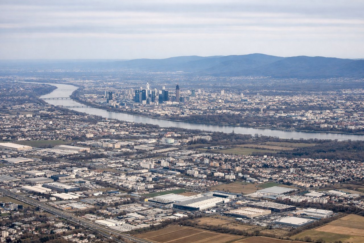
Takeoff from FRA
LEFTFrankfurt typically departs westbound on runway 07L/25R or southwestward on 18, and a left seat gives you the city of Frankfurt itself including the Sachsenhausen district and the Main River bends. As you climb out heading southwest, the left side tracks over the Rhine-Main confluence and the Taunus hills.
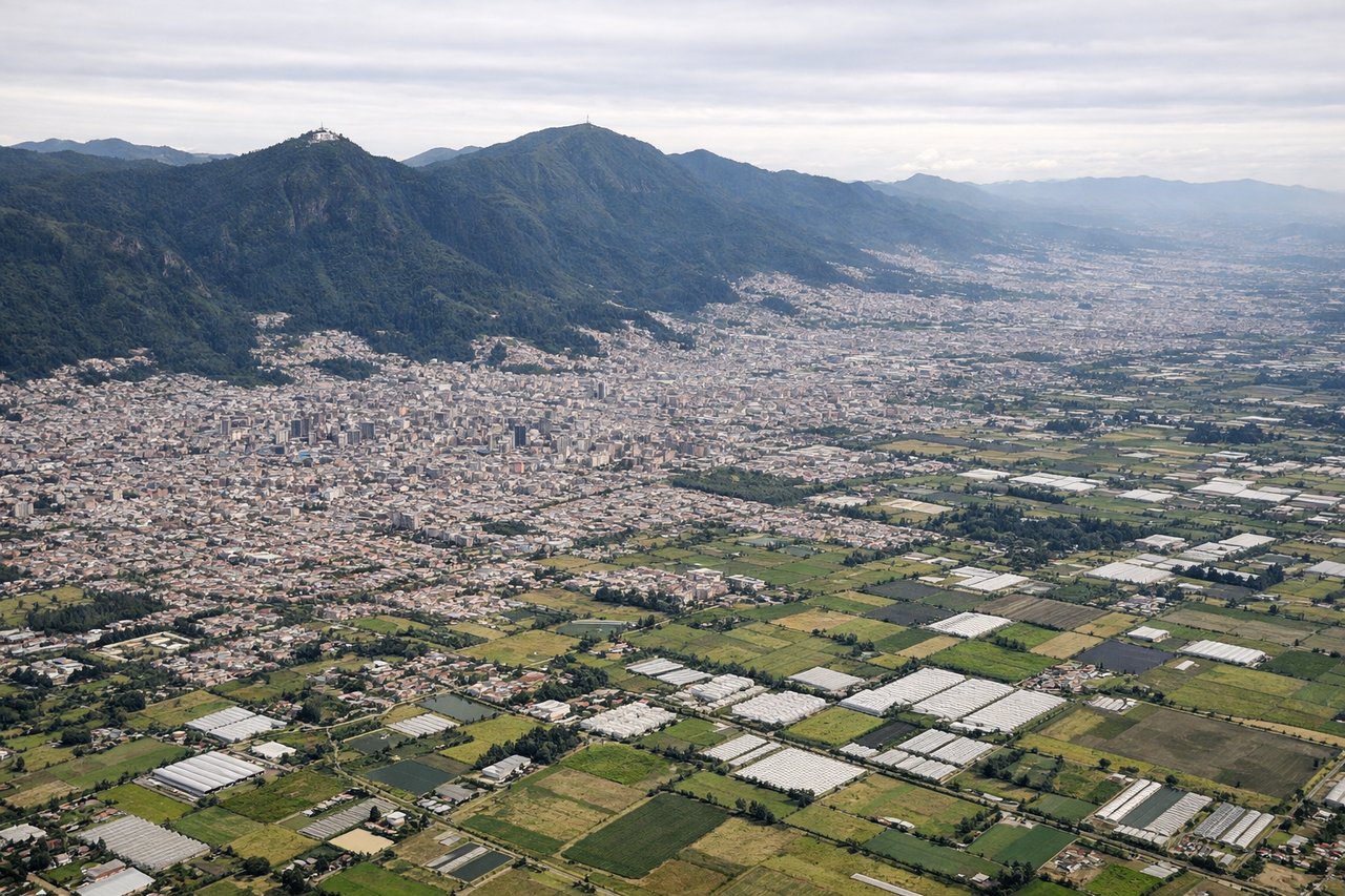
Landing at BOG
RIGHTEl Dorado airport sits on the Bogota savanna at 8,360 feet elevation, and aircraft typically approach from the north or east on runway 13R/31L. A right seat on approach from the north gives you the best view of the Eastern Cordillera escarpment dropping dramatically into the Llanos, and the city of Bogota spread across the sabana with Monserrate and Guadalupe peaks visible above the urban grid.
Will your flight be in sunlight?
Pick a date and time in the Sun Map to watch the sun move across your whole flight.
About This Route
Which side of the plane should I sit on flying from Frankfurt Main (FRA) to Eldorado International (BOG)?
Sit on the Right side of the plane for the best views on flights from Frankfurt to Bogota. While left gives a good Frankfurt departure, the right side wins overall. Over the Atlantic the views are similar on both sides, but as the flight crosses the Caribbean and enters Colombian airspace, the right side tracks the northern coast of South America and then delivers the spectacular Eastern Cordillera approach into Bogota, which is one of the more dramatic mountain-city arrivals in commercial aviation.
What can I see during takeoff from Frankfurt Main in Frankfurt?
During takeoff from Frankfurt Main (FRA), sit on the Left side for the best views. Frankfurt typically departs westbound on runway 07L/25R or southwestward on 18, and a left seat gives you the city of Frankfurt itself including the Sachsenhausen district and the Main River bends. As you climb out heading southwest, the left side tracks over the Rhine-Main confluence and the Taunus hills. Notable sights include: Frankfurt city center and Main River, Rhine-Main confluence near Mainz, Taunus hill range, Wiesbaden on the Rhine.
What can I see when landing at Eldorado International in Bogota?
When landing at Eldorado International (BOG), sit on the Right side for the best views. El Dorado airport sits on the Bogota savanna at 8,360 feet elevation, and aircraft typically approach from the north or east on runway 13R/31L. A right seat on approach from the north gives you the best view of the Eastern Cordillera escarpment dropping dramatically into the Llanos, and the city of Bogota spread across the sabana with Monserrate and Guadalupe peaks visible above the urban grid. Notable sights include: Bogota urban sabana and city grid, Cerro Monserrate and Cerro Guadalupe above the city, Eastern Cordillera escarpment, Bogota River winding across the savanna.
How long is the flight from Frankfurt to Bogota?
The flight from Frankfurt Main (FRA) to Eldorado International (BOG) takes about 11 hours 30 minutes. The shortest flight path between them is 5,646 miles (9,086 km); winds and air traffic control usually add a few percent.
What does the Frankfurt to Bogota flight path pass over?
The flight tracks southwest over France and the Bay of Biscay, crosses the Iberian Peninsula or passes south of it, then crosses the Canary Islands region over the Atlantic. The route then crosses the Caribbean Sea, passing north of Venezuela and the Venezuelan coast, before entering Colombian airspace and climbing over the Eastern Cordillera of the Andes to reach the Bogota savanna. The Atlantic crossing offers occasional views of isolated mid-ocean cloud systems but no land features. The Venezuelan and Colombian coastline and the Andes approach are the most visually dramatic segments of the second half.