Right-side seats dominate both segments: the dramatic Andean cordilleras on departure and the Guayas estuary on arrival. The westbound routing means right seats consistently face the most significant geographic features.
Flown BOG to GYE? Did we get it right?
Flight Path
Bogota to Guayaquil is 618 miles (994 km), a flight of about 1 hour 15 minutes.
The flight descends from the Bogota plateau (2,640 m) westward across the Cordillera Occidental, then crosses the Cauca River valley and Pacific coastal lowlands. The western cordillera's western slope transitions to tropical foothills and eventually flat coastal plain. The Cauca River system becomes visible in the middle portion of the flight as a meandering watercourse in the valley floor. Cumulus cloud development over the Pacific lowlands typically increases in the final 30 minutes of flight.
Great circle distance and headings ›


Phase by phase
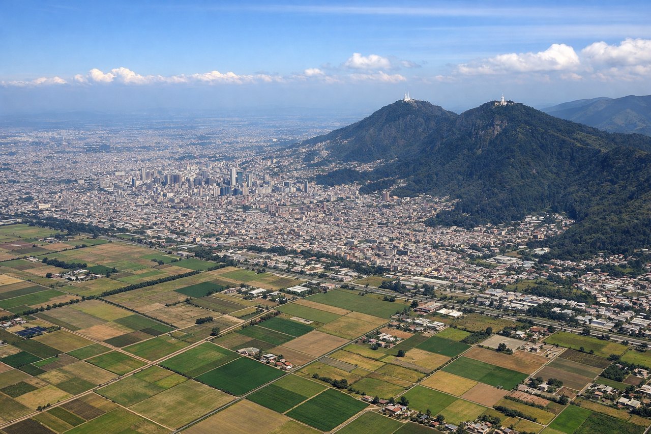
Takeoff from BOG
RIGHTBogota's primary runways (01L/R and 19L/R) typically depart westbound or eastbound depending on wind. Right-side seats capture the Cordillera Central and Cordillera Occidental mountain ranges as they rise dramatically from the high plateau. The western departure corridor offers the best view of these parallel ridges receding into the distance.
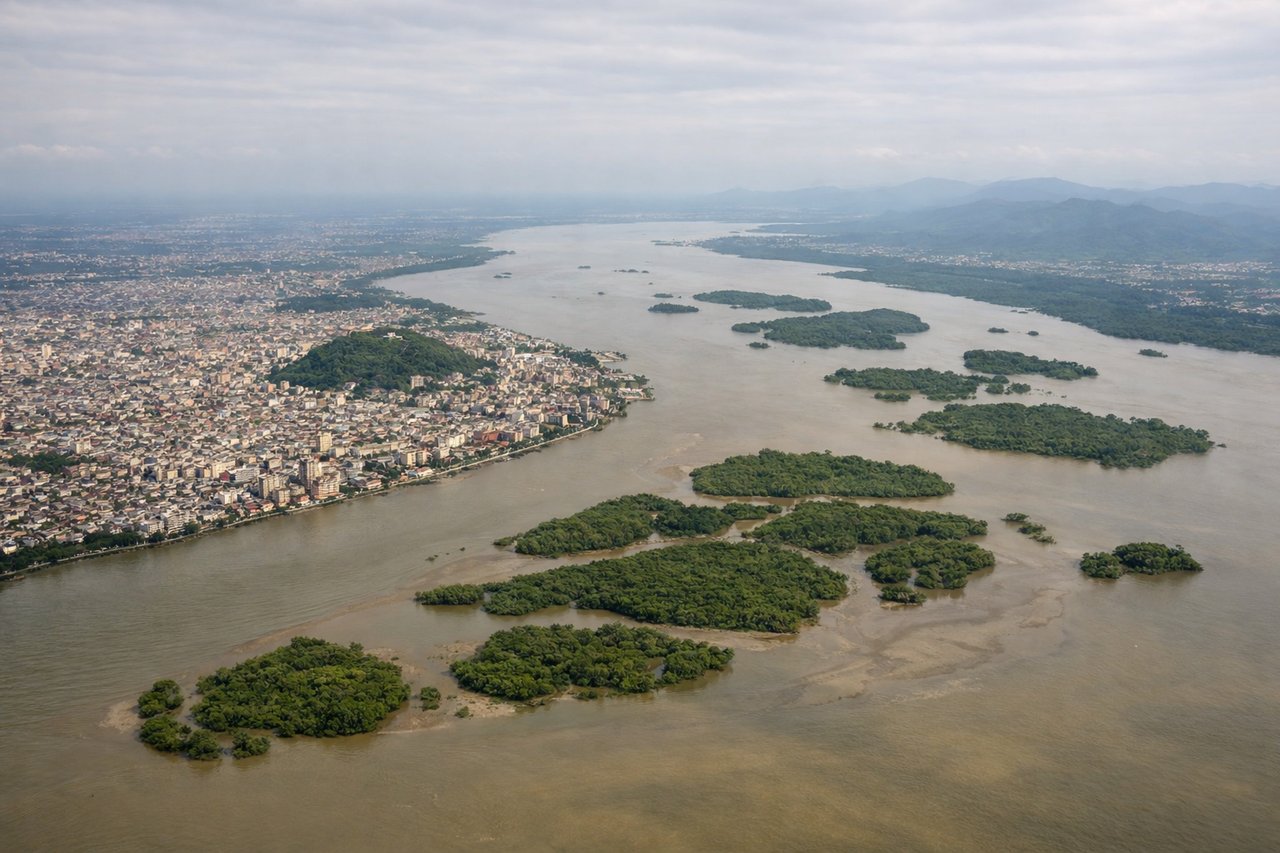
Landing at GYE
LEFTGuayaquil's primary runway is 09/27. Inbound approaches typically descend from the east over the Guayas River estuary and coastal plain. Left-side seats provide the best view of the river delta, mangrove systems, and the city's position on the western bank as you descend toward the runway.
Will your flight be in sunlight?
Pick a date and time in the Sun Map to watch the sun move across your whole flight.
About This Route
Which side of the plane should I sit on flying from Eldorado International (BOG) to Simon Bolivar International (GYE)?
Sit on the Right side of the plane for the best views on flights from Bogota to Guayaquil. Right-side seats dominate both segments: the dramatic Andean cordilleras on departure and the Guayas estuary on arrival. The westbound routing means right seats consistently face the most significant geographic features.
What can I see during takeoff from Eldorado International in Bogota?
During takeoff from Eldorado International (BOG), sit on the Right side for the best views. Bogota's primary runways (01L/R and 19L/R) typically depart westbound or eastbound depending on wind. Right-side seats capture the Cordillera Central and Cordillera Occidental mountain ranges as they rise dramatically from the high plateau. The western departure corridor offers the best view of these parallel ridges receding into the distance. Notable sights include: Cordillera Central (eastern wall of the Bogota savanna), Cordillera Occidental (western range), Bogota city sprawl below the plateau edge, Tequendama Falls area to the southwest.
What can I see when landing at Simon Bolivar International in Guayaquil?
When landing at Simon Bolivar International (GYE), sit on the Left side for the best views. Guayaquil's primary runway is 09/27. Inbound approaches typically descend from the east over the Guayas River estuary and coastal plain. Left-side seats provide the best view of the river delta, mangrove systems, and the city's position on the western bank as you descend toward the runway. Notable sights include: Guayas River estuary and delta (extensive mangrove channels), Guayaquil city on the western bank, Puná Island to the south, Pacific coastal plain.
How long is the flight from Bogota to Guayaquil?
The flight from Eldorado International (BOG) to Simon Bolivar International (GYE) takes about 1 hour 15 minutes. The shortest flight path between them is 618 miles (994 km); winds and air traffic control usually add a few percent.
What does the Bogota to Guayaquil flight path pass over?
The flight descends from the Bogota plateau (2,640 m) westward across the Cordillera Occidental, then crosses the Cauca River valley and Pacific coastal lowlands. The western cordillera's western slope transitions to tropical foothills and eventually flat coastal plain. The Cauca River system becomes visible in the middle portion of the flight as a meandering watercourse in the valley floor. Cumulus cloud development over the Pacific lowlands typically increases in the final 30 minutes of flight.