While takeoff favors the right for estuary views, the landing approach dominates this route's visual experience. Left seats provide the dramatic Cordillera Central descent, which is more visually striking and geographically significant than the coastal departure. The flight path itself trends northeastward, so left seats also capture more of the route's progression across western Colombia.
Flown GYE to BOG? Did we get it right?
Flight Path
Guayaquil to Bogota is 618 miles (994 km), a flight of about 1 hour 15 minutes.
The flight crosses the Pacific coastal plain, then transitions into the Cauca Valley (visible as a linear depression between the Cordillera Occidental and Central). The Cordillera Occidental (Western Range) becomes visible on the left around midpoint as a lower, darker green ridge. The Cauca River valley runs north-south beneath the flight path. Terrain rises progressively from sea level to the 8,600-foot Bogotá savanna. On clear days, the snow-capped Nevado del Ruiz (15,000+ feet) may be visible on the left horizon during the northern portion of the flight, though it's often obscured by weather systems.
Great circle distance and headings ›


Phase by phase
Takeoff from GYE
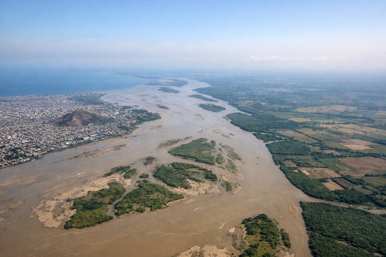
RIGHTGYE typically departs to the north on runway 09 or occasionally 27. Right-side seats offer views of the Guayas River estuary and the Pacific coastal plains as the aircraft climbs northward. Left seats face inland toward agricultural lowlands with less distinctive visual reference.
Landing at BOG
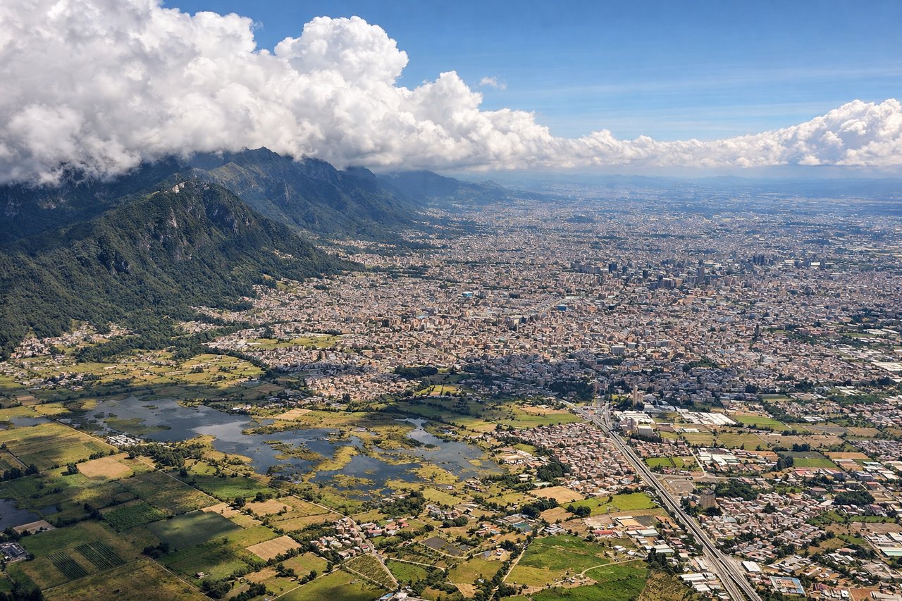
LEFTBOG approaches from the north on runway 26L/26R. Left-side seats provide excellent views of the Cordillera Central (Eastern Range) as the aircraft descends into the Bogotá savanna. The mountain wall rises dramatically on the left during final approach, while right seats face the flat savanna interior.
Will your flight be in sunlight?
Pick a date and time in the Sun Map to watch the sun move across your whole flight.
About This Route
Which side of the plane should I sit on flying from Simon Bolivar International (GYE) to Eldorado International (BOG)?
Sit on the Left side of the plane for the best views on flights from Guayaquil to Bogota. While takeoff favors the right for estuary views, the landing approach dominates this route's visual experience. Left seats provide the dramatic Cordillera Central descent, which is more visually striking and geographically significant than the coastal departure. The flight path itself trends northeastward, so left seats also capture more of the route's progression across western Colombia.
What can I see during takeoff from Simon Bolivar International in Guayaquil?
During takeoff from Simon Bolivar International (GYE), sit on the Right side for the best views. GYE typically departs to the north on runway 09 or occasionally 27. Right-side seats offer views of the Guayas River estuary and the Pacific coastal plains as the aircraft climbs northward. Left seats face inland toward agricultural lowlands with less distinctive visual reference. Notable sights include: Guayas River estuary (wide, braided waterway immediately below), Pacific Ocean horizon to the west, Cerro Santa Ana (small urban hill in Guayaquil proper, visible briefly during initial climb), coastal mangrove wetlands stretching north.
What can I see when landing at Eldorado International in Bogota?
When landing at Eldorado International (BOG), sit on the Left side for the best views. BOG approaches from the north on runway 26L/26R. Left-side seats provide excellent views of the Cordillera Central (Eastern Range) as the aircraft descends into the Bogotá savanna. The mountain wall rises dramatically on the left during final approach, while right seats face the flat savanna interior. Notable sights include: Cordillera Central (snow-capped peaks including Nevado del Ruiz visible on clear days, but more reliably the dark green forested ridge), Bogotá savanna (flat agricultural plain at 8,600 feet elevation), Río Magdalena valley (visible as a linear depression on the left during descent), urban sprawl of Bogotá appearing as a gray-brown grid in the middle distance.
How long is the flight from Guayaquil to Bogota?
The flight from Simon Bolivar International (GYE) to Eldorado International (BOG) takes about 1 hour 15 minutes. The shortest flight path between them is 618 miles (994 km); winds and air traffic control usually add a few percent.
What does the Guayaquil to Bogota flight path pass over?
The flight crosses the Pacific coastal plain, then transitions into the Cauca Valley (visible as a linear depression between the Cordillera Occidental and Central). The Cordillera Occidental (Western Range) becomes visible on the left around midpoint as a lower, darker green ridge. The Cauca River valley runs north-south beneath the flight path. Terrain rises progressively from sea level to the 8,600-foot Bogotá savanna. On clear days, the snow-capped Nevado del Ruiz (15,000+ feet) may be visible on the left horizon during the northern portion of the flight, though it's often obscured by weather systems.