While takeoff offers excellent estuary views on the right, the landing approach on the left provides more sustained and dramatic geography—the Andes foothills, Rimac River valley, and Lima's urban setting are far more visually distinctive than the coastal plain between the two cities.
Flown GYE to LIM? Did we get it right?
Flight Path
Guayaquil to Lima is 707 miles (1,139 km), a flight of about 2 hours 5 minutes.
The flight path crosses the Peruvian coastal desert (completely barren, no landmarks visible for roughly 40 minutes). The Andes mountain range becomes visible on the left (east) side around 30 minutes into the flight as a distant ridge line. The Western Cordillera's peaks remain on the horizon throughout the descent into Lima. No significant water bodies or cities are visible in the midpoint section—this is one of the driest regions on Earth.
Great circle distance and headings ›

Phase by phase
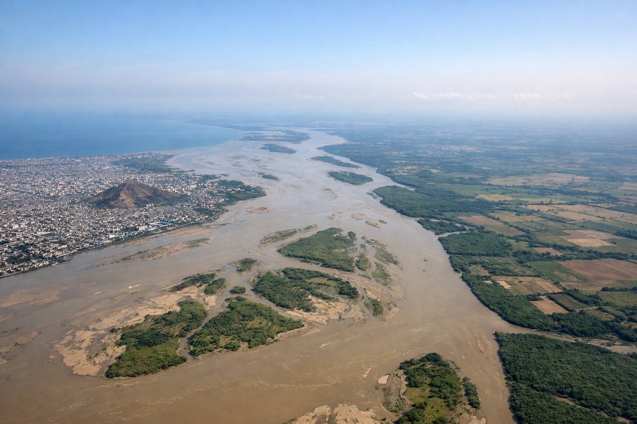
Takeoff from GYE
RIGHTRight-side seats capture the Guayas River estuary and mangrove wetlands immediately after departure. GYE typically departs runway 09 (westbound) or 27 (eastbound); either direction gives right-seat passengers a clear view of the river delta and coastal plain spreading south and east of the airport.
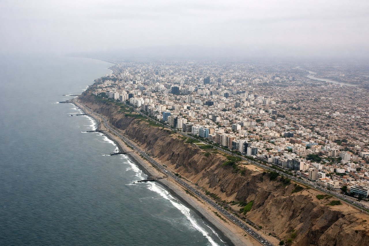
Landing at LIM
LEFTLeft-side seats offer the best view of Lima's approach corridor and the Andes foothills. LIM typically lands runway 15 (southbound) or 33 (northbound); left-seat passengers descending on either approach see the Rimac River valley, the city sprawl, and the western Andes escarpment rising inland.
Will your flight be in sunlight?
Pick a date and time in the Sun Map to watch the sun move across your whole flight.
About This Route
Which side of the plane should I sit on flying from Simon Bolivar International (GYE) to Jorge Chávez International Airport (LIM)?
Sit on the Left side of the plane for the best views on flights from Guayaquil to Lima. While takeoff offers excellent estuary views on the right, the landing approach on the left provides more sustained and dramatic geography—the Andes foothills, Rimac River valley, and Lima's urban setting are far more visually distinctive than the coastal plain between the two cities.
What can I see during takeoff from Simon Bolivar International in Guayaquil?
During takeoff from Simon Bolivar International (GYE), sit on the Right side for the best views. Right-side seats capture the Guayas River estuary and mangrove wetlands immediately after departure. GYE typically departs runway 09 (westbound) or 27 (eastbound); either direction gives right-seat passengers a clear view of the river delta and coastal plain spreading south and east of the airport. Notable sights include: Guayas River estuary, mangrove wetlands of the Gulf of Guayaquil, Cerro Santa Ana (low hill visible inland), Pacific coastline to the west.
What can I see when landing at Jorge Chávez International Airport in Lima?
When landing at Jorge Chávez International Airport (LIM), sit on the Left side for the best views. Left-side seats offer the best view of Lima's approach corridor and the Andes foothills. LIM typically lands runway 15 (southbound) or 33 (northbound); left-seat passengers descending on either approach see the Rimac River valley, the city sprawl, and the western Andes escarpment rising inland. Notable sights include: Rimac River valley and urban Lima, Andes foothills (Cerro San Cristóbal visible), Pacific coastline and Callao port district, desert plains of the Peruvian coastal strip.
How long is the flight from Guayaquil to Lima?
The flight from Simon Bolivar International (GYE) to Jorge Chávez International Airport (LIM) takes about 2 hours 5 minutes. The shortest flight path between them is 707 miles (1,139 km); winds and air traffic control usually add a few percent.
What does the Guayaquil to Lima flight path pass over?
The flight path crosses the Peruvian coastal desert (completely barren, no landmarks visible for roughly 40 minutes). The Andes mountain range becomes visible on the left (east) side around 30 minutes into the flight as a distant ridge line. The Western Cordillera's peaks remain on the horizon throughout the descent into Lima. No significant water bodies or cities are visible in the midpoint section—this is one of the driest regions on Earth.