The right side captures the most dramatic and varied scenery: the Cordillera Oriental during departure and the transition from Colombian highlands through Central American terrain. While the landing approach favors the left, the takeoff views are more visually striking.
Flown BOG to MID? Did we get it right?
Flight Path
Bogota to Merida is 1,529 miles (2,461 km), a flight of about 4 hours 15 minutes.
The flight path crosses from the Colombian Andes northwestward over the Magdalena River valley, then transitions into Central America passing over the mountainous terrain of Central Colombia and Panama. The aircraft will cross the Caribbean coast near the Panama-Colombia border, then traverse the Caribbean Sea toward the Yucatán Peninsula. Notable features include the Cordillera Central and Occidental ranges of Colombia (visible on right during early flight), the Cauca River valley, the Caribbean coastline, and eventually the flat limestone platform of the Yucatán as the aircraft approaches Mérida from the south.
Great circle distance and headings ›


Phase by phase
Takeoff from BOG
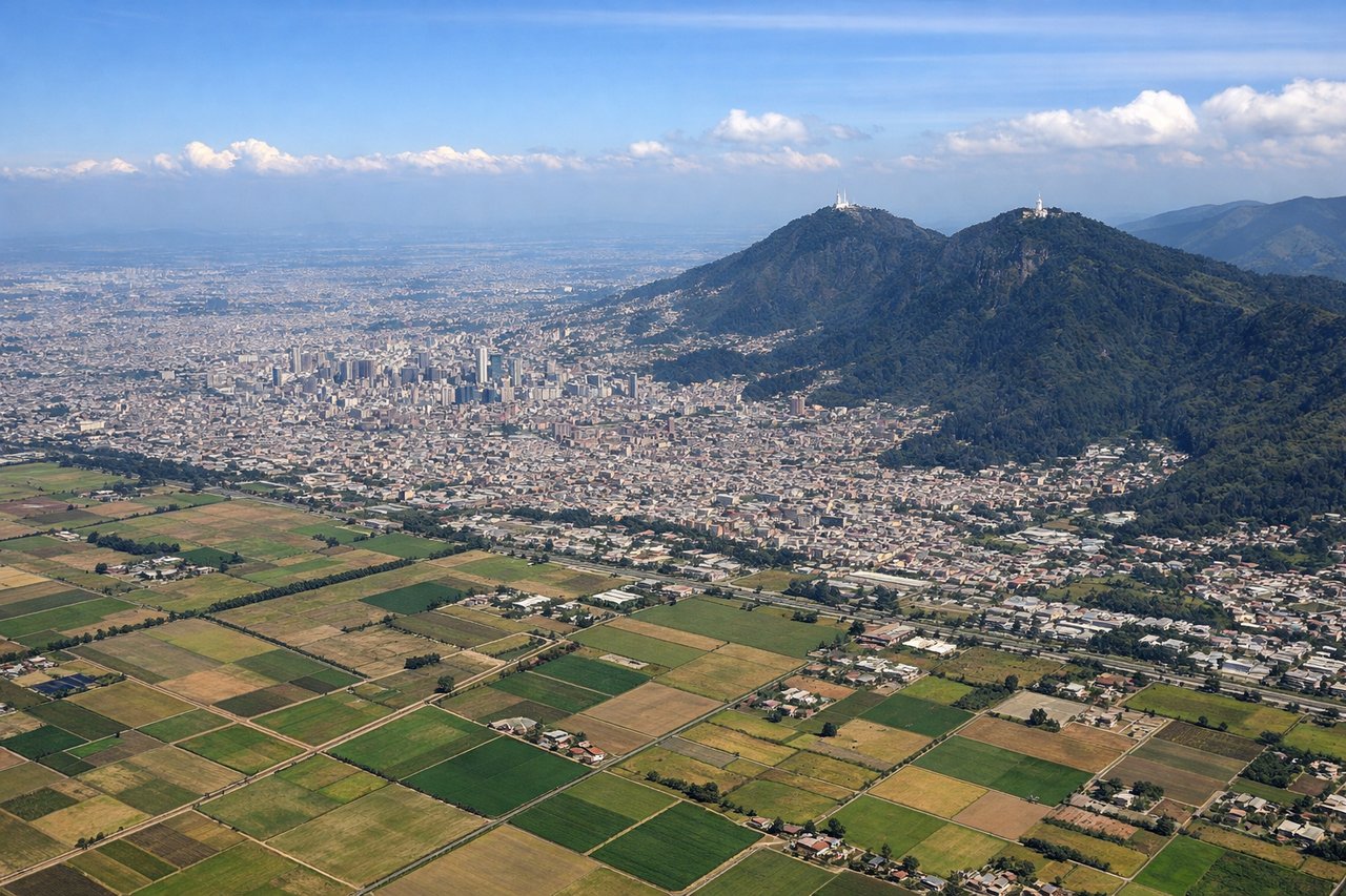
RIGHTRight side offers views of the Cordillera Oriental (Eastern Range) of the Colombian Andes as the aircraft climbs northwestward from Bogotá. The left side faces inland terrain with less dramatic relief.
Landing at MID
LEFTLeft side provides views of the Yucatán Peninsula's distinctive flat limestone terrain and the Caribbean coastline as the aircraft descends toward Mérida from the south. The right side faces inland scrubland with minimal visual interest.
Will your flight be in sunlight?
Pick a date and time in the Sun Map to watch the sun move across your whole flight.
About This Route
Which side of the plane should I sit on flying from Eldorado International (BOG) to Licenciado Manuel Crecencio Rejon International (MID)?
Sit on the Right side of the plane for the best views on flights from Bogota to Merida. The right side captures the most dramatic and varied scenery: the Cordillera Oriental during departure and the transition from Colombian highlands through Central American terrain. While the landing approach favors the left, the takeoff views are more visually striking.
What can I see during takeoff from Eldorado International in Bogota?
During takeoff from Eldorado International (BOG), sit on the Right side for the best views. Right side offers views of the Cordillera Oriental (Eastern Range) of the Colombian Andes as the aircraft climbs northwestward from Bogotá. The left side faces inland terrain with less dramatic relief. Notable sights include: Cordillera Oriental mountain range, Bogotá urban sprawl in the Altiplano Cundiboyacense plateau, Río Magdalena valley to the northwest.
What can I see when landing at Licenciado Manuel Crecencio Rejon International in Merida?
When landing at Licenciado Manuel Crecencio Rejon International (MID), sit on the Left side for the best views. Left side provides views of the Yucatán Peninsula's distinctive flat limestone terrain and the Caribbean coastline as the aircraft descends toward Mérida from the south. The right side faces inland scrubland with minimal visual interest. Notable sights include: Yucatán Peninsula flat topography, Caribbean Sea coastline, cenote-dotted limestone landscape, Mérida city grid.
How long is the flight from Bogota to Merida?
The flight from Eldorado International (BOG) to Licenciado Manuel Crecencio Rejon International (MID) takes about 4 hours 15 minutes. The shortest flight path between them is 1,529 miles (2,461 km); winds and air traffic control usually add a few percent.
What does the Bogota to Merida flight path pass over?
The flight path crosses from the Colombian Andes northwestward over the Magdalena River valley, then transitions into Central America passing over the mountainous terrain of Central Colombia and Panama. The aircraft will cross the Caribbean coast near the Panama-Colombia border, then traverse the Caribbean Sea toward the Yucatán Peninsula. Notable features include the Cordillera Central and Occidental ranges of Colombia (visible on right during early flight), the Cauca River valley, the Caribbean coastline, and eventually the flat limestone platform of the Yucatán as the aircraft approaches Mérida from the south.