The landing approach into Bogota offers the most dramatic and sustained visual reward—the Andes cordillera is genuinely spectacular and visible for the final 30+ minutes of descent. Takeoff from Merida is pleasant but relatively flat; the landing wins decisively.
Flown MID to BOG? Did we get it right?
Flight Path
Merida to Bogota is 1,529 miles (2,461 km), a flight of about 4 hours.
The flight path crosses the Yucatan Peninsula northward, then over the Gulf of Mexico and Caribbean Sea. Around the midpoint (roughly over the Honduran/Nicaraguan border region at cruise altitude), you'll be at 35,000+ feet over the Caribbean, with no significant landmarks visible—just open ocean. As you approach Colombia, the Sierra Nevada de Santa Marta (northernmost Andes peaks) becomes visible on the left around 90 minutes before landing. The descent into Bogota begins over the Magdalena River valley, with the Andes' eastern cordillera becoming increasingly prominent as you descend into the high-altitude savanna.
Great circle distance and headings ›


Phase by phase
Takeoff from MID
RIGHTMerida typically departs to the north or northeast. Right-side seats offer views of the Yucatan Peninsula's limestone terrain and the northern coastline along the Gulf of Mexico, with the Caribbean visible in the distance.
Landing at BOG
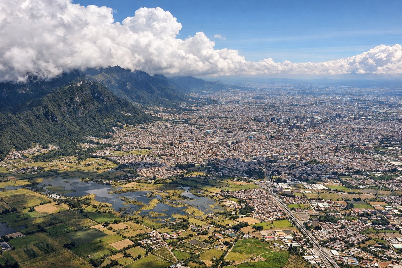
LEFTBogota's Eldorado typically lands from the east on runway 01L/01R. Left-side seats provide dramatic views of the Andes' eastern cordillera as you descend into the Bogota savanna, with the city's urban sprawl visible against the mountain backdrop.
Will your flight be in sunlight?
Pick a date and time in the Sun Map to watch the sun move across your whole flight.
About This Route
Which side of the plane should I sit on flying from Licenciado Manuel Crecencio Rejon International (MID) to Eldorado International (BOG)?
Sit on the Left side of the plane for the best views on flights from Merida to Bogota. The landing approach into Bogota offers the most dramatic and sustained visual reward—the Andes cordillera is genuinely spectacular and visible for the final 30+ minutes of descent. Takeoff from Merida is pleasant but relatively flat; the landing wins decisively.
What can I see during takeoff from Licenciado Manuel Crecencio Rejon International in Merida?
During takeoff from Licenciado Manuel Crecencio Rejon International (MID), sit on the Right side for the best views. Merida typically departs to the north or northeast. Right-side seats offer views of the Yucatan Peninsula's limestone terrain and the northern coastline along the Gulf of Mexico, with the Caribbean visible in the distance. Notable sights include: Gulf of Mexico coastline, Yucatan Peninsula scrubland and cenote-dotted terrain, Progreso port area to the north, Caribbean Sea horizon.
What can I see when landing at Eldorado International in Bogota?
When landing at Eldorado International (BOG), sit on the Left side for the best views. Bogota's Eldorado typically lands from the east on runway 01L/01R. Left-side seats provide dramatic views of the Andes' eastern cordillera as you descend into the Bogota savanna, with the city's urban sprawl visible against the mountain backdrop. Notable sights include: Eastern Cordillera of the Colombian Andes, Bogota savanna floor, Monserrate peak (3,152m) east of the city, Bogota city grid and urban districts.
How long is the flight from Merida to Bogota?
The flight from Licenciado Manuel Crecencio Rejon International (MID) to Eldorado International (BOG) takes about 4 hours. The shortest flight path between them is 1,529 miles (2,461 km); winds and air traffic control usually add a few percent.
What does the Merida to Bogota flight path pass over?
The flight path crosses the Yucatan Peninsula northward, then over the Gulf of Mexico and Caribbean Sea. Around the midpoint (roughly over the Honduran/Nicaraguan border region at cruise altitude), you'll be at 35,000+ feet over the Caribbean, with no significant landmarks visible—just open ocean. As you approach Colombia, the Sierra Nevada de Santa Marta (northernmost Andes peaks) becomes visible on the left around 90 minutes before landing. The descent into Bogota begins over the Magdalena River valley, with the Andes' eastern cordillera becoming increasingly prominent as you descend into the high-altitude savanna.