The right side captures Boston's harbor and skyline on departure, glimpses of the Appalachian ridgelines in Pennsylvania and Virginia during cruise, and the dramatic Lake Pontchartrain approach into New Orleans — giving it more consistent visual interest than the largely featureless left side.
Flown BOS to MSY? Did we get it right?
Flight Path
Boston to New Orleans is 1,367 miles (2,200 km), a flight of about 2 hours 50 minutes.
The route crosses the ridge-and-valley Appalachians of central Pennsylvania and western Virginia, then flattens out over the Piedmont and Tennessee Valley before descending toward the Gulf coastal plain and the Mississippi River delta region near Louisiana.
Great circle distance and headings ›


Phase by phase
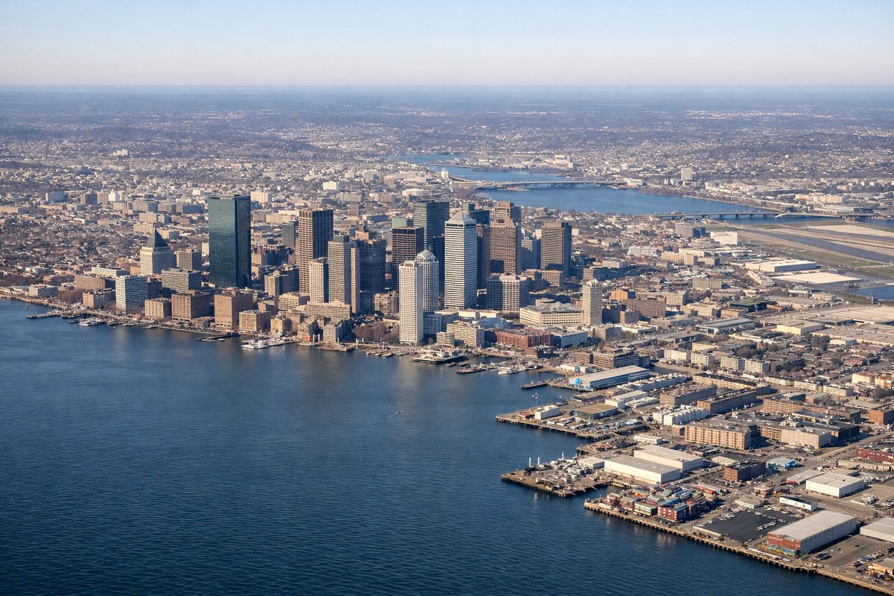
Takeoff from BOS
RIGHTAs the aircraft climbs out of Logan and banks southwest toward the interior, the right side offers a last look at downtown Boston's skyline and the harbor islands before the turn straightens out over Massachusetts. The left side mostly shows open Atlantic water with little definition.
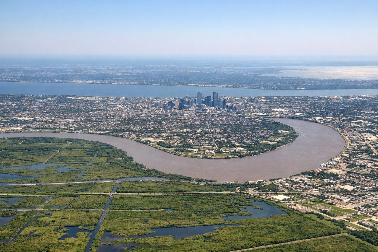
Landing at MSY
RIGHTOn approach into MSY from the north, the right side of the aircraft typically faces the broad expanse of Lake Pontchartrain and the New Orleans skyline as the plane lines up for the runway, giving a strong sense of the city's relationship to the water. The left side mainly shows flat marsh and suburban sprawl.
Will your flight be in sunlight?
Pick a date and time in the Sun Map to watch the sun move across your whole flight.
About This Route
Which side of the plane should I sit on flying from General Edward Lawrence Logan International (BOS) to Louis Armstrong New Orleans International (MSY)?
Sit on the Right side of the plane for the best views on flights from Boston to New Orleans. The right side captures Boston's harbor and skyline on departure, glimpses of the Appalachian ridgelines in Pennsylvania and Virginia during cruise, and the dramatic Lake Pontchartrain approach into New Orleans — giving it more consistent visual interest than the largely featureless left side.
What can I see during takeoff from General Edward Lawrence Logan International in Boston?
During takeoff from General Edward Lawrence Logan International (BOS), sit on the Right side for the best views. As the aircraft climbs out of Logan and banks southwest toward the interior, the right side offers a last look at downtown Boston's skyline and the harbor islands before the turn straightens out over Massachusetts. The left side mostly shows open Atlantic water with little definition. Notable sights include: Boston Harbor Islands, Downtown Boston skyline, Charles River mouth.
What can I see when landing at Louis Armstrong New Orleans International in New Orleans?
When landing at Louis Armstrong New Orleans International (MSY), sit on the Right side for the best views. On approach into MSY from the north, the right side of the aircraft typically faces the broad expanse of Lake Pontchartrain and the New Orleans skyline as the plane lines up for the runway, giving a strong sense of the city's relationship to the water. The left side mainly shows flat marsh and suburban sprawl. Notable sights include: Lake Pontchartrain, Lake Pontchartrain Causeway, New Orleans skyline, Mississippi River bends.
How long is the flight from Boston to New Orleans?
The flight from General Edward Lawrence Logan International (BOS) to Louis Armstrong New Orleans International (MSY) takes about 2 hours 50 minutes. The shortest flight path between them is 1,367 miles (2,200 km); winds and air traffic control usually add a few percent.
What does the Boston to New Orleans flight path pass over?
The route crosses the ridge-and-valley Appalachians of central Pennsylvania and western Virginia, then flattens out over the Piedmont and Tennessee Valley before descending toward the Gulf coastal plain and the Mississippi River delta region near Louisiana.