While takeoff favors the right, the landing approach on the left provides more dramatic and sustained views of the Serra da Mantiqueira and the descent into São Paulo's geography. The left side captures the most visually distinctive features of the route's final segment.
Flown BSB to CGH? Did we get it right?
Flight Path
Brasilia to Sao Paulo is 542 miles (873 km), a flight of about 1 hour 25 minutes.
The flight path crosses the central Brazilian plateau (cerrado biome) with scattered towns and agricultural areas. The Paraíba River valley becomes increasingly visible as you approach São Paulo. The Serra da Mantiqueira's eastern escarpment forms a dramatic topographic boundary between the plateau and the Atlantic coastal lowlands, becoming prominent in the final 30 minutes of descent.
Great circle distance and headings ›Phase by phase
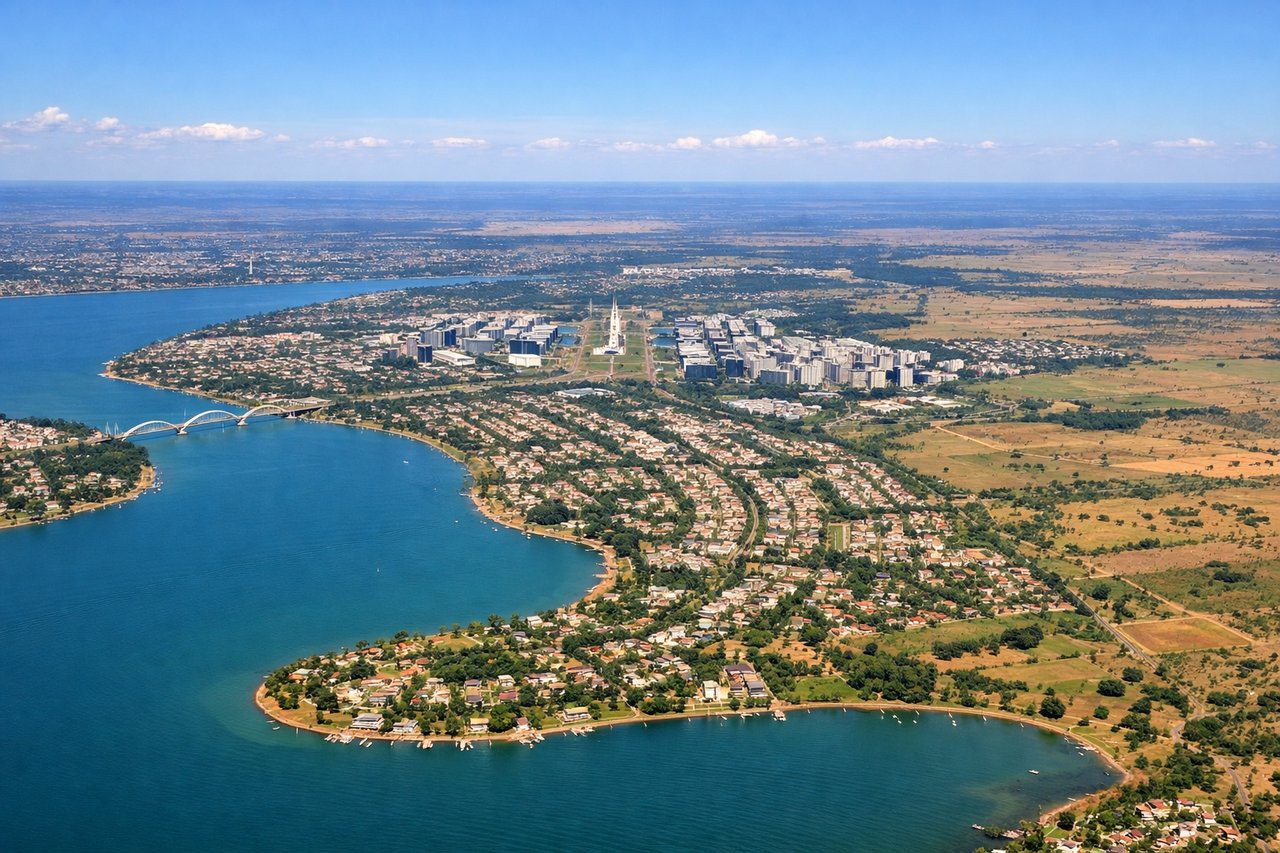
Takeoff from BSB
RIGHTBSB typically departs to the east or northeast. Right-side seats capture the initial climb over Brasília's distinctive planned city layout and the surrounding cerrado plateau, with views extending toward the Serra da Mantiqueira in the distance.
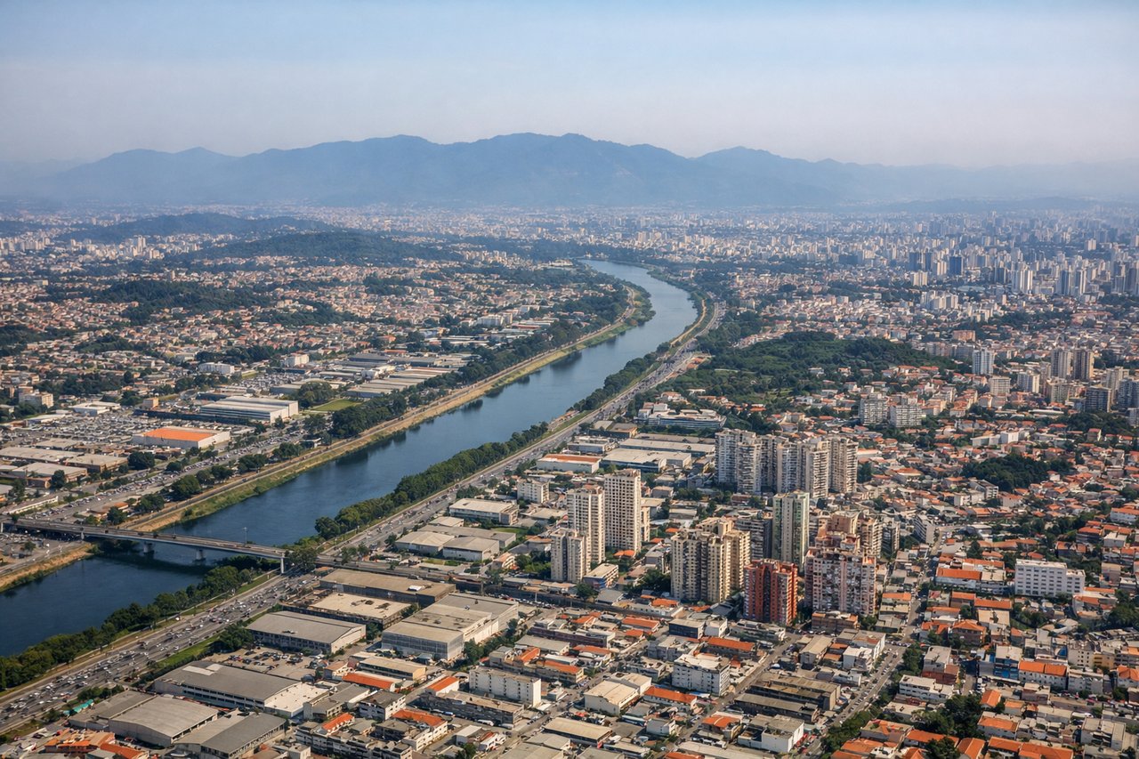
Landing at CGH
LEFTCGH approaches from the northeast, typically landing on runways 09L/09R. Left-side seats provide views of the Serra da Mantiqueira's eastern slopes and the Paraíba River valley as you descend into the São Paulo metropolitan area, with the city's urban sprawl becoming visible in the final approach.
Will your flight be in sunlight?
Pick a date and time in the Sun Map to watch the sun move across your whole flight.
About This Route
Which side of the plane should I sit on flying from Presidente Juscelino Kubitschek (BSB) to Congonhas (CGH)?
Sit on the Left side of the plane for the best views on flights from Brasilia to Sao Paulo. While takeoff favors the right, the landing approach on the left provides more dramatic and sustained views of the Serra da Mantiqueira and the descent into São Paulo's geography. The left side captures the most visually distinctive features of the route's final segment.
What can I see during takeoff from Presidente Juscelino Kubitschek in Brasilia?
During takeoff from Presidente Juscelino Kubitschek (BSB), sit on the Right side for the best views. BSB typically departs to the east or northeast. Right-side seats capture the initial climb over Brasília's distinctive planned city layout and the surrounding cerrado plateau, with views extending toward the Serra da Mantiqueira in the distance. Notable sights include: Brasília's central axis and monumental plaza (immediately below during climb), Paranoá Lake to the north, cerrado grassland and scattered vegetation extending to the horizon, distant ridge lines of the Brazilian Shield plateau.
What can I see when landing at Congonhas in Sao Paulo?
When landing at Congonhas (CGH), sit on the Left side for the best views. CGH approaches from the northeast, typically landing on runways 09L/09R. Left-side seats provide views of the Serra da Mantiqueira's eastern slopes and the Paraíba River valley as you descend into the São Paulo metropolitan area, with the city's urban sprawl becoming visible in the final approach. Notable sights include: Serra da Mantiqueira mountain range (eastern escarpment), Paraíba River valley and tributaries, São Paulo's urban sprawl and high-rise districts, Guarulhos region to the northeast.
How long is the flight from Brasilia to Sao Paulo?
The flight from Presidente Juscelino Kubitschek (BSB) to Congonhas (CGH) takes about 1 hour 25 minutes. The shortest flight path between them is 542 miles (873 km); winds and air traffic control usually add a few percent.
What does the Brasilia to Sao Paulo flight path pass over?
The flight path crosses the central Brazilian plateau (cerrado biome) with scattered towns and agricultural areas. The Paraíba River valley becomes increasingly visible as you approach São Paulo. The Serra da Mantiqueira's eastern escarpment forms a dramatic topographic boundary between the plateau and the Atlantic coastal lowlands, becoming prominent in the final 30 minutes of descent.