Although left wins the takeoff with Brasília's urban geometry, right dominates the landing with the Andes Cordillera Central—a dramatic, snow-capped mountain range that provides sustained visual drama during the critical final descent phase. The landing experience outweighs the takeoff advantage, and the Andes represent a far more distinctive geographic feature than the plateau city. Right side scores higher overall for the full flight experience.
Flown BSB to SCL? Did we get it right?
Flight Path
Brasilia to Santiago is 1,870 miles (3,010 km), a flight of about 4 hours 10 minutes.
The flight crosses the Brazilian plateau (cerrado scrubland and sparse settlements), then transitions over the Paraguay-Argentina border region, crosses the Gran Chaco lowlands, and approaches the Andes foothills. The Paraná River basin and scattered agricultural development mark the central portion. The Cordillera Central becomes visible approximately 90 minutes before landing, with the snow line becoming prominent in the final 45 minutes of descent.
Great circle distance and headings ›Phase by phase

Takeoff from BSB
LEFTLeft side captures Brasília's modernist urban layout during climb-out, with the distinctive artificial Lago Paranoá and the city's geometric street grid visible before transitioning to the Brazilian plateau. Right side offers only flat cerrado scrubland with minimal visual interest.
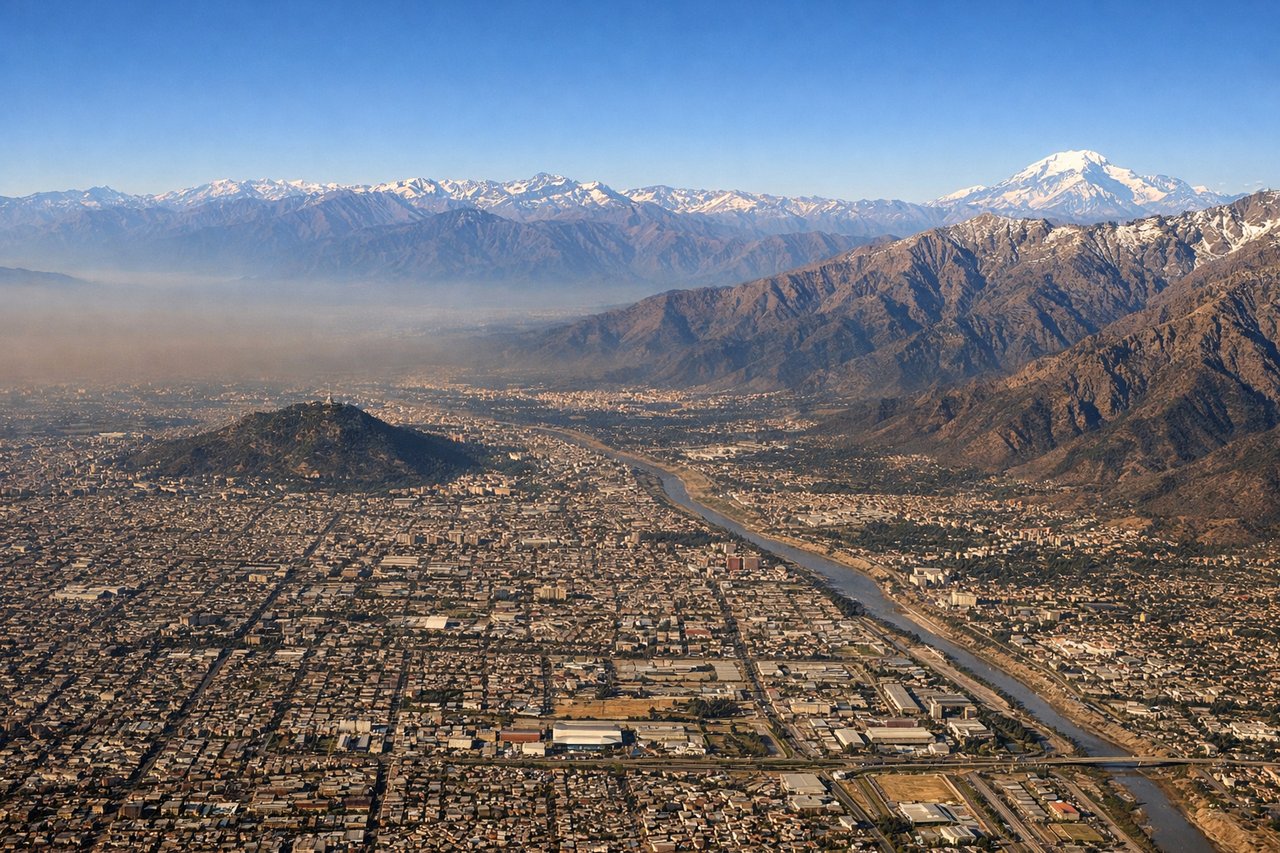
Landing at SCL
RIGHTRight side provides dramatic views of the Andes during descent into Santiago, with the snow-capped peaks of the Cordillera Central rising prominently as the aircraft approaches from the north. Left side shows only the flat Central Valley and urban sprawl with minimal topographic interest.
Will your flight be in sunlight?
Pick a date and time in the Sun Map to watch the sun move across your whole flight.
About This Route
Which side of the plane should I sit on flying from Presidente Juscelino Kubitschek (BSB) to Arturo Merino Benitez International (SCL)?
Sit on the Right side of the plane for the best views on flights from Brasilia to Santiago. Although left wins the takeoff with Brasília's urban geometry, right dominates the landing with the Andes Cordillera Central—a dramatic, snow-capped mountain range that provides sustained visual drama during the critical final descent phase. The landing experience outweighs the takeoff advantage, and the Andes represent a far more distinctive geographic feature than the plateau city. Right side scores higher overall for the full flight experience.
What can I see during takeoff from Presidente Juscelino Kubitschek in Brasilia?
During takeoff from Presidente Juscelino Kubitschek (BSB), sit on the Left side for the best views. Left side captures Brasília's modernist urban layout during climb-out, with the distinctive artificial Lago Paranoá and the city's geometric street grid visible before transitioning to the Brazilian plateau. Right side offers only flat cerrado scrubland with minimal visual interest. Notable sights include: Lago Paranoá (artificial lake in city center), Brasília's radial street pattern, Planalto Central plateau edge.
What can I see when landing at Arturo Merino Benitez International in Santiago?
When landing at Arturo Merino Benitez International (SCL), sit on the Right side for the best views. Right side provides dramatic views of the Andes during descent into Santiago, with the snow-capped peaks of the Cordillera Central rising prominently as the aircraft approaches from the north. Left side shows only the flat Central Valley and urban sprawl with minimal topographic interest. Notable sights include: Cordillera Central peaks (including views toward Aconcagua massif), Santiago metropolitan area sprawl, Mapocho River valley.
How long is the flight from Brasilia to Santiago?
The flight from Presidente Juscelino Kubitschek (BSB) to Arturo Merino Benitez International (SCL) takes about 4 hours 10 minutes. The shortest flight path between them is 1,870 miles (3,010 km); winds and air traffic control usually add a few percent.
What does the Brasilia to Santiago flight path pass over?
The flight crosses the Brazilian plateau (cerrado scrubland and sparse settlements), then transitions over the Paraguay-Argentina border region, crosses the Gran Chaco lowlands, and approaches the Andes foothills. The Paraná River basin and scattered agricultural development mark the central portion. The Cordillera Central becomes visible approximately 90 minutes before landing, with the snow line becoming prominent in the final 45 minutes of descent.