While the landing approach favors the left, the takeoff experience from Burbank is more visually dramatic with the San Gabriel Mountains providing a striking scenic highlight. The climb-out view outweighs the landing approach in terms of memorable scenery.
Flown BUR to IND? Did we get it right?
Flight Path
Burbank to Indianapolis is 1,801 miles (2,898 km), a flight of about 4 hours 15 minutes.
The flight path crosses the Colorado Plateau region. Notable features include the Grand Canyon (visible from cruising altitude if the flight path passes nearby), the Colorado River, and the transition from the high desert of Arizona/New Mexico into the flatter terrain of Oklahoma and Kansas. The landscape shifts from mountainous terrain in the west to increasingly flat agricultural plains as the flight approaches Indiana. Lake Michigan becomes visible during the final descent phase as the aircraft approaches the Midwest.
Great circle distance and headings ›


Phase by phase
Takeoff from BUR
RIGHTRight-side seats offer views of the San Gabriel Mountains immediately after departure, which rise dramatically to the northeast of Burbank. The aircraft typically climbs eastward over the Los Angeles basin before turning toward Indianapolis, giving right-side passengers the best angle on this prominent range.
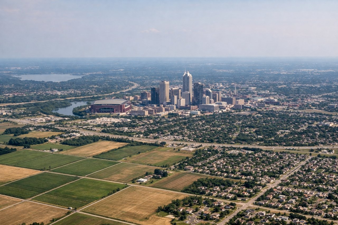
Landing at IND
LEFTLeft-side seats provide views of the White River and downtown Indianapolis during the final approach from the west. Aircraft typically descend on a westerly approach path, making the left side ideal for seeing the city center, the river's distinctive curves, and the surrounding Indiana landscape.
Will your flight be in sunlight?
Pick a date and time in the Sun Map to watch the sun move across your whole flight.
About This Route
Which side of the plane should I sit on flying from Burbank Glendale Pasadena (BUR) to Indianapolis International (IND)?
Sit on the Right side of the plane for the best views on flights from Burbank to Indianapolis. While the landing approach favors the left, the takeoff experience from Burbank is more visually dramatic with the San Gabriel Mountains providing a striking scenic highlight. The climb-out view outweighs the landing approach in terms of memorable scenery.
What can I see during takeoff from Burbank Glendale Pasadena in Burbank?
During takeoff from Burbank Glendale Pasadena (BUR), sit on the Right side for the best views. Right-side seats offer views of the San Gabriel Mountains immediately after departure, which rise dramatically to the northeast of Burbank. The aircraft typically climbs eastward over the Los Angeles basin before turning toward Indianapolis, giving right-side passengers the best angle on this prominent range. Notable sights include: San Gabriel Mountains, Los Angeles urban sprawl extending south toward Long Beach, San Fernando Valley to the northwest, Pacific Ocean visible on the distant western horizon.
What can I see when landing at Indianapolis International in Indianapolis?
When landing at Indianapolis International (IND), sit on the Left side for the best views. Left-side seats provide views of the White River and downtown Indianapolis during the final approach from the west. Aircraft typically descend on a westerly approach path, making the left side ideal for seeing the city center, the river's distinctive curves, and the surrounding Indiana landscape. Notable sights include: White River flowing through downtown Indianapolis, downtown skyline and Monument Circle, Indianapolis International Airport runways, flat Indiana farmland and tree lines to the west.
How long is the flight from Burbank to Indianapolis?
The flight from Burbank Glendale Pasadena (BUR) to Indianapolis International (IND) takes about 4 hours 15 minutes. The shortest flight path between them is 1,801 miles (2,898 km); winds and air traffic control usually add a few percent.
What does the Burbank to Indianapolis flight path pass over?
The flight path crosses the Colorado Plateau region. Notable features include the Grand Canyon (visible from cruising altitude if the flight path passes nearby), the Colorado River, and the transition from the high desert of Arizona/New Mexico into the flatter terrain of Oklahoma and Kansas. The landscape shifts from mountainous terrain in the west to increasingly flat agricultural plains as the flight approaches Indiana. Lake Michigan becomes visible during the final descent phase as the aircraft approaches the Midwest.